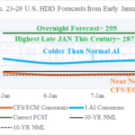
Week-4 AI HDD Forecasts from Early January Were Very Cold for Last Week of January
01/21/2026, 1:00 pm EST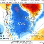
Extended-range U.S. Forecasts Rebuilds The Cold
01/23/2026, 3:12 pm EST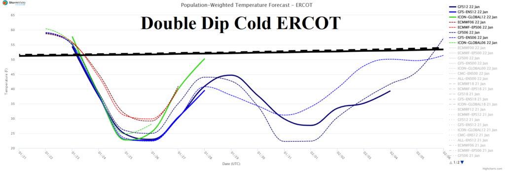
![]()
Climate Impact Company Midday Update
Issued: Thursday January 22, 2026
Highlight: The cold is getting out of control for next 2+ weeks.
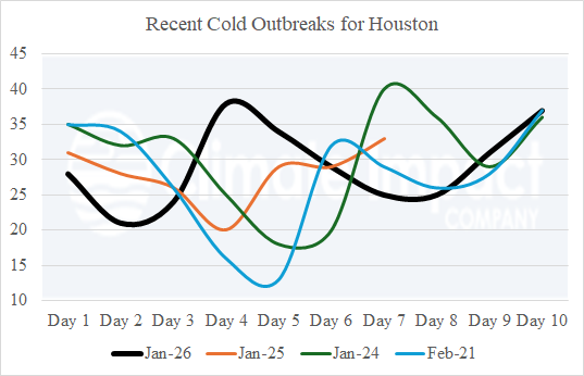
Fig. 1-2: The ERCOT population weight daily temperature average 15-day forecast and a comparison between projected Houston low temperature beginning this weekend into early February compared with other recent cold outbreaks.
Discussion: The latest 15-day ERCOT daily temperature average outlook indicates a double dip of cold weather ahead centered on Houston (Fig. 1). The evolving double dip cold rival other cold outbreaks for Texas this decade (Fig. 2). The 12Z GFS enhances the cold air mass over snow cover in the 6-10-day period where record cold is likely (Fig. 3). The risk of <0F extends into the Mid-south States and just inland the Northeast Corridor Coast (Fig. 4). In the 11-15-day period, the cold core remains impressive shifting to the Interior Southeast (Fig. 5). The catalyst to the cold set-up is a stratospheric warming event across eastern North America and Greenland (Fig. 6).
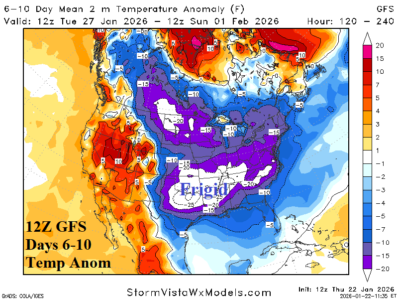
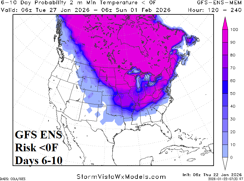
Fig. 3-4: The 12Z GFS U.S. 6-10-day temperature anomaly forecast and 6-10-day risk of <0 projection.

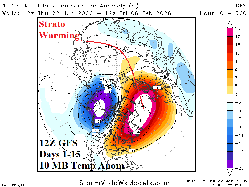
Fig. 5-6: The 12Z GFS U.S. 11-15-day temperature anomaly forecast and the 15-day stratospheric warming event across east/northeast North America.
| EIA End | Forecast | 12-Hour Change | 24-Hour Change | 30-Year Normal | 10-Year Normal |
| 1/22 | 231.9 | +0.2 | +0.5 | 212.6 | 204.8 |
| 1/29 | 290.4 | +4.0 | +13.0 | 211.7 | 204.3 |
| 2/5 | 270.0 | +25.5 | +0.3 | 207.9 | 199.2 |
Table 1: The midday 12Z GFS U.S. gas population weight HDD projections into early February.