
Did Oceanic Forcing Cause Warmer Pattern-change Across North America?
02/03/2026, 8:22 am EST
Negative Pacific North America Index Pattern Ahead; Cold to Storms High Impact U.S. Weather
02/08/2026, 10:07 am EST
Climate Impact Company AG Market Research Report
Issued: Thursday February 5, 2026
Highlight: The Great West Coast of South America Marine Heatwave
Discussion: The warmest sea surface temperature anomalies (SSTA) on record for early February stretching north-to-south off the coast of Chile and Peru exceeding 3C throughout much of this region has generated (Fig. 1). Onset of this large and intense marine heatwave (MHW) occurred in DEC-25. Strengthening continues especially along the immediate coast of Chile during the past 2 weeks (Fig. 2). The warming is spreading equatorward. The daily Nino12 SSTA region off the northwest coast of South America is +0.63C today and 1.27C warmer than 30 days ago.
The MHW is affecting mid-summer climate across South America. The rainfall pattern is biased very wet over western portions of South America as convective rains are enhanced by the increase in low-level atmospheric moisture produced by the very warm ocean surface (Fig. 3). The wetter regime is compensated by a drier climate affecting much of eastern continent especially Northeast Argentina, Uruguay, and Southeast Brazil during the past 30 days.
The best initialization of the SSTA conditions off the West Coast of South America and the tropical East Pacific described is provided by the International multi-model ensemble (IMME). The IMME projection for MAR/APR/MAY 2026 is continued warming of the tropical East Pacific while the MHW broadens and loses some intensity.
The closest analog years are 2023 and 2017 which yield a drier than normal autumn climate across much of Brazil while above normal rainfall extends from northwest continent to Bolivia and Southeast Brazil (Fig. 4). In contrast, ECMWF “monthlies” issued earlier today produce a much wetter scenario for Brazil (Fig. 5).
Typically, when El Nino forms during MAR/APR/MAY, the precipitation pattern across South America is prohibitively wet in Brazil compensated for by arid climate in Northeast Argentina (Fig. 6). Additionally, developing El Nino episodes during MAR/APR/MAY can be quite intense (1997 and 2015). However, during each analog year (which includes 1994), the February SSTA pattern was not prohibitively warm as observed in 2026 off the South America West Coast.
In conclusion, MHW conditions off the West Coast of South America may bias the wet influence of a potential developing El Nino during the autumn season to the western half of South America limiting wet weather exposure to Brazil.
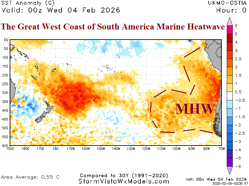
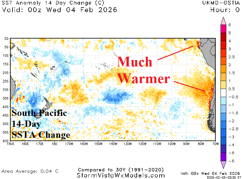
Fig. 1-2: Current South Pacific SSTA analysis and 14-day change.

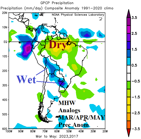
Fig. 3-4: The percent normal rainfall valid for Jan. 5-Feb. 3, 2026 and marine heat wave analog years and their autumn rainfall anomalies.
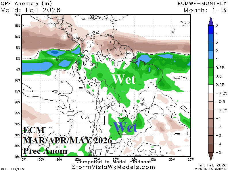

Fig. 5-6: The ECMWF “monthlies” rainfall anomaly forecast for MAR/APR/MAY 2026 and typical rainfall for the same time of year when El Nino forms.