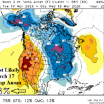
Mega-cluster Ensemble “Most Likely” Forecast Indicates Cold Spike East March 18th
03/06/2026, 3:12 pm EST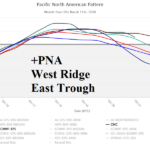
-PNA Pattern Rules U.S. Weather Pattern Next 15 Days
03/11/2026, 5:37 am EDT![]()
Climate Impact Company Daily Feature
Issued: Monday, March 9, 2026
Highlight: At midday, models agree, temperature extremes are likely for March 16-19. Very cold Midwest/East-central U.S. and very hot Southwest States.
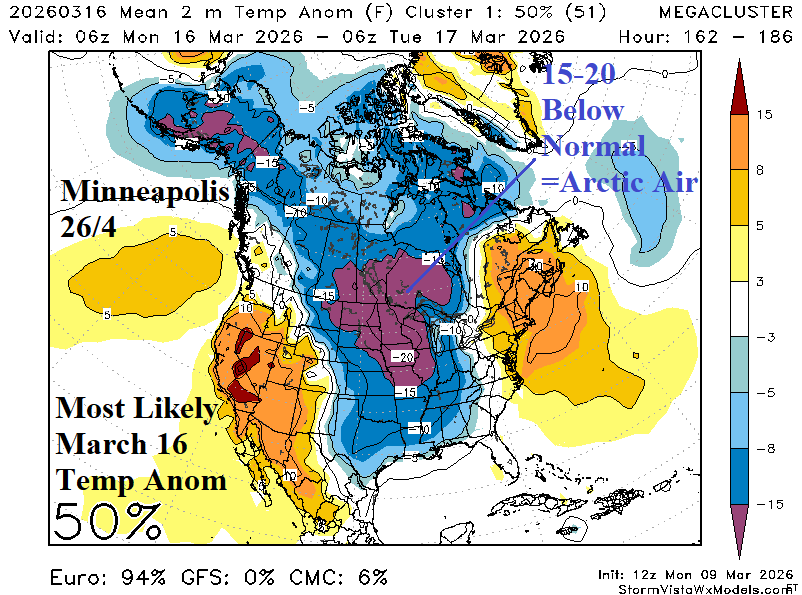
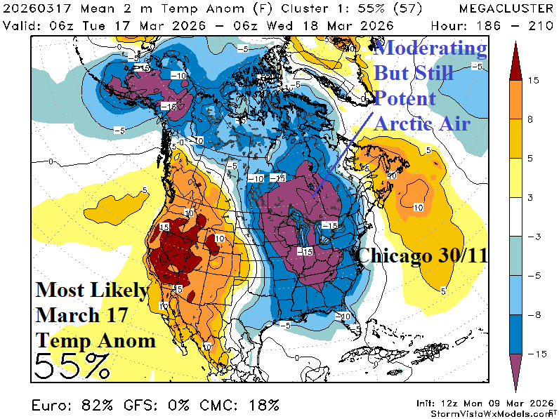
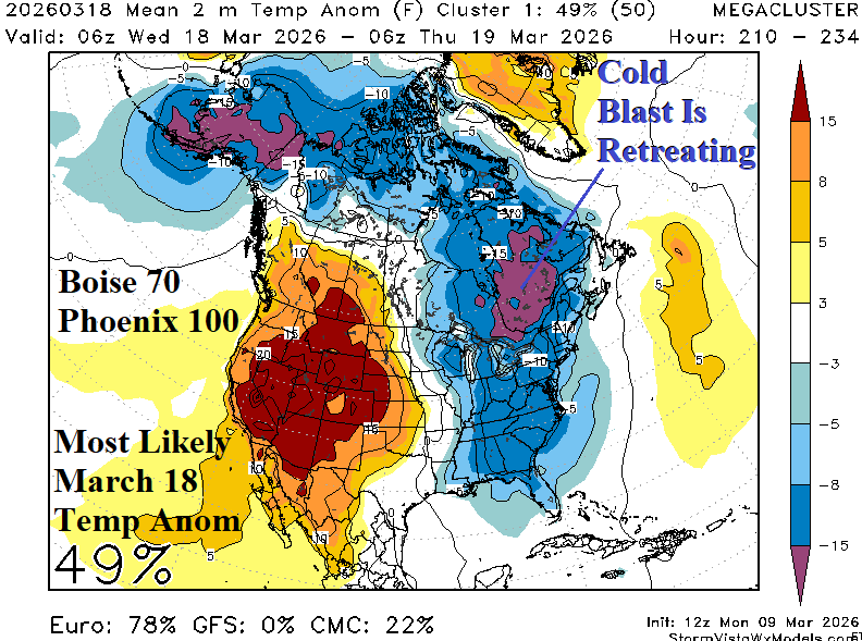
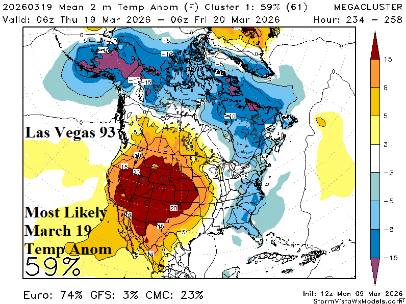
Fig. 1-4: The daily mega-cluster ensemble “most likely” temperature anomaly pattern for March 16-19 features cold and hot extremes.
Discussion: At midday, most forecast models agree that cross polar arctic air moves into North America and gains (anomalous) intensity flowing southward into the North-central/East-central U.S. March 16-17. At that time a small but potent polar vortex enhances the cold. This event may be related to the breakdown of a lengthy stratospheric warming event in the polar region. The mega-cluster ensemble indicates extreme cold, albeit brief, is likely with temperatures >20F below normal in the core of the air mass easily qualifying as arctic air. The aerial coverage of the extreme cold is largest on March 17th and can extend as far south as The Tennessee Valley. The Great Lakes have lost some ice and snow cover is below normal which may defeat the cold intensity. After March 16-17, the cold moderates while retreating to Canada.
Conversely, a subtropical ridge emerges on the West Coast and drifts southeastward across the Southwest U.S. peaking in strength March 18-19. At that time Phoenix roars to 100F and 70F can reach Boise, ID. Las Vegas approaches 95F. The hot weather risk may last through March 20th then ease.
This week, a “Kona Storm” affects the Hawaiian Islands. An upper trough is cutoff from the jet stream flow and hovers northwest of Hawaii causing a day after day long-duration rainstorm. Flood Watch areas are posted for Kauai and Oahu and are likely to spread eastward this week. The “Kona Storm” is consolidating rainfall across the Hawaiian Islands with short wave energy to the north having limited entrainment. Consequently, the significant rain threat for the Northwest U.S. is limited to Washington and British Columbia. This is not a true atmospheric river pattern. In the 8-14-day period, a long wave trough forms extending south from the Gulf of Alaska forcing a moderate atmospheric river pattern to push heavy precipitation into Western Canada possibly north of the important HYDRO areas near the U.S. border. Note that the heat release of the atmospheric river convection is fueling the amplitude of the upper ridge shifting over the Southwest U.S.
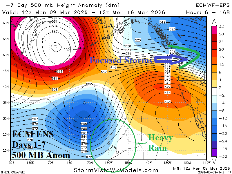
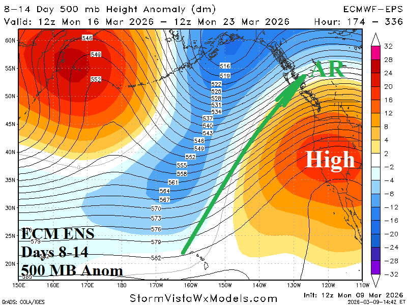
Fig. 5-6: 14-day ECM ENS 500 MB anomaly forecast across the East Pacific.