NAWH Low Pressure Trough Soaks Europe
09/17/2025, 6:10 am EDT
Reports of Crop Damage India and Canada Due Mostly to Rainfall Patterns
09/23/2025, 9:05 am EDT
Climate Impact Company Week 2-4 Outlook
North America
Issued: Sunday, September 21, 2025
Highlight: Drier again.
Chart of the day: Why is the Caribbean and Gulf TC Inactive?
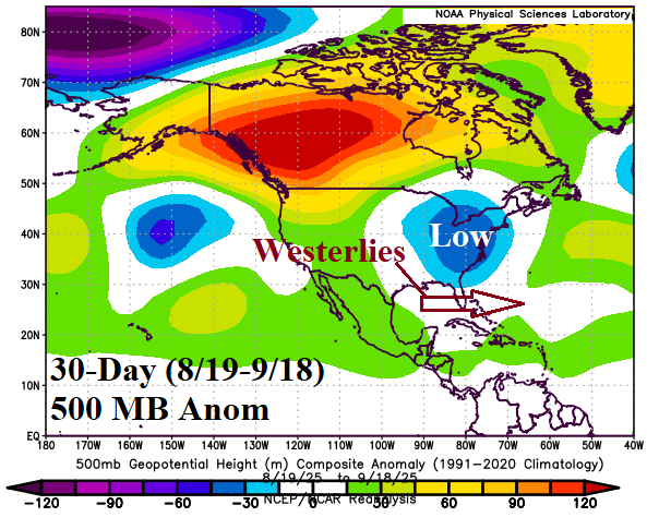

Discussion: Since mid-August, an upper trough settled over the East U.S. propelling upper-level westerly flow across the Gulf of Mexico extending to Cuba. The shearing westerly flow aloft has helped to keep this zone dry in the middle troposphere and produced an environment hostile to tropical development. The ECM ENS 500 MB anomaly forecast maintains the shearing westerlies across the Gulf of Mexico.
Week-2 Ahead Forecast valid September 28-October 5, 2025: Regenerating dryness Midwest and South U.S.
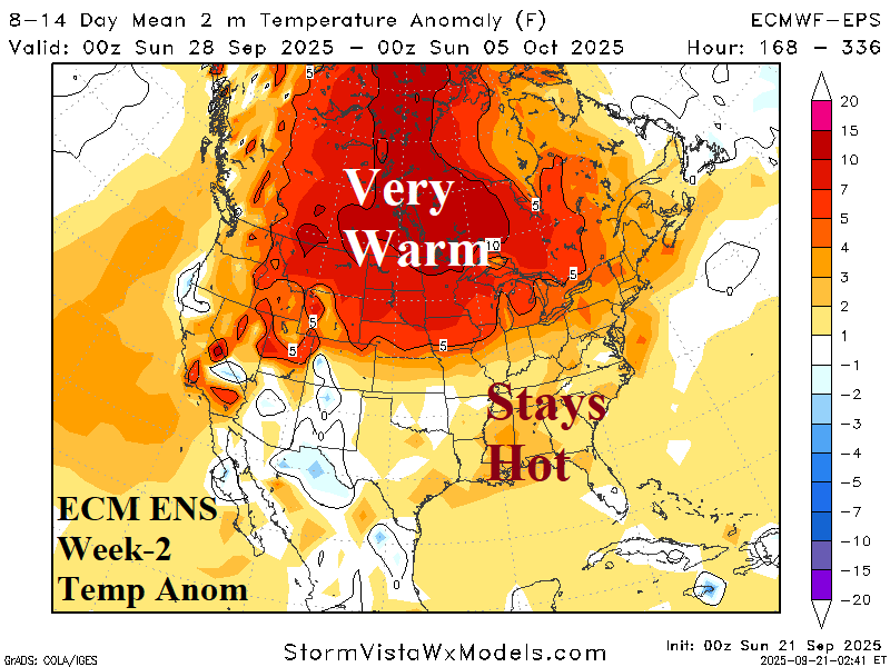
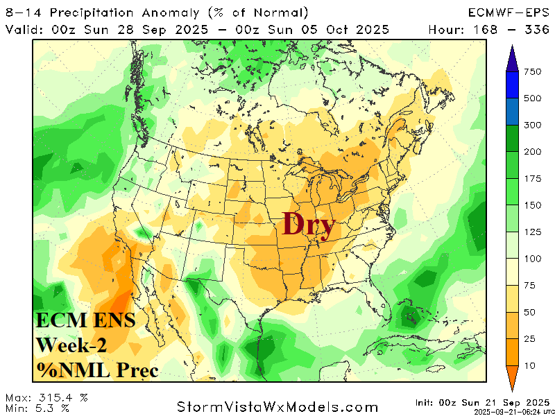
Discussion: The ECM ENS returns the very dry pattern centered on the East-central U.S. while borderline hot weather lingers in the Southeast U.S. and much of Canada remains well above normal.
Week-3 Ahead Forecast valid October 5-12, 2025: Cooler East.
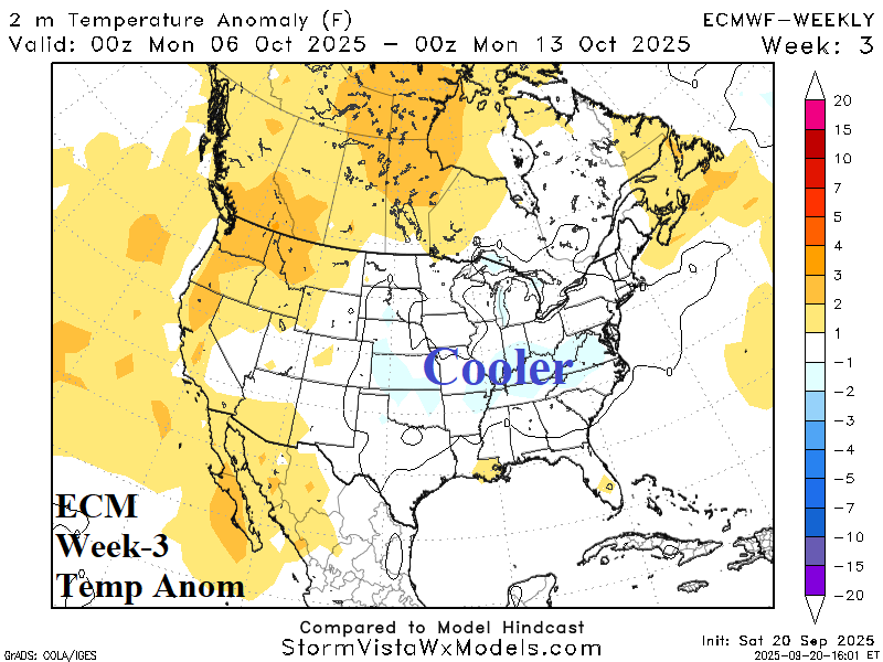

Discussion: Upper trough forecast for the Northeast U.S. by ECM which maintains dry westerlies across the Southeast while cooler weather spreads across the East. A large area of tropical rains extend from the East Pacific to the southwestern Gulf of Mexico.
Week-4 Ahead Forecast valid October 12-19, 2025: Rainy tropics; Nationally marginally warm.
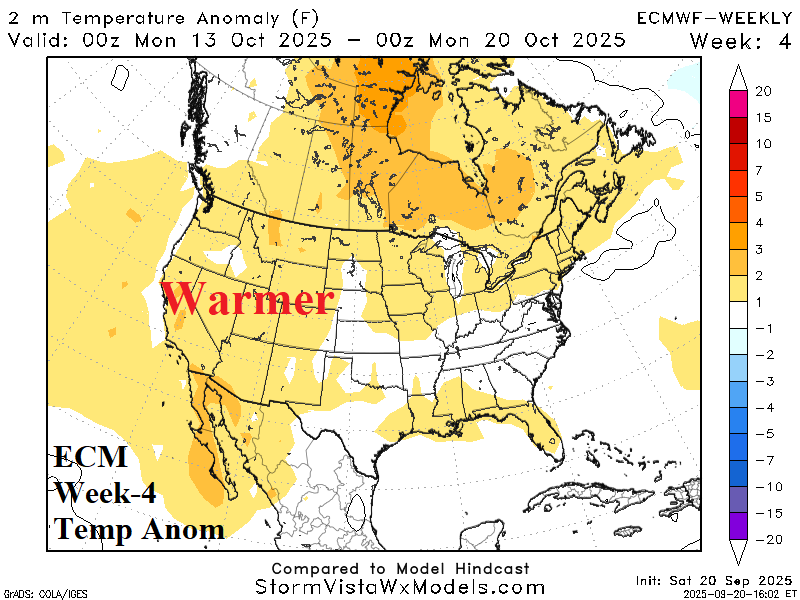
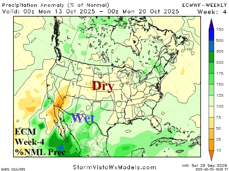
Discussion: Tropical rains across the southern half of the Gulf of Mexico extend across Mexico into the East Pacific. Mostly dry weather to the north of that rainfall. Nationally, a marginal warm pattern.