
The Warm Oceans, Causal to Warm Medium-range Forecasts
10/15/2025, 7:01 am EDT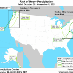
NOAA/CPC High Impact Weather Forecast in 6-10-Day Period
10/23/2025, 8:20 am EDT
Climate Impact Company Week 2-4 Outlook
North America
Issued: Monday, October 20, 2025
Highlight: AI models develop trough anchoring in the East during November. CFS V2/GFS ENS are much warmer (East), ECM is in-between (and preferred).
Charts of the day: Differing week-4 forecasts.
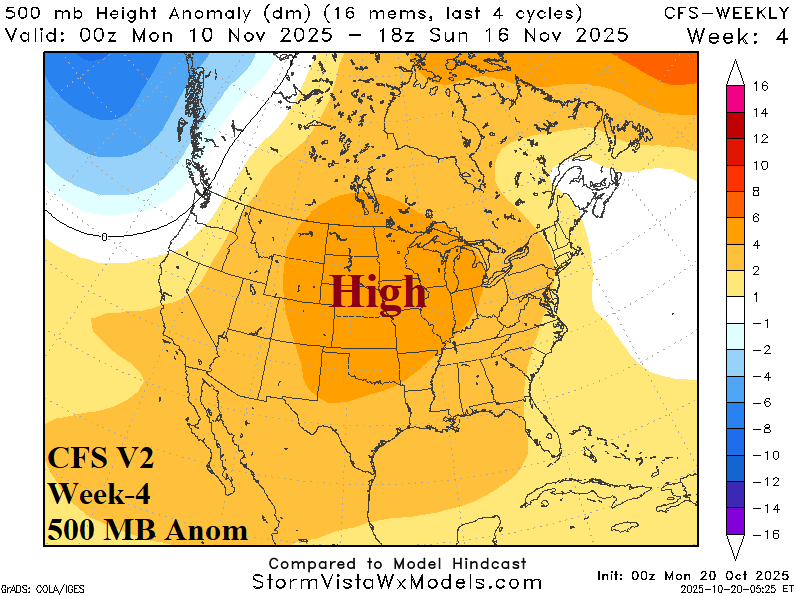
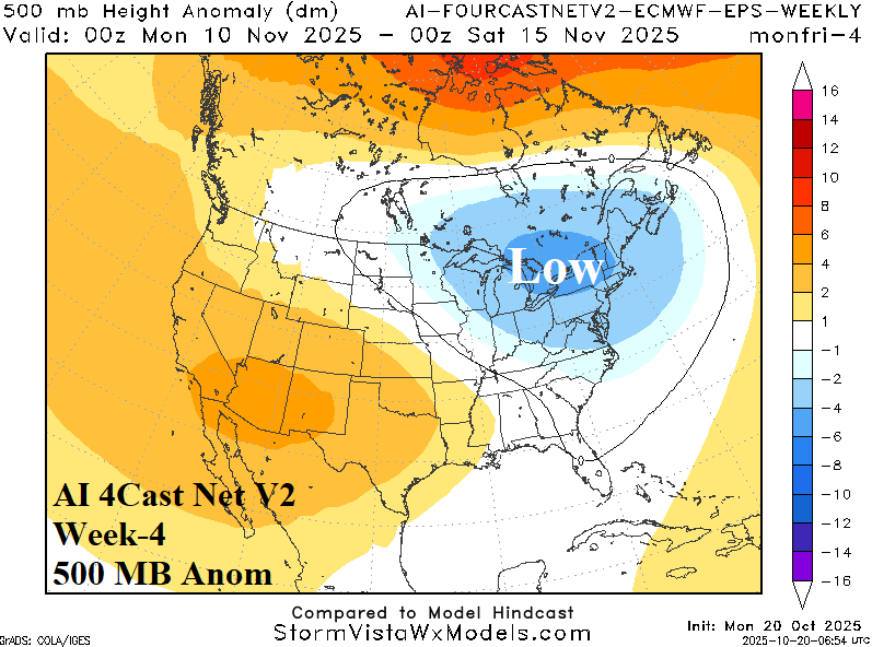
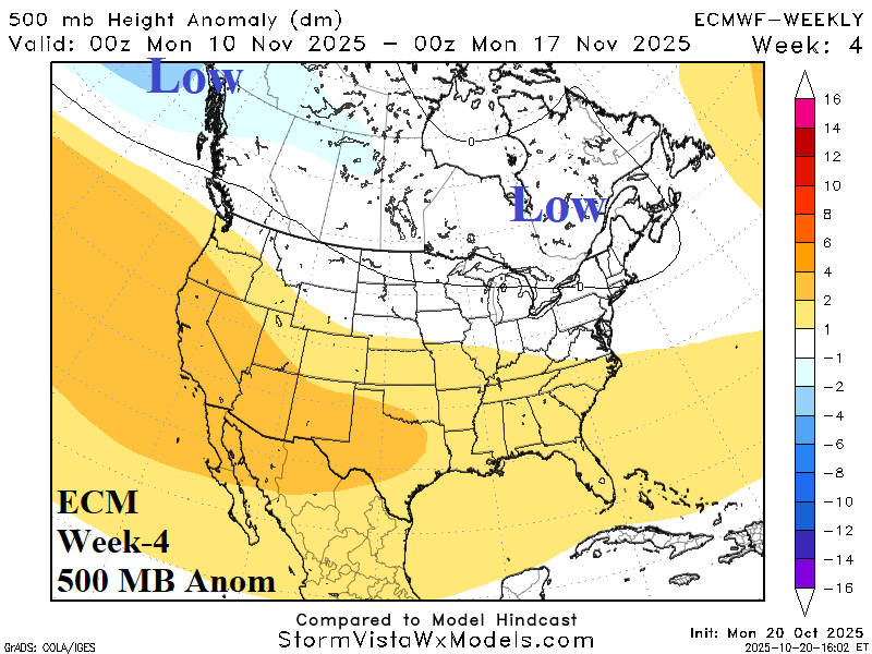
Discussion: The upper air forecast for week-4 is highly variable ranging from an amplified (warm) Central U.S. high pressure ridge according to CFS V2 to a deep cool upper trough centered on New York based on the 4Cast Net V2 ECM ENS, or somewhat of a compromise by ECMWF. MJO projections for mid-November are in phase_6 (near the Dateline) which favors a warm solution for the U.S. ECM is the chosen model with CFS V2 the caveat forecast while leaning away from the cooler East AI scenarios.
Week-2 Ahead Forecast valid October 26-November 2, 2025: U.S. is stormy; Cooling East delayed.

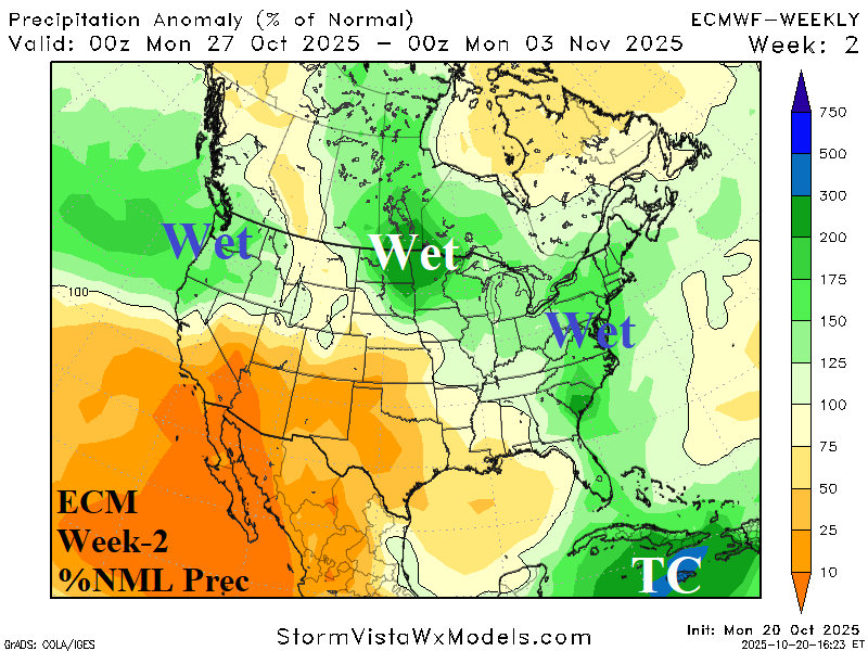
Discussion: The outlook delays cooling in the East while the Northwest is adjusted cooler. The Northwest, North-central, and East are stormy, little change from the previous forecast. The Caribbean Sea remains tropically active.
Week-3 Ahead Forecast valid November 2-9, 2025: Stormy New England; Cooler East.

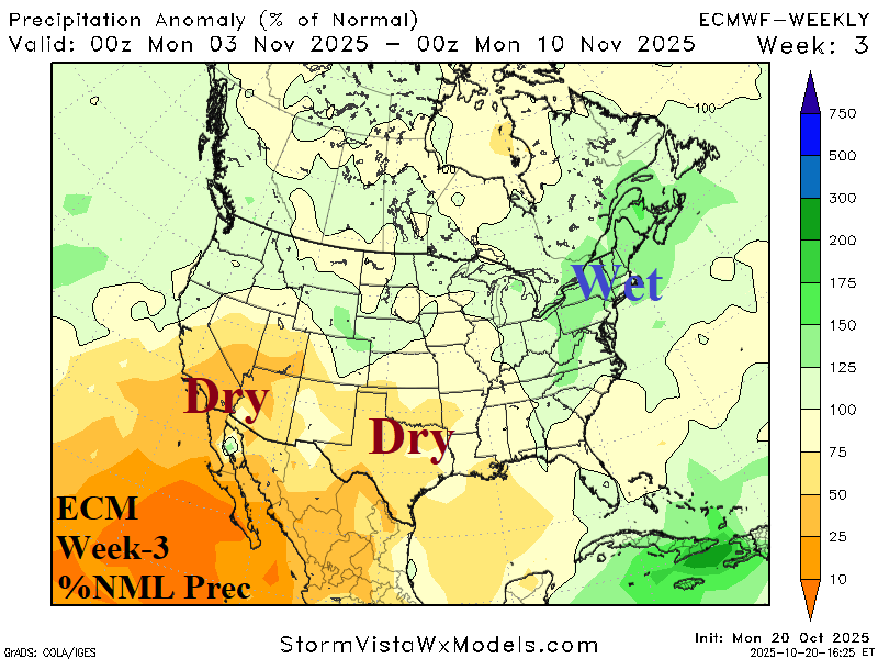
Discussion: Upper trough causes additional storminess over New England including mountain snows. A trailing cool air mass convenes in the Southeast U.S. Anomalous warmth and dryness shifts to the Southwest U.S.
Week-4 Ahead Forecast valid November 9-16, 2025: Much drier; Mild!


Discussion: The week-4 outlook is warmer than normal except normally cool in the Southeast and Northwest U.S. The pattern shifts considerably drier.