
Colder HDD Forecasts for Later November and December
11/07/2025, 5:36 am EST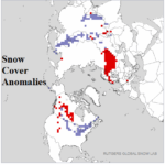
Below Normal Northwest Eurasia Snow Cover Changes Next Couple Weeks
11/11/2025, 5:50 am ESTClimate Impact Company U.S. Sunday Report
Issued: Sunday, November 9, 2025
Highlight: An early season cold blast for the Midwest to Gulf States. Medium range looks warmer.
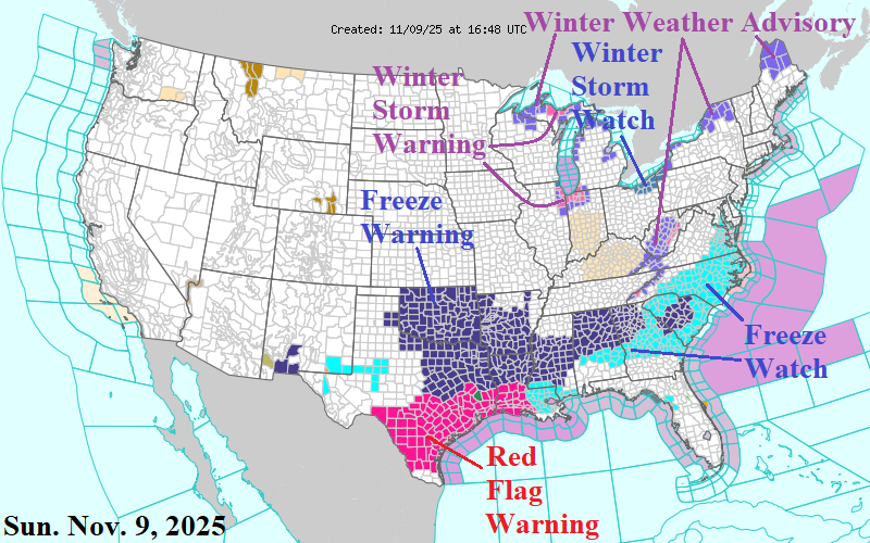
Fig. 1: The NOAA/NWS weather watch, warning, and advisory areas.
Discussion: An exceptional cold spike is developing in the Midwest U.S. rapidly spreading to the Gulf States to start the week. Most of the Mid-south U.S. have Freeze Warning’s in effect (Fig. 1). A Freeze Watch extends eastward across the Carolinas. Lake effect snow arrives early and targets Northeast Illinois/Northwest Indiana for heaviest amount today and tonight (Fig. 2). Heavy snow extends northeastward along and north of the St. Lawrence River. On Monday, snow continues downwind Southern Lake Michigan, Lake Erie, and Lake Ontario (Fig. 3). The snow helps to make the incoming chill colder. Temperatures challenge century-old previous records in the Midwest to Gulf States. The coldest anomaly maps are forecast for tomorrow morning when parts of Arkansas are 22F cooler than normal (Fig. 4) and morning low temperatures are in the middle teens Wisconsin/Illinois and 32F in northeast Texas (Fig. 5). Tomorrow afternoon is 27F cooler than normal in East Tennessee (Fig. 6) which means near 32F in that region, 20’s in the Ohio Valley, and upper 30’s Northern Alabama (Fig. 7). The third coldest anomaly map is across the Southeast U.S. on Tuesday morning with low temperatures <20F below normal in Florida (Fig. 8). Near 32F will reach Northern Florida with widespread 20’s Midwest and Interior East (Fig. 9). The medium range forecasts are warm except for a cooler trend West, which could be cooler than indicated, and resistance in New England to significant warming (Fig. 10-11). The very cold shot into the Interior East to start the week is caused by an intense negative North Atlantic oscillation (-NAO) which indicates titanic high pressure over Greenland inspired by the heat release of late October 892 MB category-5 major hurricane Melissa.


Fig. 2-3: Heavy plowable snow for today/tonight and tomorrow.
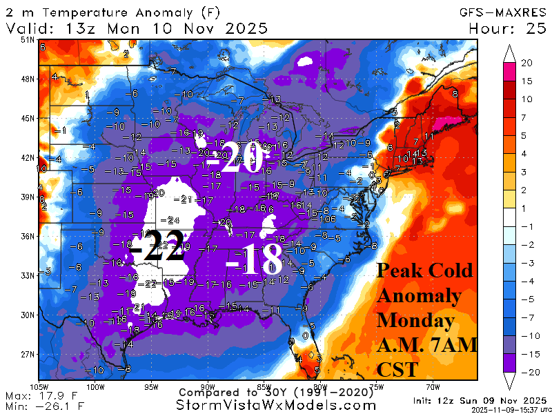
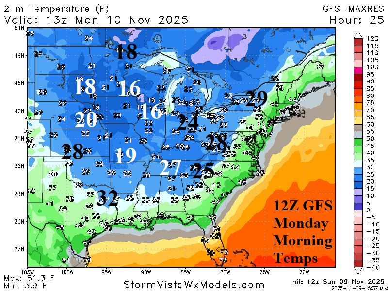
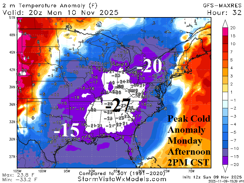
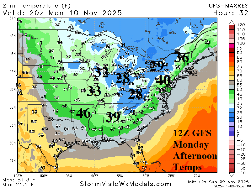
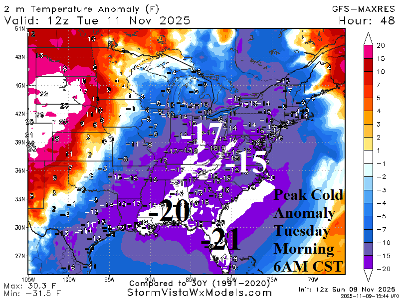
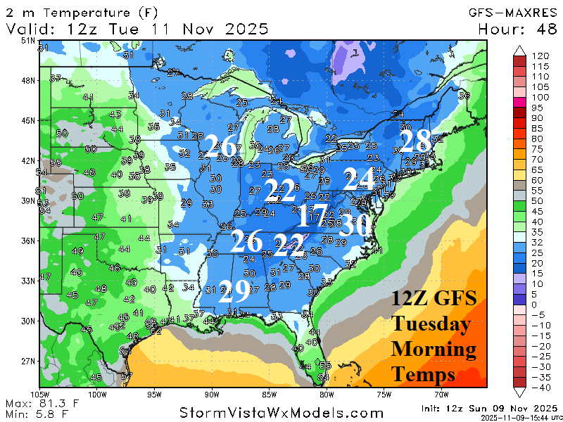
Fig. 4-9: The 3 coldest anomaly forecasts by the 12Z GFS and the attendant temperature (Monday morning, Monday afternoon, and Tuesday morning).
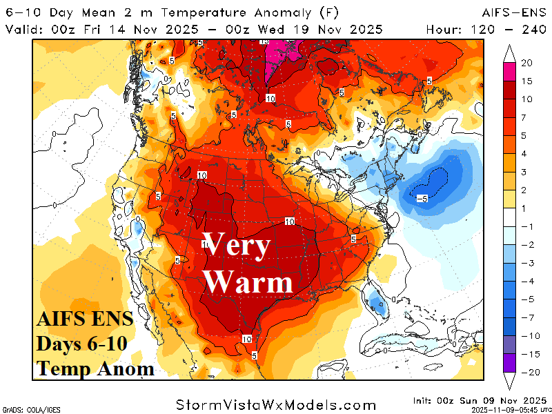
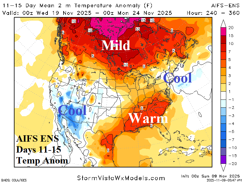
Fig. 10-11: The AIFS ENS medium range temperature anomaly forecasts.