Reports of Crop Damage India and Canada Due Mostly to Rainfall Patterns
09/23/2025, 9:05 am EDT
Potential Excessive Rainfall Pattern for Mid-Atlantic into Early October
09/25/2025, 6:44 am EDT
Climate Impact Company Early U.S. Notes
Issued: Wednesday September 24, 2025
Highlight: Tropics activate, expect busy October; Relentless warm pattern.
Discussion: The tropics are likely to activate to finish September extending well into October. So far, 7 tropical storms and 2 hurricanes have generated, and seasonal outlooks projected a minimum of 13 tropical storms and 5 hurricanes. Operational models project 3 events in the 15-day outlook. Two storms, Humberto and Imelda, occur simultaneously off the Mid-Atlantic Coast on the last day of September (Fig. 1). Imelda may impact the Mid-Atlantic Coast with heavy rain, high wind, and coastal flooding. The Gulf of Mexico has been quiet but potential for a significant event is indicated by GFS late in the 11-15-day period, possibly a major hurricane (Fig. 2). Be prepared for a busy October as the seasonal forecast minimums (13 storms/5 hurricanes) are LIKELY to verify.
The GFS has been a good guide insisting the very warm pattern continues well into October. The ECM ENS is warmer during the next 15 days (Fig. 3). ECM “weeklies” maintain the warmth shifting eastward in the week 3-4 outlook (Fig. 4).
Charts of the Day
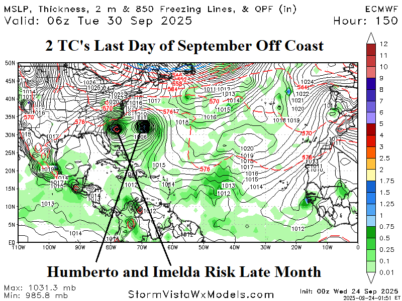

Fig. 1-2: Tropical cyclone risk increases across the North Atlantic basin into early October.
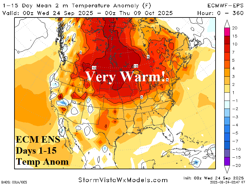

Fig. 3-4: The ECM ENS 15-day temperature anomaly forecast is vigorously warm and the anomalous warmth is maintained in the ECM week 3-4 outlook.