Heavy Rains Heading for Europe
07/25/2023, 5:32 am EDTThe Ocean/Atmosphere July Pattern Change Affecting Europe Climate
08/01/2023, 7:52 am EDT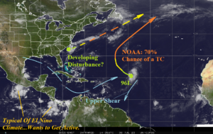
Fig. 1: Satellite view of the North Atlantic basin and primary features.
Today’s discussion: Tropical Disturbance 96L located in the central North Atlantic subtropics (Fig. 1) is forecast to drift northwest and north with a 70% chance of tropical cyclone development according to NOAA/NHC. A second area of low pressure off the Carolina Coast is expected to drift east-northeast and may gain organized subtropical (or tropical) characteristics this week. Meanwhile, typical of El Nino, the tropical East Pacific has percolating convection areas where tropical cyclone formation is likely. North and east of the tropical convection, also typical of El Nino climate, is a shear axis across the Gulf of Mexico and Caribbean Sea. It’s still early, the most active part of tropical cyclone season is a few days away (Aug. 1st), but today’s analysis is reminiscent of past El Nino years in the modern climate (since the mid-to-late 1990’s) when tropical activity was biased to the East Coast or outer Atlantic especially during stronger El Nino (Fig. 2-3) while weaker El Nino offered some Gulf of Mexico risk (Fig. 4-5). Although today’s southern oscillation index (SOI) is positive, the past 3 weeks have featured a strong -SOI signaling El Nino climate is developing. Unlike previous El Nino years, the 2023 season has a record warm North Atlantic basin surface/upper ocean heat signature. A new assessment of the 2023 tropical cyclone season will be issued by Climate Impact Company, Colorado State University, and Tropical Storm Risk/U.K. mid-to-late this week.
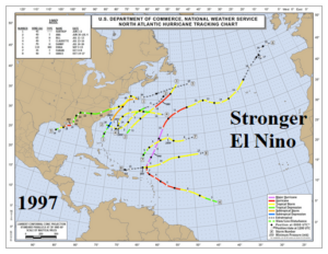
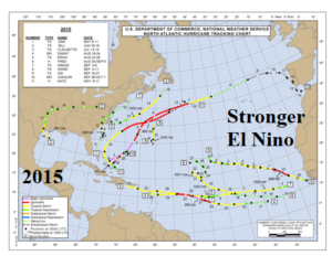
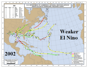
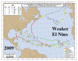
Fig. 2-5: Tropical cyclone activity during the 2 strongest (top) and 2 weaker (bottom) El Nino’s in the current climate cycle.
