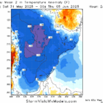
Season’s First Chilly Risk to Southern Brazil in 10+ Days
05/21/2025, 9:37 am EDT
Negative Scandinavia Index Pattern Develops; Cools/Soaks North/Central Europe
05/27/2025, 5:32 am EDT
Climate Impact Company Week 2-to-5 Tropical Outlook
Issued: Friday May 23, 2025
Headline: Concern…set-up for early season Gulf of Mexico tropical systems.
Charts of the day: The warm (and warming) Gulf of Mexico.
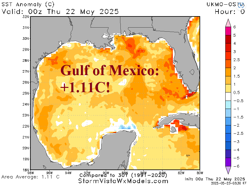
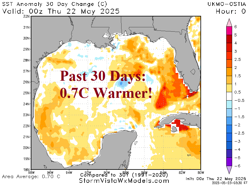
Discussion: The Gulf of Mexico has suddenly warmed dramatically. The daily SSTA analysis reveals a basin average of +1.11C which is very warm and most of that warming has occurred during the past 30 days.
Week-2 Valid June 1-7, 2025: Careful eye on the Gulf of Mexico.
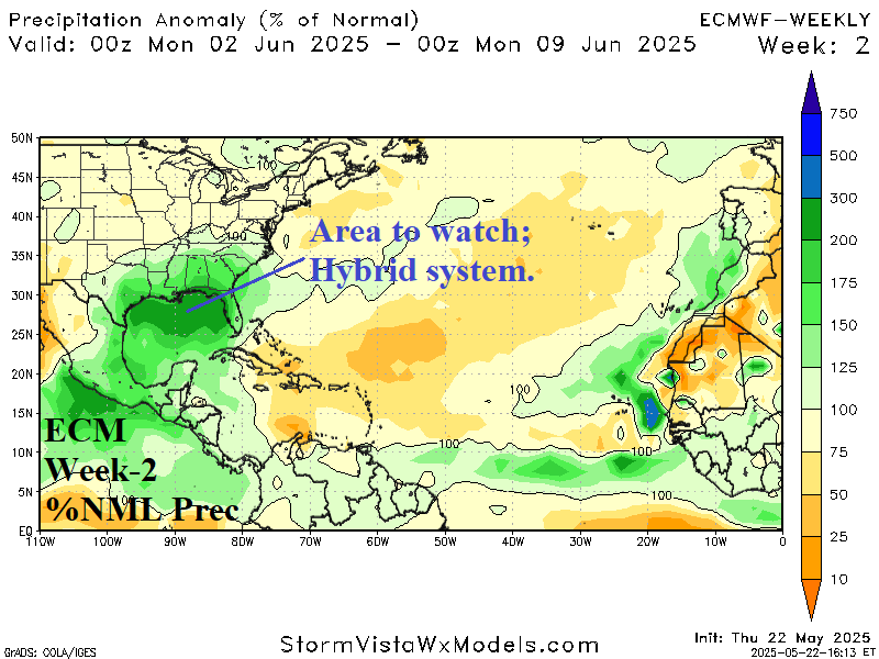
Discussion: An upper trough located in the northwestern Gulf of Mexico spawning a massive amount of rain across the Gulf of Mexico affecting the coastal region. A careful watch late in the period for any subtropical/tropical low-pressure development.
Week 3 Valid June 8-14, 2025: Early season trouble remains possible in the Gulf.
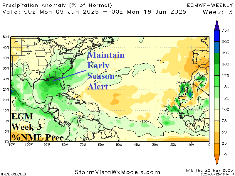
Discussion: The rainy Gulf of Mexico pattern continues inspired by an upper-level trough. A “hybrid” tropical system could form in this scenario in the central or eastern Gulf of Mexico.
Week 4 Valid June 15-21, 2025: Above normal early season tropical development risk is maintained in the Gulf.
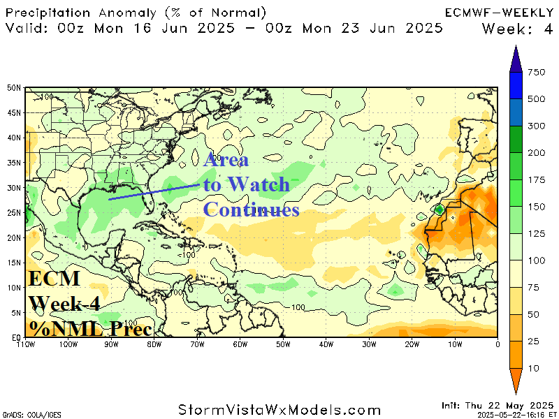
Discussion: The showery regime in the Gulf of Mexico continues inspired by an upper-level low-pressure near the Texas Coast. The set-up maintains an early season tropical system risk in the Gulf of Mexico.
Week 5 Valid June 22-28, 2025: All clear late June.

Discussion: The week-5 forecast indicates an ALL CLEAR.