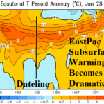
Major East Pacific Subsurface Warming…La Nina to End, El Nino Ahead
02/02/2026, 5:56 am EST
Coldest Days (Feb. 7-8) of Winter in Northeast
02/06/2026, 8:32 am EST
Climate Impact Company Early U.S. Notes
Issued: Thursday February 5, 2026
Highlight: Catalyst to U.S. warm pattern ahead.
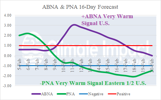
Fig. 1: The 16-day forecast of an emerging vigorous positive phase of the Asia/Bering Sea/North America index which inspires a developing strong negative Pacific North America pattern.
Discussion: One of the strongest climate signals during DEC/JAN/FEB representing extreme temperature across North America is the Asia/Bering Sea/North America (ABNA) index. The ABNA index 16-day forecast indicates a strong positive phase spike next week (Fig. 1) and representative of a widening anomalous warm pattern in North America. In the short-term, latent heat release from the presence of a tropical cyclone approaching the Philippines causes an upper ridge to form to the northeast south of the Aleutian Islands (Fig. 2). A compensating cold trough amplifies over Coastal Northeast Asia. In the 6-10-day period, the upper ridge crests north of Hawaii forcing Northeast Asia upper trough eastward across Alaska (Fig. 3). The upper trough beings amplifying on the North America West Coast, characteristic of a negative Pacific North America (PNA) index. Compensating for the evolving western North America trough is a warming ridge affecting most of North America. In the 11-15-day period, a full -PNA regime has evolved, and the +ABNA regime begins to weaken (Fig. 4). In the 11-15-day period a warm upper ridge rests over the eastern half of North America. The ABNA influence on North America begins over Northeast Asia. What are the potential scenarios on day-15? The mega-cluster ensemble indicates the most likely 500 MB anomaly pattern is the West Coast trough shifting toward the Central U.S. propelling a significant storm for the Great Plains (Fig. 5). Warmth in the East continues while western half of the U.S. cools. The caveat forecast is the -PNA West Coast trough is not progressive and amplifies on the West Coast while the memory of winter 2025-26 upper trough re-emerges on the East Coast (Fig. 6).
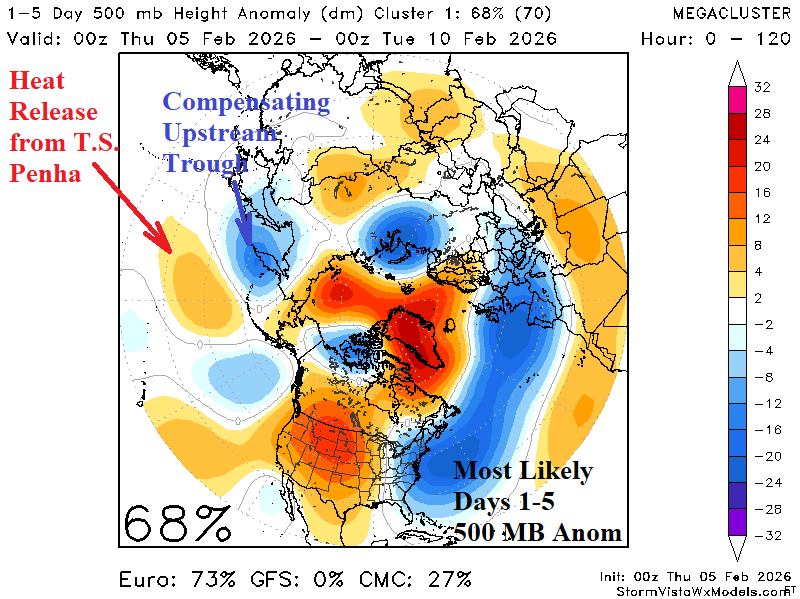

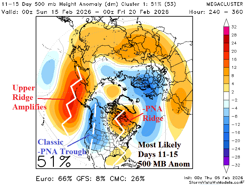
Fig. 2-4: Mega-cluster ensemble “most likely” 500 MB anomaly pattern across the northern hemisphere through the next 15 days.
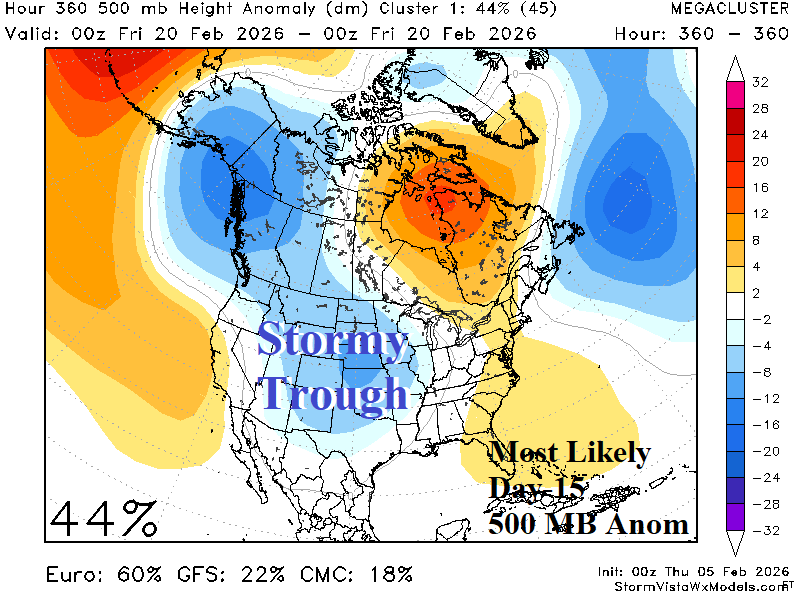
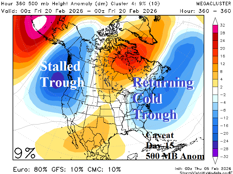
Fig. 5-6: The mega-cluster most likely and caveat 500 MB anomaly forecast for day 15.