12/30/2025, 6:02 am EST

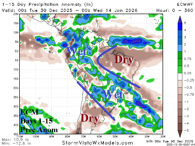
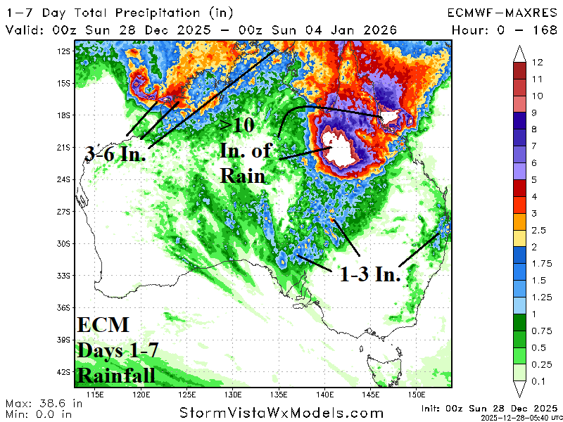
Never a shortage of dramatic weather events as 2025 comes to a close. A lingering negative phase of the Antarctic oscillation (-AAO) causes a mid-latitude trough east of Argentina that extends northwestward to soak Brazil into the New Year. Meanwhile, excessive rainfall across Northern Australia will continue. The arctic air source region across Western Canada during December is likely to dissipate in early January due to a cold stratosphere.
