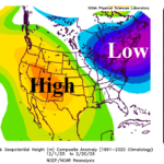
The Ongoing Memory of The Winter 2025-26 Upper Air Pattern in North America
02/23/2026, 5:25 am EST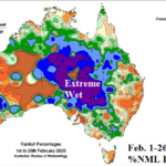
Extreme Rainfall in Australia during February 2026
02/26/2026, 12:09 pm EST
Climate Impact Company Early AG Market ALERT
Issued: Wednesday February 25, 2026
Highlight: El Nino risk 2026 increasing, MJO supports wider aerial coverage of U.S. warmth while maintaining Australia rains. Brazil to Argentina wet shift.
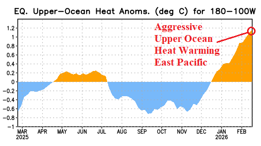
Fig. 1: The upper ocean heat east of the Dateline during the past 12 months clearly identifies accelerating warmth supporting increased El Nino risk for 2026.
Discussion: The upper ocean heat across the equatorial East Pacific is accelerating (Fig. 1). Normally, upper ocean heat content is a strong indicator of ENSO phase ahead which in this scenario is La Nina demise, brief neutral ENSO, and El Nino onset by Q2/2026. We’re in the ENSO prediction barrier time of year which means LOW ENSO phase forecast skill. However, the impressive warming, if continued, strongly supports El Nino development ahead. The daily southern oscillation index (SOI) remains in positive phase which supports lingering La Nina climate. However, the Madden Julian oscillation (MJO) 15-day forecast is stronger and shifting eastward toward the Dateline which suggests SOI reversal to negative phase, a warm U.S. climate, and increased rain risk in the Central States. Usually, during FEB/MAR, MJO shift to phase_5/phase_6 is a wet signal in Australia and drier signal for South America.
The 15-day forecast across the U.S. is warm, as supported by the MJO outlook, and turns wet in the East-central/Midsouth States (Fig. 2-3). In South America, the outlook is (very) wet in East Brazil for the next 1-7 days followed by a wetter transition for Argentina in the medium range. The 15-day temperature anomaly outlook indicates anomalous heat across an area missing the rain in Northeast Argentina (Fig. 4). The wet areas in East Brazil and Argentina (Fig. 5) observed suppressed heat risk due to wet weather. An active and fluctuating southern annular mode (SAM) has larger control over South America climate (now) versus the MJO. The latest 7-day rainfall observations across South America confirm the evolving wetter regime in East Brazzil. In Australia, the wet pattern continues. Interestingly, a small area of relatively dry and anomalous hot weather remains forecast across the northeast quadrant of New South Wales (Fig. 6). The heavy rain focus is cross the North and southward to South Australia (Fig. 7).
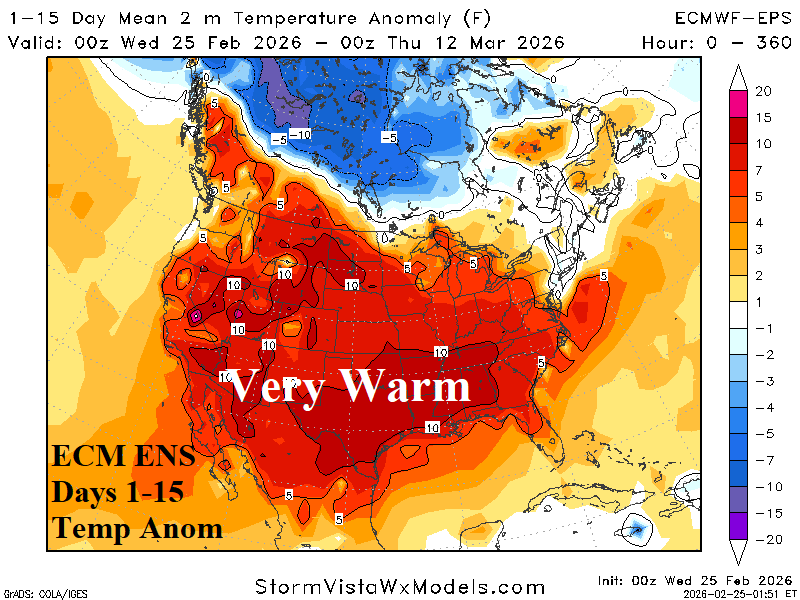
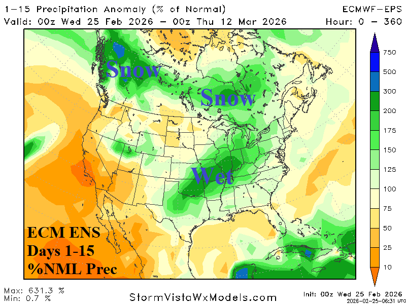
Fig. 2-3: The ECM ENS 15-day temperature anomaly and percent of normal precipitation forecast across North America.
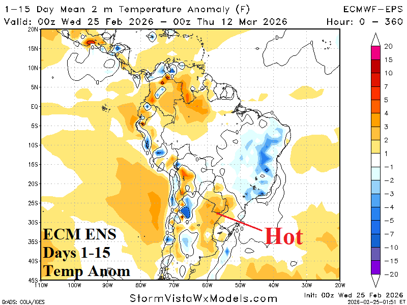
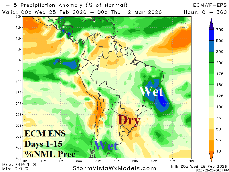
Fig. 4-5: The ECM ENS 15-day temperature anomaly and percent of normal precipitation forecast across South America.
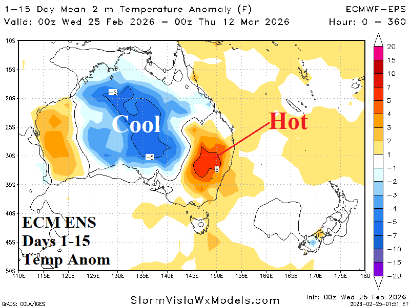
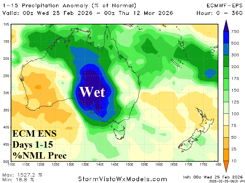
Fig. 6-7: The ECM ENS 15-day temperature anomaly and percent of normal precipitation forecast across Australia.