Wicked Weather Ahead for Australia
07/14/2025, 4:42 am EDT
New NOAA Long-lead Climate Forecasts Implicate Southeast U.S. for Tropical Cyclone Risk
07/17/2025, 9:18 am EDT
Climate Impact Company Week 2-to-5 Tropical Outlook
Issued: Tuesday July 15, 2025
Headline: Tropics are dry well into August; Gulf and Bahamas become early season target areas for development.
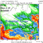
Charts of the day: ALERT for Northern Gulf of Mexico tropical cyclone.
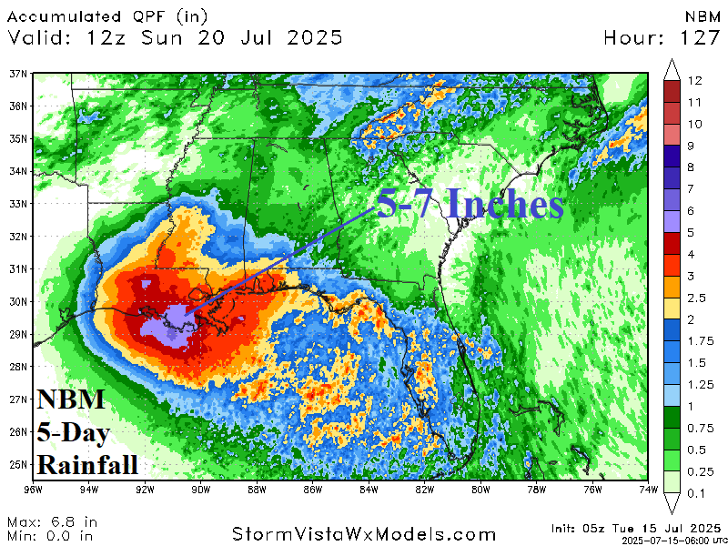
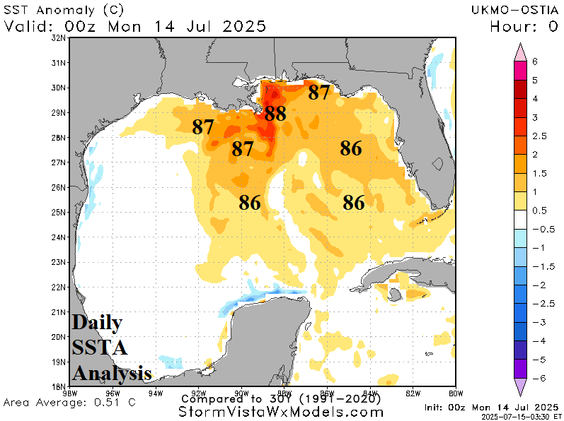
Discussion: Operational models are piling rainfall forecasts for Louisiana later this week and weekend. Notable is the considerably lower amount of rain forecast by most AI models. The culprit is a westward drifting low pressure area across the northeast Gulf toward Louisiana moving across water temperatures in the 86-88F range. The SST are a red flag for potential development despite proximity to land.
Week-2 Valid July 20-26, 2025: Strengthening ITCZ but very dry just to the north.

Discussion: The subtropical ridge starves the North Atlantic tropics for moisture. The exception is an active ITCZ in the deep tropics. The remains of a Gulf of Mexico system are inland early next week.
Week 3 Valid July 27-August 2, 2025: Possible issue in the Gulf.
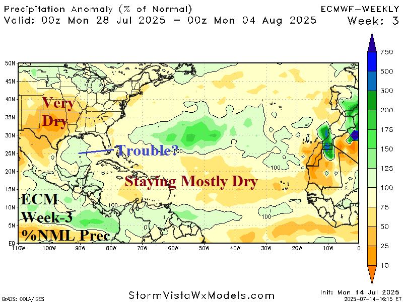
Discussion: Tropical cyclone risk areas are subtly indicted by ECM “weeklies” offering the central Gulf of Mexico as a possible problem area in early August. Otherwise, the tropics stay mostly dry.
Week 4 Valid August 3-9, 2025: Watching the Gulf of Mexico.
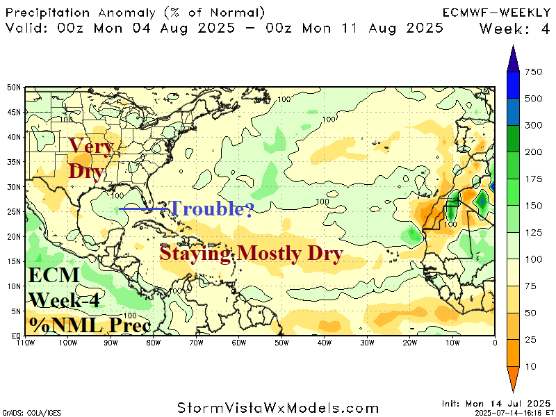
Discussion: The dry tropics in the Central North Atlantic coupled with a dry and hot climate across the Mid-south U.S. create a low-pressure region in the Gulf of Mexico where tropical development risk is possible.
Week 5 Valid August 10-16, 2025: Still awaiting a deep tropics significant storm.
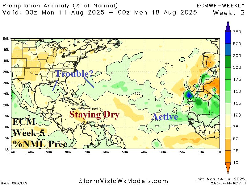
Discussion: Possible trouble in the Gulf and east of the Bahamas while outer tropics are active.