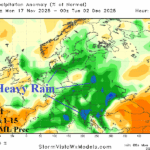
Europe Outlook To Close November Stormy/Wet
11/17/2025, 4:30 am EST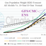
Climbing Heating Degree Days in U.S. as December Arrives
11/19/2025, 4:48 am EST![]()
Climate Impact Company Midday Update
Issued: Tuesday November 18, 2025
Highlight: 12Z GFS shifts the stratospheric warming to Northern Canada, causes colder 11-15-day change. Monitoring other stratosphere forecasts to validate is important.
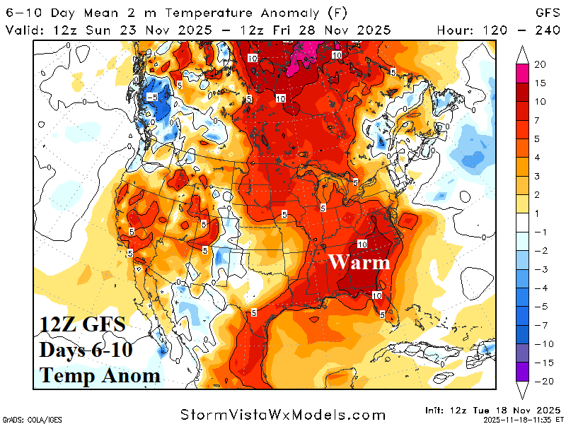
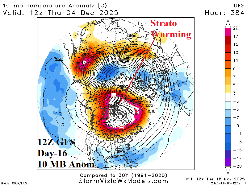
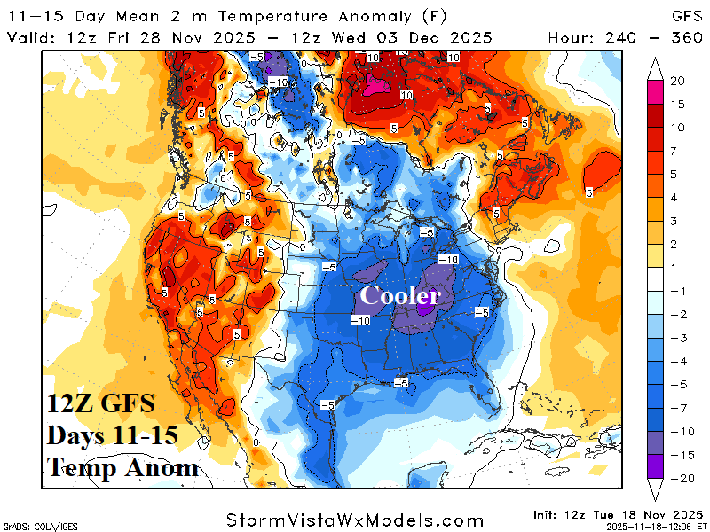
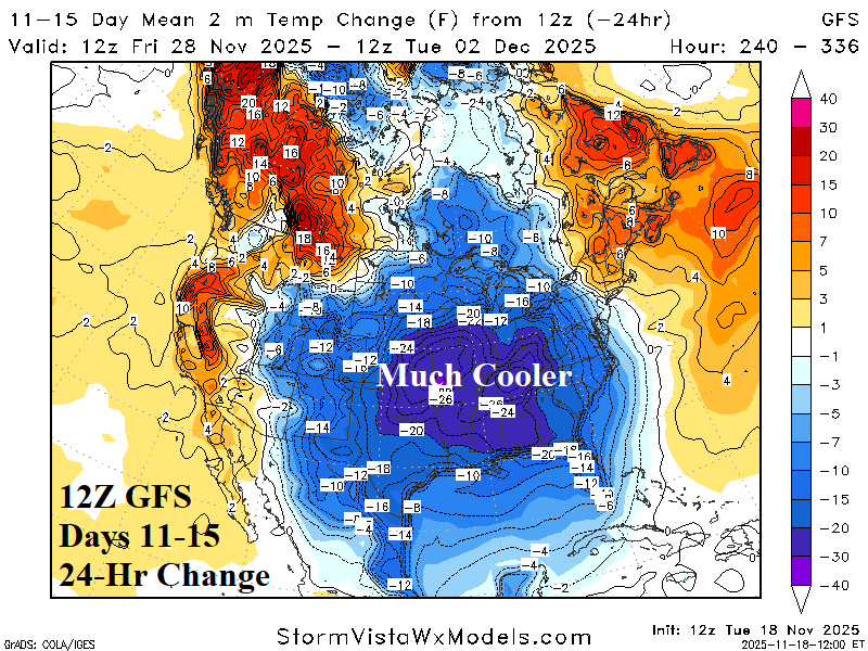
Fig. 1-4: The 12Z GFS 6-10-day temperature anomaly, day-16 10 MB temperature anomaly, day 11-15 temperature anomaly, and 11-15-day 24-hour change.
Discussion: The 12Z GFS attracts attention with a stratospheric warming driven cold outbreak into the East-central and East U.S. in the 11-15-day period. The 6-10-day forecast looks familiar, warmer than normal (Fig. 1) although not as warm as previously indicated. At day-16, the 12Z GFS shifts stratospheric warming from northwest continent indicated by all models during previous model runs, to Northern Canada (Fig. 2). In this position, the model creates cold air quickly thrusted into the U.S. in the 11-15-day period (Fig. 3), a dramatic cooler change (Fig. 4). The HDD forecast for the week ending Dec. 4th is a whopping 175 (Table 1). The change is 48 HDD colder than 24 hours ago when the same model forecast a major warm change. The colder change is (also) related to the GFS 10 MB temperature anomaly forecast indicating that in 15 days the temperature warms to the upper (historical) limit (Fig. 5). To validate the GFS, stratosphere regimes offered by other models require close monitoring.
| EIA End | Forecast | 12-Hour Change | 24-Hour Change | 30-Year Normal | 10-Year Normal |
| 11/20 | 109.2 | -0.1 | 0.0 | 134.7 | 129.8 |
| 11/27 | 115.5 | -4.8 | -7.2 | 150.4 | 145.8 |
| 12/4 | 174.9 | +10.5 | +48.4 | 165.8 | 158.2 |
Table 1: The midday 12Z GFS U.S. gas population weight HDD projections into early December.
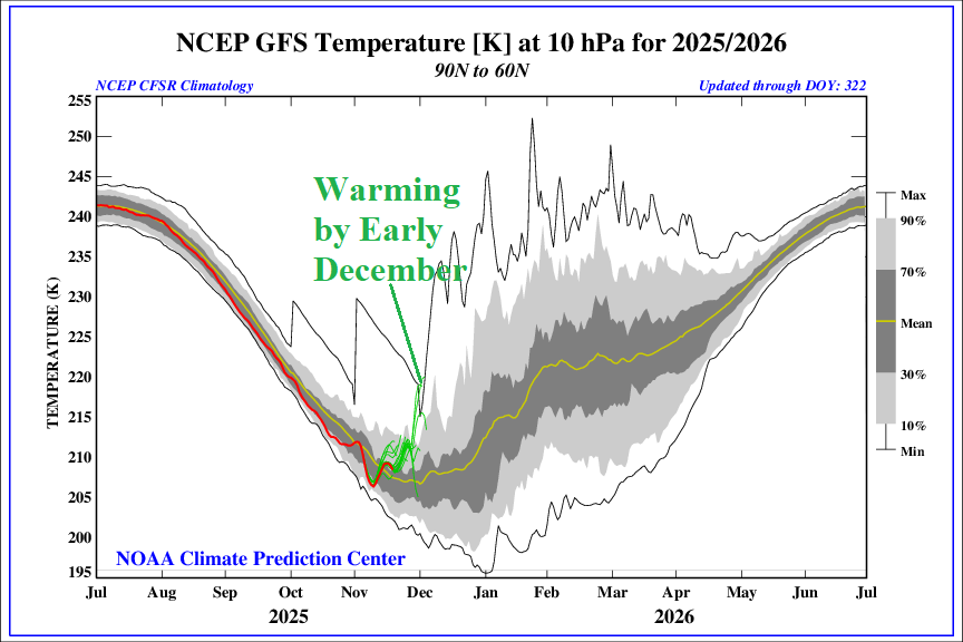
Fig. 5: The NCEP GFS stratospheric probabilistic temperature regime through the winter season and the GFS 16-day forecast (green).