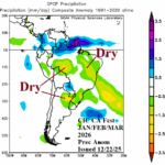
Latest Month 1-4 Outlook: Q1/2026 Marginally Dry/Hot in Brazil; Moderately Hot and Dry in Argentina
12/22/2025, 12:43 pm EST
Atmospheric River Closes After Today; Northern Mid-Atlantic Snowstorm Today
12/26/2025, 8:16 am EST

Climate Impact Company U.S. Medium Range Report
Issued: Tuesday December 23, 2025
Highlight: Colder Northeast/East U.S. medium range forecast.
Charts of the day: -NAO, Northeast snow cover, and latest HDD forecast.
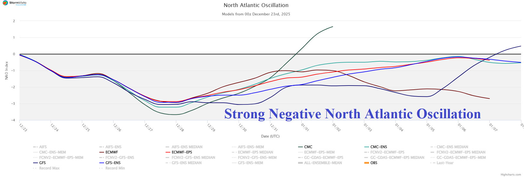
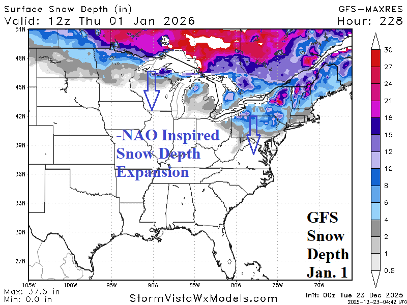
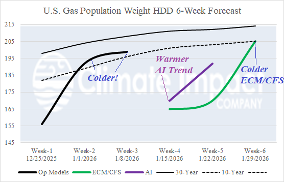
Discussion: The negative phase North Atlantic oscillation forecast continues and inevitably drives colder changes in the East U.S. Helping to increase East U.S. cold risk is a southern and sustained shift of snow cover across the Northeast States. The U.S. gas population weight HDD forecast based on all models shifts colder for next week and the first week of January. However, week 4 and 5 HDD forecasts remain warm including a much warmer shift of AI models.
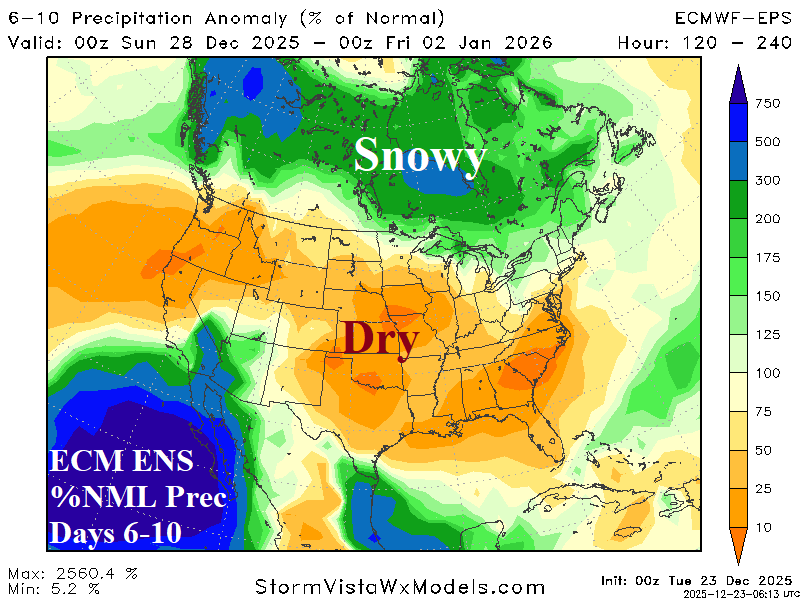
Medium-range 6-10 Day Forecast Valid December 28, 2025-January 1, 2026 (ECM ENS left and 24-hour change right)
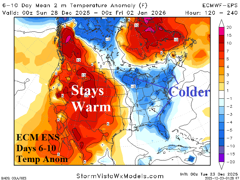
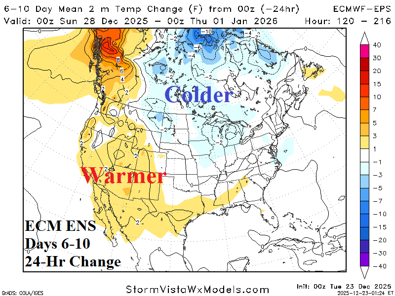
Discussion: -NAO regime continues to chill down the East U.S. while the warm pattern is pushed farther westward.
Medium-range 11-15 Day Forecast Valid January 2-6, 2026 (ECM ENS left and 24-hour change right)
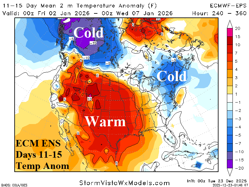
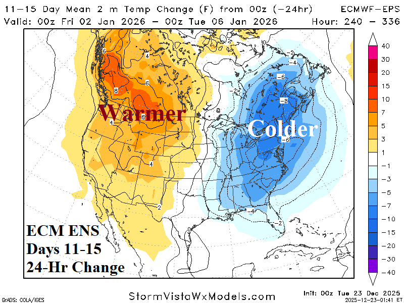
Discussion: The Northeast stays cold, inspired by much colder changes since yesterday. The warm West U.S. pattern is stronger.
U.S. Medium-range Precipitation Forecast
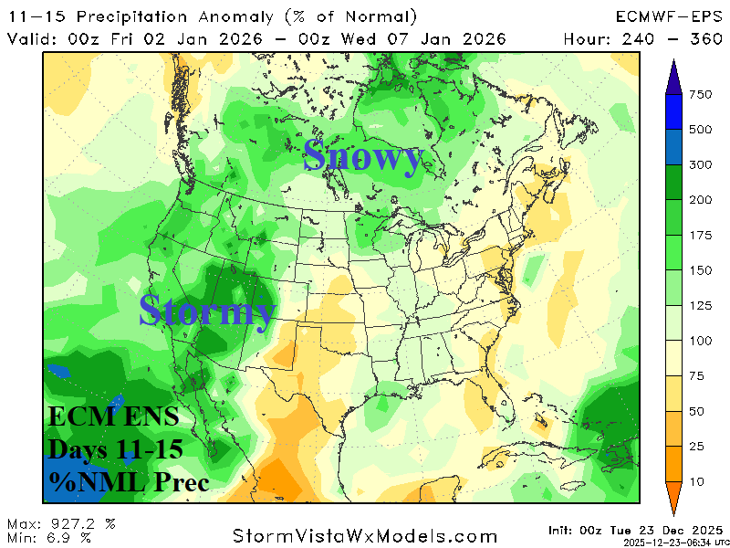
Discussion: Agreement increases on a lingering Pacific Storm Track into the Southwest U.S. during the medium range. The Canadian snow cover steadily deepens.
Days 16-20 Extended range Temperature Forecast valid January 7-11, 2026
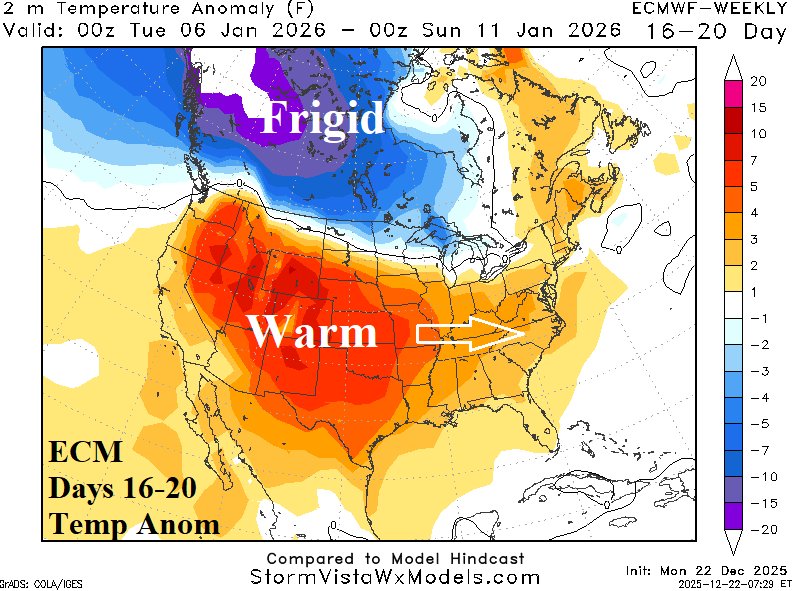
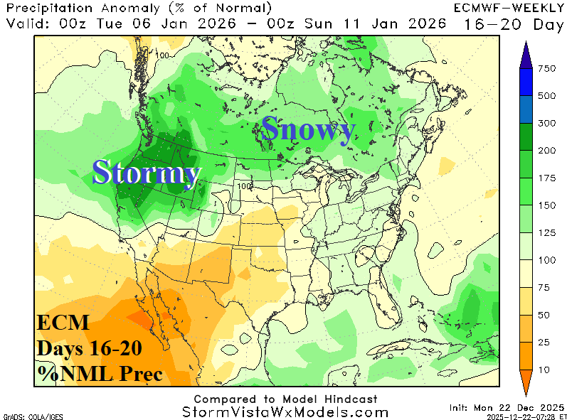
Discussion: South of snow cover, the U.S. pattern stays warm. The warmth is likely to expand eastward to rewarm the Atlantic States. The Northwest U.S. storm track regenerates.