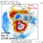
12Z GFS Shifts Stratospheric Warming to Northern Canada, Causes Cold 11-15-day Forecast for U.S.
11/18/2025, 12:44 pm EST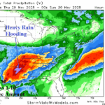
Unusual for La Nina Climate…Heavy Rains Texas
11/20/2025, 5:53 am EST
Climate Impact Company Early U.S. Notes
Issued: Wednesday November 19, 2025
Highlight: Evolution of a colder pattern as December arrives.
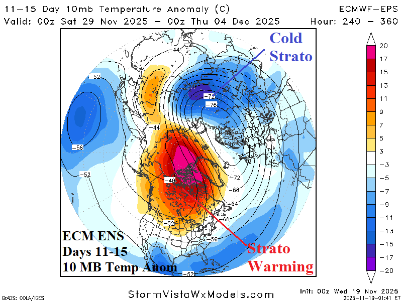
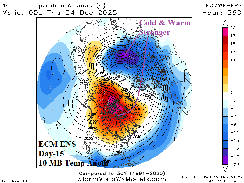
Fig. 1-2: ECM ENS 11-15-day and day-15 10 MB temperature anomalies.
Discussion: Stratospheric warming is developing on the North America side of the North Pole now, strengthening in the 6-10-day period, and peaking across northwest continent during the 11-15-day period (Fig. 1). The catalyst is late season tropical cyclone activity across the western North Pacific venting heat into the upper-level atmosphere. To compensate for the warming, the stratosphere is frigid across North-central Asia. Each regime intensifies by day-15 (Fig. 2). Not a classic stratospheric warming episode as demonstrated by the wide array of arctic oscillation forecasts during the medium range (Fig. 3). However, the confined stratospheric warming on the North America side of the North Pole causes the troposphere below to cool and contract forcing evolution of a potent long wave low-pressure trough at 500 MB (Fig. 4). The trough creates a cold air mass (likely enhanced by evolving/deepening snow cover) sprawling across Western Canada and reaching southward across the Central and East U.S. in the 11-15-day period (Fig. 5). The colder temperature trend causes a surge in U.S. gas population weight HDD for the week ending December 4th (Fig. 6). In the 11-15-day period, nighttime low temperatures are in the teens across the northern half of the Great Plains and into northern New England implying snow cover (Fig. 7). The week 4-6 U.S. gas population weight HDD forecast indicates the cold extends through the first third of December with uncertain impact mid-to-late month (Fig. 8) likely somewhat reliant on snow cover which is patchy in the U.S. in 16 days (Fig. 9).
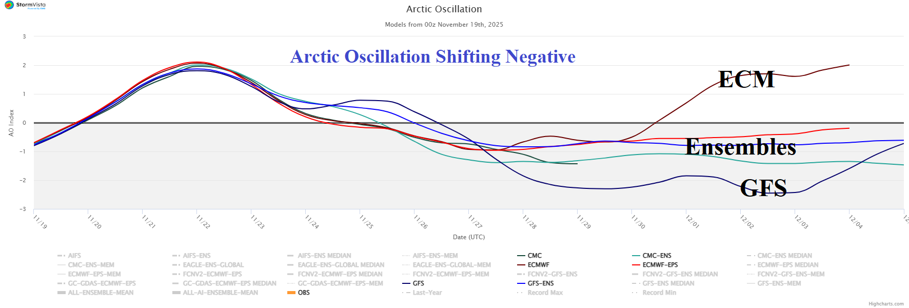
Fig. 3: Utilizing all models, the 16-day arctic oscillation forecast.
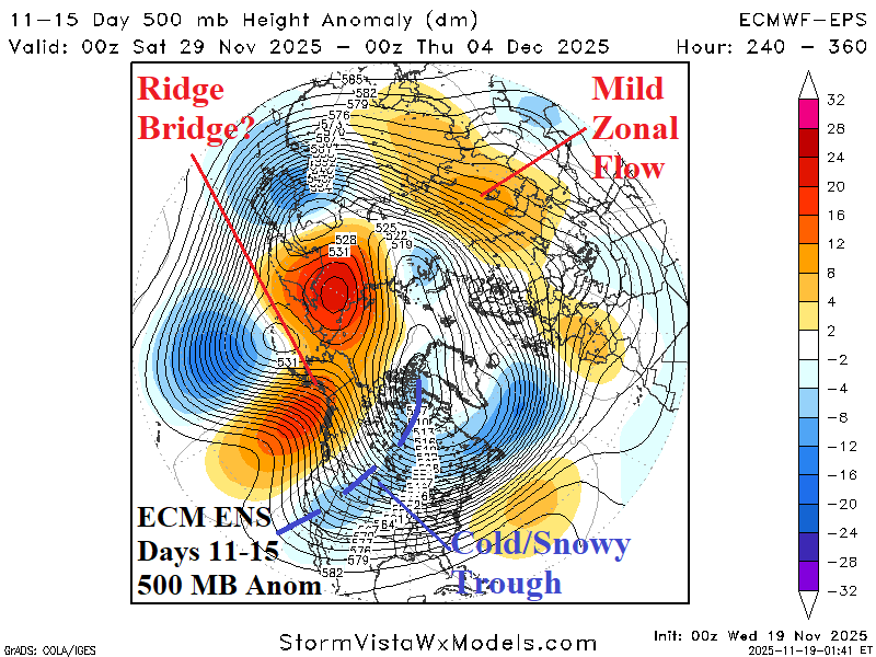
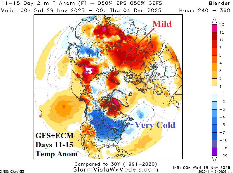
Fig. 4-5: The ECM ENS 11-15-day 500 MB anomaly forecast and 11-15-day temperature anomaly outlook combining equally GFS and ECM.
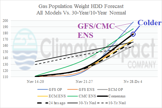
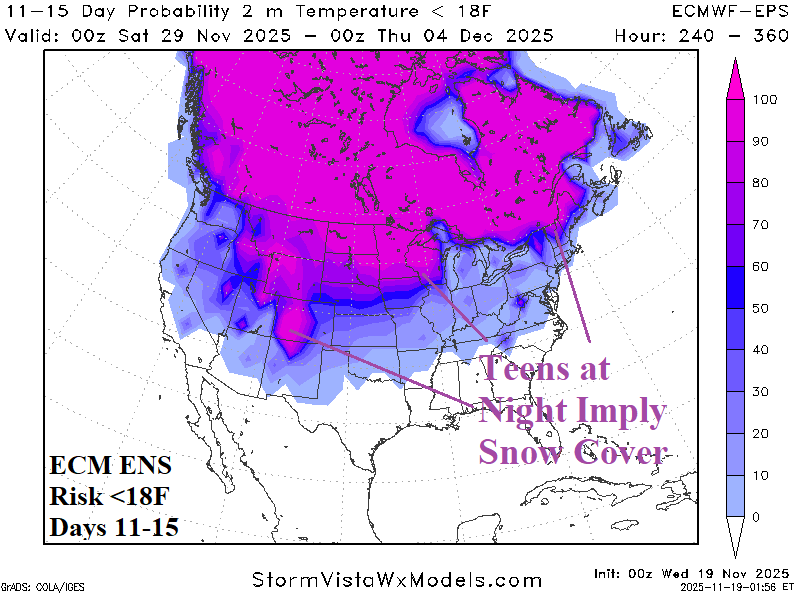
Fig. 6-7: The U.S. gas population weight HDD forecast through Dec. 4th and <18F temperature threshold forecast for the 11-15-day period.
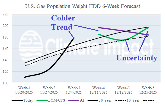
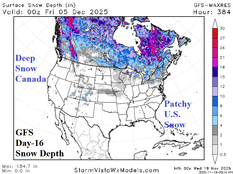
Fig. 8-9: The U.S. gas population weight HDD 6-week forecast and day-16 GFS U.S. snow depth outlook.