
Potential Very Cold, Snow, and Ice for Central/East-central U.S. Early December
11/23/2025, 1:05 pm EST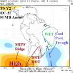
South America Weather Pattern Change In December
11/25/2025, 4:35 am EST
Climate Impact Company Early U.S. Notes
Issued: Monday November 24, 2025
Highlight: An update on the snow and ice potential associated with the developing cold pattern.
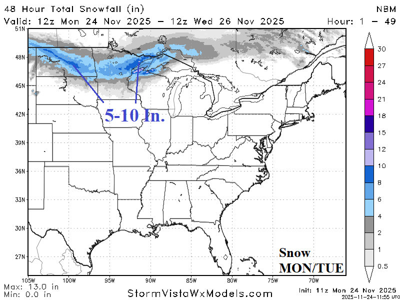

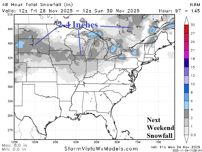

Fig. 1-4: NBM 48-hour periods of snowfall for this week into early next week across the eastern half of the U.S.
Discussion: Using the National Blend of Models (NBM), the 48-hour snowfall valid today and tomorrow indicates potential for 5-10 inches across the northern Great Plains and Upper Midwest (Fig. 1). The attendant storm moves towards James Bay midweek and strengthens causing heavy snow across Upper Michigan and Ontario with significant snow downwind the Great Lakes (Fig. 2). The FRI/SAT snowfall forecast by the NBM indicates another swath of several inches of snow into the Midwest States (Fig. 3). Early next week snow is prominent across the western Great Plains with possible heavy snow in Quebec (Fig. 4). Freezing rain and accreting ice are expected on the weekend centered on Kansas (Fig. 5) and early next week from northwestern Texas to the Missouri Valley and parts of the Interior Northeast (Fig. 6). A major ice storm is not expected. During the 6-10-day period (next weekend and early next week) the risk of <32F (Fig. 7) extends southward to northern Texas, may reach Atlanta, and covers most of the Atlantic Seaboard (north of Georgia). The <0F risk extends across the Northern U.S. snow cover in the 6-10-day period (Fig. 8).
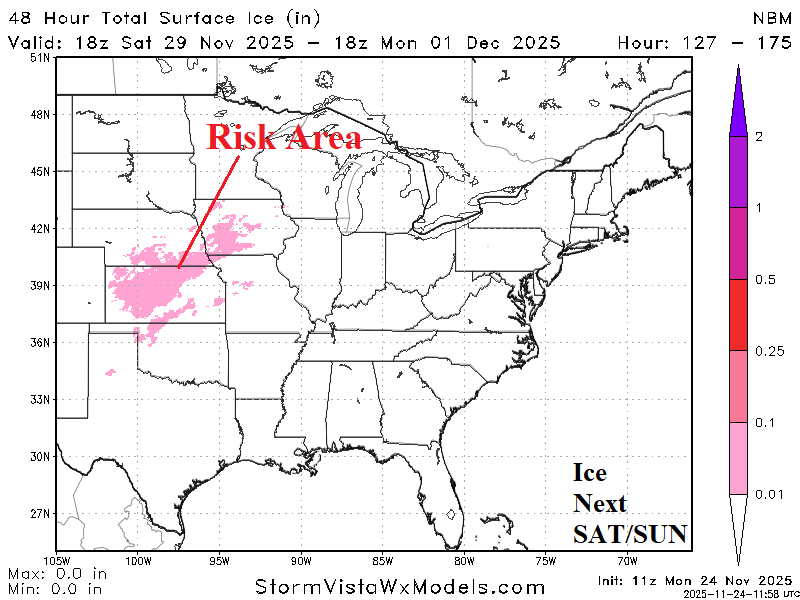
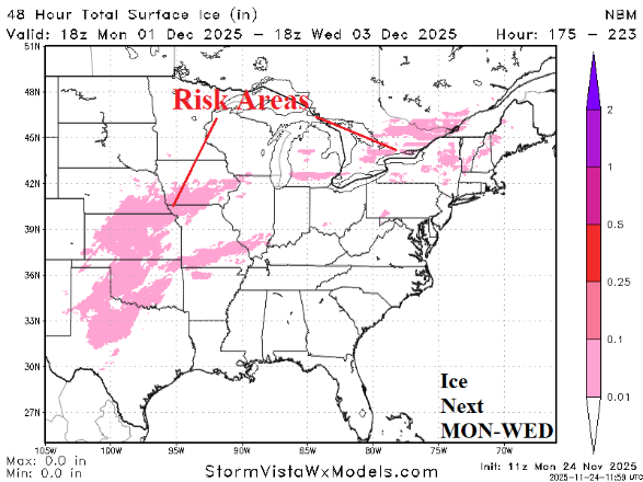
Fig. 5-6: NBM ice accretion risk areas for this weekend and early next week across the eastern half of the U.S.
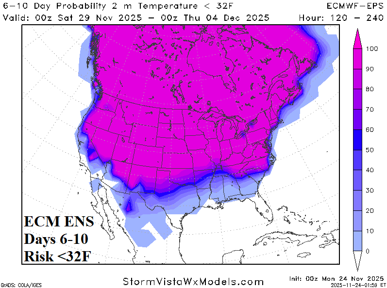
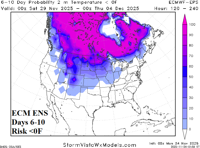
Fig. 7-8: ECM ENS 6-10-day risk of <32F and <0F for the U.S.