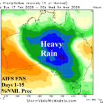
Widening/Intensifying Australia Rainfall
02/17/2026, 8:36 am EST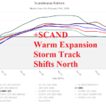
Scandinavia Index Reverses, Allows Europe to Warm/Turn Drier
02/19/2026, 9:16 am EST
Climate Impact Company Early U.S. Notes
Issued: Wednesday February 18, 2026
Highlight: Wintery precipitation Great Lakes to Northeast U.S., severe storms Ohio Valley tomorrow, ongoing West U.S. hazards due to -PNA pattern.
Climate signals discussion: Negative Pacific North America (-PNA) index is maintained through the weekend keeping California in the face of a vigorous Pacific storm track. The Northeast is on the downhill side of the attendant Central U.S. (warm) ridge (Fig. 1) which forces snow/sleet/freezing rain events going from the Great Lakes to New York and New England. In the 6-10-day period, the negative West Pacific oscillation (-WPO) inspires an upper trough in the East (Fig. 2) supporting coolest anomalies in the Southeast although New York/New England could be “sneaky” cold due to snow cover. In the 6-10-day period, the California “atmospheric river” storm track should ease northward and lose some intensity. Low forecast confidence is indicated during the 11-15-day period as upper air forecasts vary widely. Leading models AIFS ENS and ECM ENS (Fig. 3) favor a cold trough in Canada while zonal flow warms most of the U.S. Each model lifts the Pacific storm track northward affecting Southwest Canada. Most prominent in the 11-15-day period is a positive East Pacific oscillation (+EPO) which is a warm signal for the U.S. The ECM OP is alone developing a cold polar vortex in North-central Canada with some attendant cold exposure to the Northern U.S.
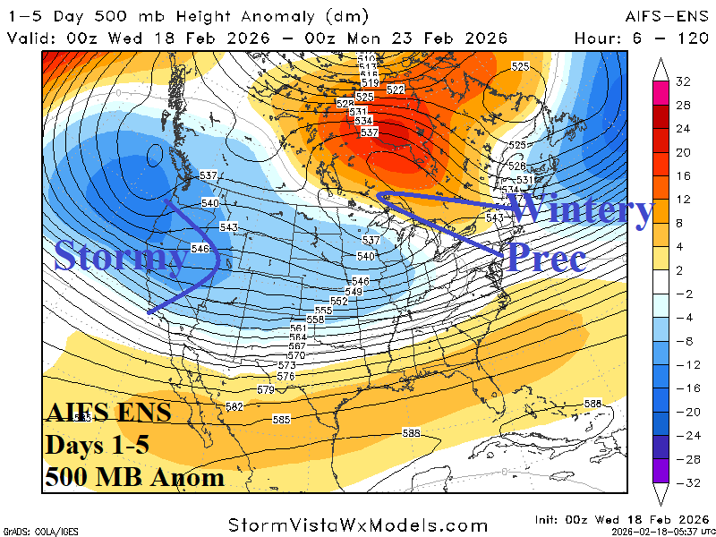
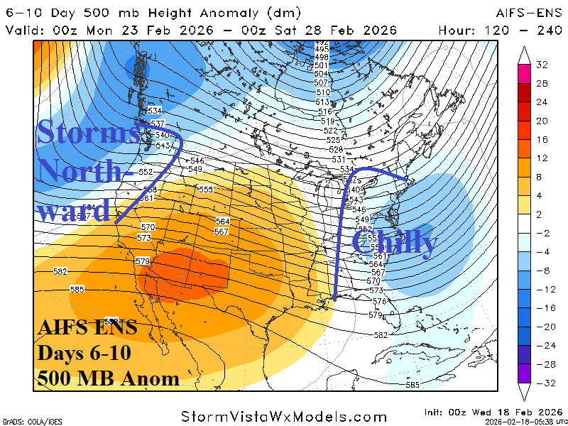
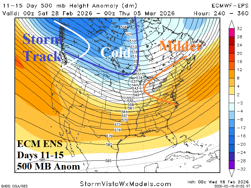
Fig. 1-3: AIFS ENS and ECM ENS 500 MB anomaly pattern forecast through the next 15 days.
ENSO/SSTA discussion: Tahiti sea level pressure (SLP) is lowering although southern oscillation index (SOI) remains positive. The Madden Julian oscillation (MJO) is forecast to shift eastward from Maritime Continent toward the Dateline during the next 2 weeks. If MJO has intensity, SOI should shift negative (not indicated in 15-day forecasts). The eastward MJO intensity and attendant influence on SOI is important as a warming signal for the U.S. and warming surface of the eastern equatorial Pacific Ocean.
Today’s weather discussion: Mild air across snow cover produces dense fog in the Northern Mid-Atlantic States this morning (Fig. 4). A Winter Weather Advisory for snow and sleet is issued for New York State to Massachusetts. A 7-day period of snow/sleet/freezing rain is ahead for New York/New England. In the West, high wind with heavy mountain snow, and Central California Coast flooding continues. Heavy snow remains across the Northern Great Plains to Northern Great Lakes where blizzard conditions occur in some areas. NOAA/SPC maintains severe weather Illinois to Ohio tomorrow and evolution of a major coastal storm in the East is forecast for early next week.
The latest U.S. gas population weight HDD forecast reveals a return to seasonably cold weather and near normal national heating demand next week (Fig. 5). The week 4-5 projections are generally quite warm (Fig. 6).
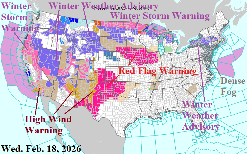
Fig. 4: The NOAA/NWS weather watch, warning, and advisory areas.
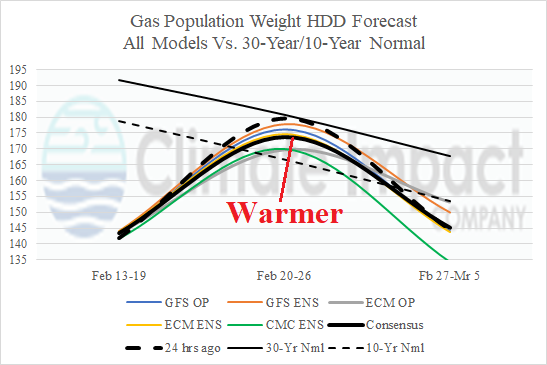
Fig. 5: The U.S. gas population weight HDD forecast utilizing all models is a little less cold for next week.
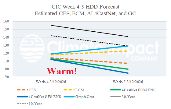
Fig. 6: The estimated U.S. HDD forecast for week 4 and 5 ahead utilizing ECM, CFS, and 3 AI models.