
Madden Julian Oscillation Activates
01/05/2026, 3:07 pm EST
Interior West/Northern U.S. and Florida are Windy Regions for Q1/2026
01/08/2026, 5:00 am EST![]()
Climate Impact Company Daily Feature
Issued: Tuesday, January 6, 2026
Highlight: Impactful convection phase of the Madden Julian oscillation is ahead for mid-January.
Discussion: An impactful influence on global climate by a strengthening convection phase of the Madden Julian oscillation (MJO) is forecast to develop during the next 2 weeks (Fig. 1). The location across the tropical Pacific from north-northeast of Australia to just east of the Dateline (phase_6). The strength of the event may rival the East Indian Ocean/West Pacific tropics event of NOV/DEC which impacted the stratosphere via poleward latent heat release. Potentially, the just-after mid-January MJO phase_6 begins to warm the stratosphere over northwestern North America in the 11-15-day period (Fig. 2). However, the mid-January stratosphere is mostly cold and combined with MJO phase_6 supports a January thaw in the U.S. (Fig. 3). A regional streak of stratospheric warming manages to linger across Southern Eurasia and coupled with increasing snow cover supports a frigid air mass adhering to Europe and West/Northwest Russia (Fig. 4). In the southern hemisphere, MJO phase_6 supports heavy rain across Northeast/East Australia (Fig. 5) including tropical cyclone risk increase while eastern South America dryness is supported (Fig. 6). AI Graph Cast has the least wet-biased model output of the past 30 days in Australia and South America and is preferred over operational models for now. MJO phase_6 usually favors a significant storm in the Mid-south U.S. to Texas. Operational models are not yet convincingly indicating this possibility. However, most forecast models in the 8-14/11-15-day period indicate prohibitive rainfall across Mexico and a northward extension of that storminess into the Mid-south U.S. is likely to appear in 8-14/11-15-day forecasts as we shift through this week. Finally, MJO phase_6 coupled with a warm subsurface Kelvin Wave already shifting eastward past the Dateline in the equatorial Pacific is likely propelled to the northwest coast of South America during the next couple weeks dissipating oceanic La Nina in February.
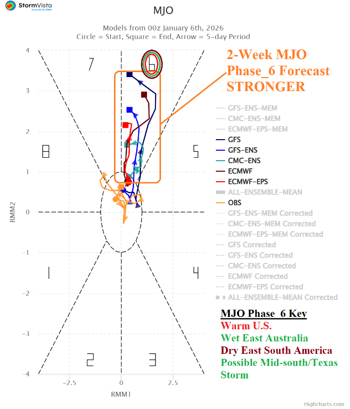
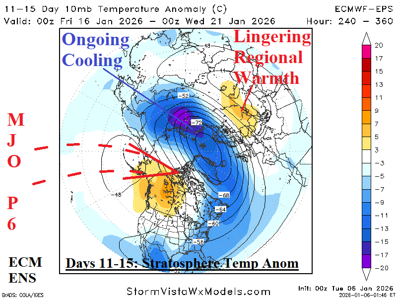
Fig. 1-2: The MJO 15-day forecast utilizing all operational models reveals a strengthening phase_6 plus the ECM ENS 10 MB temperature anomaly forecast.
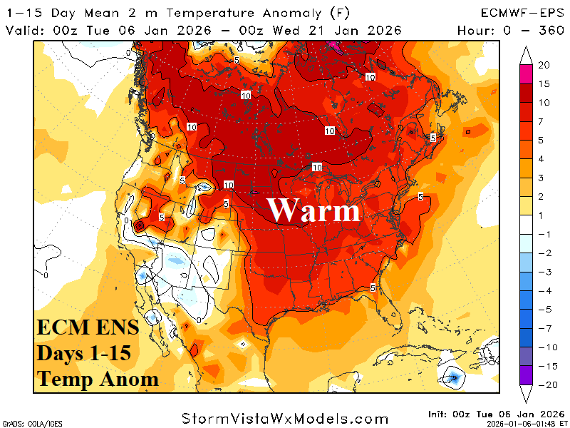

Fig. 3-4: ECM ENS 15-day temperature anomaly forecasts across North America and Europe.
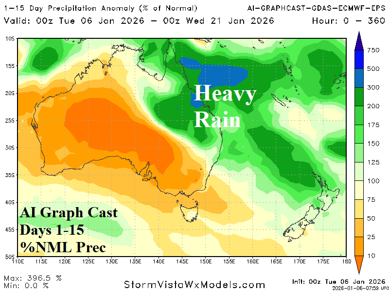

Fig. 5-6: AI Graph Cast percent of normal 15-day rainfall forecasts for Australia and South America.