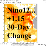
Warming Nino12 Region; South America Rains Expand Eastward across Argentina
02/04/2026, 4:56 am EST
Very Cold Eastern Europe in January 2026
02/06/2026, 8:41 am EST![]()
Climate Impact Company Daily Feature
Issued: Thursday, February 5, 2026
Highlight: High impact climate for MAR/APR/MAY 2026 according to ECMWF.
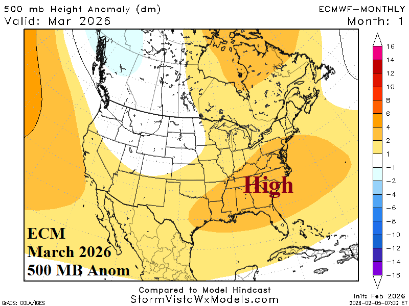
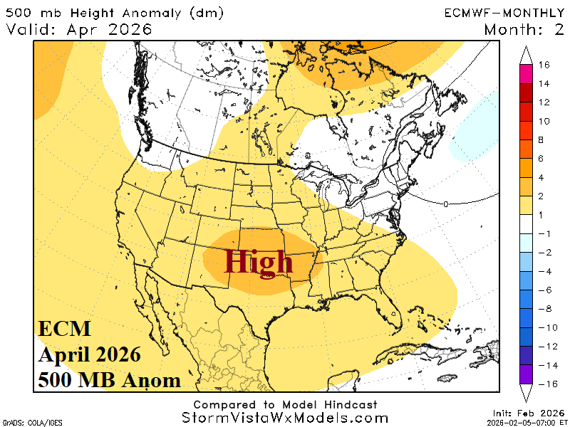
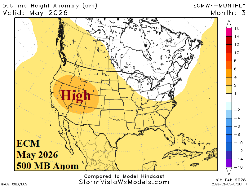
Fig. 1-3: ECMWF 500 MB anomaly forecast across North America for MAR, APR, and MAY 2026.
Discussion: In March, ECMWF crests an upper ridge across the Southeast U.S. which leads to high risk of unusually warm early spring climate for the Southeast and Mid-Atlantic States (Fig. 1). In April, the warm ridge shifts westward and settles on the southern Great Plains where dry and warm mid-spring weather is likely (Fig. 2). Late meteorological spring brings an upper ridge to the Great Basin promoting dry and very warm climate across the West and Southwest U.S. (Fig. 3). Upper trough patterns are less amplified across West Canada in March, east of New England during April, and across Southeast Ontario in May.
In Europe, the prevailing upper air pattern during meteorological spring 2026 according to ECMWF is a persistent warm and dry upper ridge developing across and east of the Black Sea region while Western Europe is rainy due to an offshore upper trough (Fig. 4). In Australia, due to an ENSO shift away from La Nina, a drier than normal climate for autumn 2026 is likely (Fig. 5).
In South America, rainfall forecasts are wetter than normal across northern and western Brazil plus Northeast Argentina while East Brazil is marginally dry (Fig. 6). In April, much of Brazil is wetter than normal while Northeast Argentina stays wet (Fig. 7). Northeast Argentina remains wet in May adding western and northern Brazil (Fig. 8).
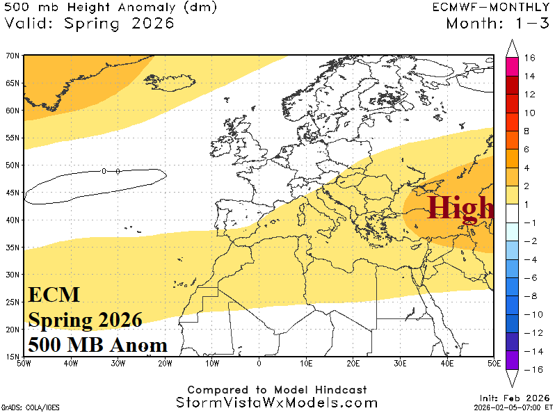
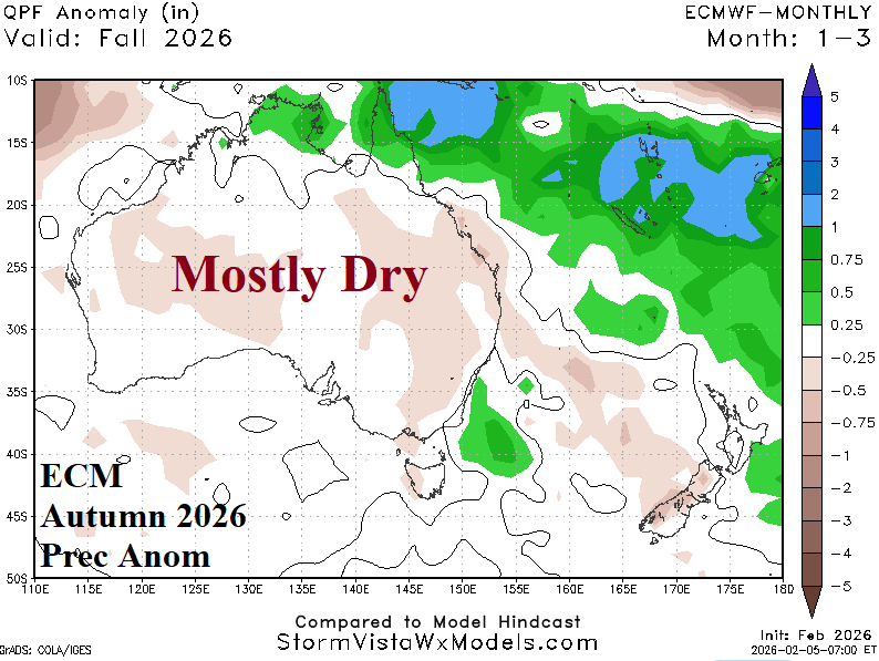
Fig. 4-5: ECMWF 500 MB anomaly forecast for spring 2026 across Europe and the autumn precipitation anomaly outlook for Australia.
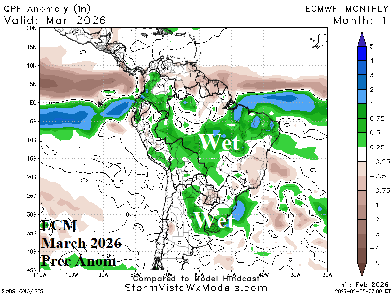

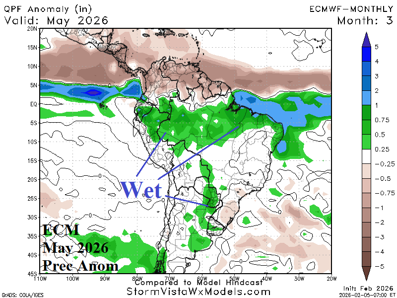
Fig. 6-8: ECMWF precipitation anomaly forecasts for each month of autumn across South America.