Spring Rains Erode Brazil and Argentina Long-term Drought
12/06/2024, 10:34 am ESTStatus of the Potential North America January 2025 “Polar Vortex” Forecast
12/10/2024, 4:21 pm ESTHighlight: La Nina onset possible early January, Australia heat increase, Argentina trend is wetter, and possible cold regeneration in U.S. 11-15 days.
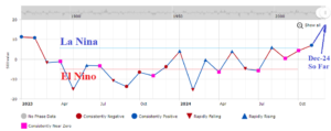
Fig. 1: Southern oscillation index has shifted into the positive phase and intensifying during early December supportive of La Nina development.
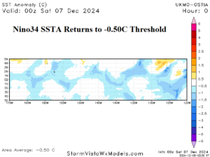
Fig. 2: The Nino34 SSTA reaches the La Nina threshold.
Discussion: On the ENSO front, nearly 30 days of positive phase southern oscillation index (+SOI) intensifying during early December (Fig. 1) has caused increased trade winds and cooling SSTA in the eastern equatorial Pacific Ocean. The Nino34 SSTA reached the La Nina threshold of -0.50C over the weekend (Fig. 2). The +SOI regime continues through mid-December. Oceanic La Nina onset is possible by early January.
High impact weather forecasts for the middle third of December begin in Australia. During November, an amplified upper ridge anchored over New Zealand (Fig. 3). On the back side of the ridge, periods of heavy rain were observed in parts of interior West and East Australia. A change in the high-pressure area is indicated in the latest 15-day outlook. The 12Z GFS projects the upper ridge to crest over West-central Australia causing a drier pattern for central and east continent pus anomalous heat for the southern half of the nation (Fig. 4). Temperature threshold forecasts push >100F risk across much of the continent during the medium range.
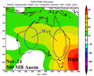
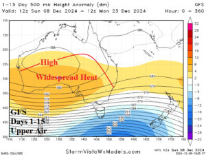
Fig. 3-4: The NOV-24 upper air pattern across Australia and the projected upper air pattern for the next 15 days by the 12Z GFS.
Wet weather in Brazil and Argentina eased slightly during the past week. However, the energetic upper-level flow along the southern periphery of the subtropical ridge areas returns significant rainfall during the middle third of December. Wet weather is consistently projected across Brazil through the next 15 days (Fig. 5). However, Argentina rains return to the forecast in the 8-14/11-15-day period, a wetter change.
Overnight, a few model-runs, particularly AI indicated potential new cold risk to the U.S. in the 11-15-day period. The 12Z GFS indicates a colder Canada and cooler Southeast U.S. regime defeating previously warm medium range outlooks (Fig. 6).
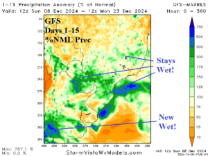
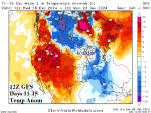
Fig. 5-6: The 12Z GFS reveals more wet weather for Southern Brazil and Argentina. The 12Z GFS reveals a colder return in the 11-15-day period.
