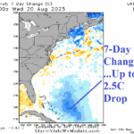
Erin Significantly Cools Waters East of Bahamas
08/21/2025, 3:56 pm EDT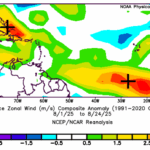
Strong Tradewinds Prevent Deep Tropics to Gulf Significant Storms So Far
08/26/2025, 1:30 pm EDT
Climate Impact Company Sunday Global AG Report
Global Weather/Climate Report
Issued: Sunday August 24, 2025
Highlights: Europe drought to receive beneficial rainfall; Southern Great Plains wet for 10 days. Chilly Paraguay, wetter West Africa cocoa areas.
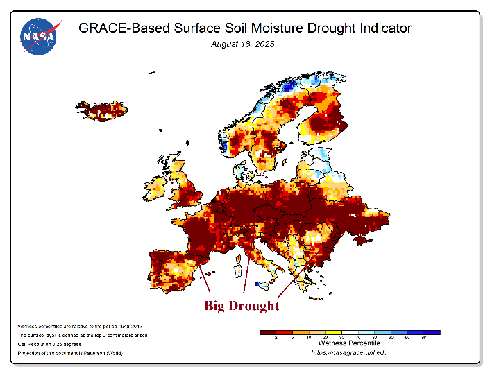

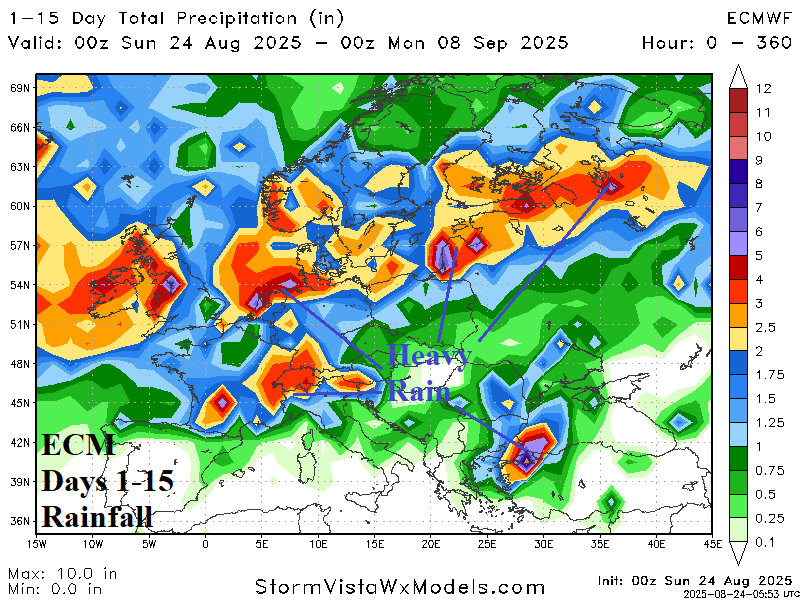
Fig. 1-3: GRACE-based soil moisture anomaly analysis for Europe, the 7-day percent of normal rainfall, and ECM 15-day rainfall amount forecast.
Discussion: Europe continues to encounter widespread harsh drought (Fig. 1). The drought is related to the NAWH-trough and downstream ridge pattern, common during the past decade especially during the warm season. However, pattern change is on the way. During recent days, wet weather has developed across South-central and Southeast Europe plus Western Russia while areas to the north and west remain parched (Fig. 2). In the 15-day forecast, a persistent Northwest Eurasia trough produces consistent streaks of rain across the drought area to bring relief (Fig. 3).
The 10-day rainfall forecast across the U.S. AG Belt by GFS and ECM (Fig. 4) is reasonably confident through 10 days. Moderate to heavy rain remains forecast across the central and southern Great Plains where a frontal boundary separates unseasonably cool are centered on the Mid-south/Midwest U.S. through the next 1-2 weeks (Fig. 5) and a hotter air mass across the Southwest States. The AIFS ENS defeated most operational models forecasting the depth and duration of the cool weather regime.

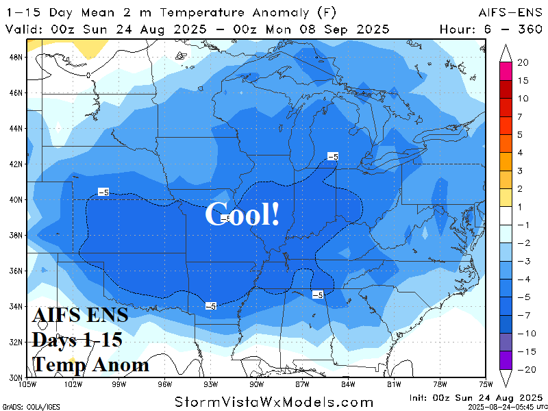
Fig. 4-5: NBM 10-day percent of normal rainfall forecast and the AIFS ENS 15-day temperature anomaly outlook for the U.S. AG Belt.
Elsewhere, a chilly air mass shifts northward to extreme southwest Brazil and most potent over Paraguay during the next few days. A frontal boundary stalls and causes daytime temperature to average nearly 20F cooler than normal. Any cold risk stays well southwest of Brazil coffee-growing areas. Moderating temperatures are expected across South America during the medium range.
Far South China and North Vietnam rice-growing areas can expect extreme rainfall associated with Typhoon Kajiki during the next few days.
In Australia, a changeable (temperature) 15-day forecast and mostly dry except potential heavy rain in Victoria and vicinity.
West Africa cocoa-growing areas trend wetter in the latest 15-day forecast. Eastern areas observe some thunderstorm activity this week and reverse drier in the medium range. The 15-day forecast is wetter for eastern cocoa growing areas.