-AO Sustains Northern Europe Cold and Energetic Southern Europe Storm Track
01/28/2026, 9:07 am EST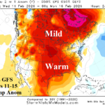
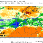
Suddenly, U.S. Much Warmer Days 11-15/AI Models Warmer Week 4-5
02/01/2026, 6:48 am EST
Climate Impact Company Early AG Market ALERT
Issued: Thursday January 29, 2026
Highlight: Persistent North-central to Northeast U.S. extreme cold risk, North/East Europe chill and potent South Europe storm track continue, and heavy rains for Brazil.
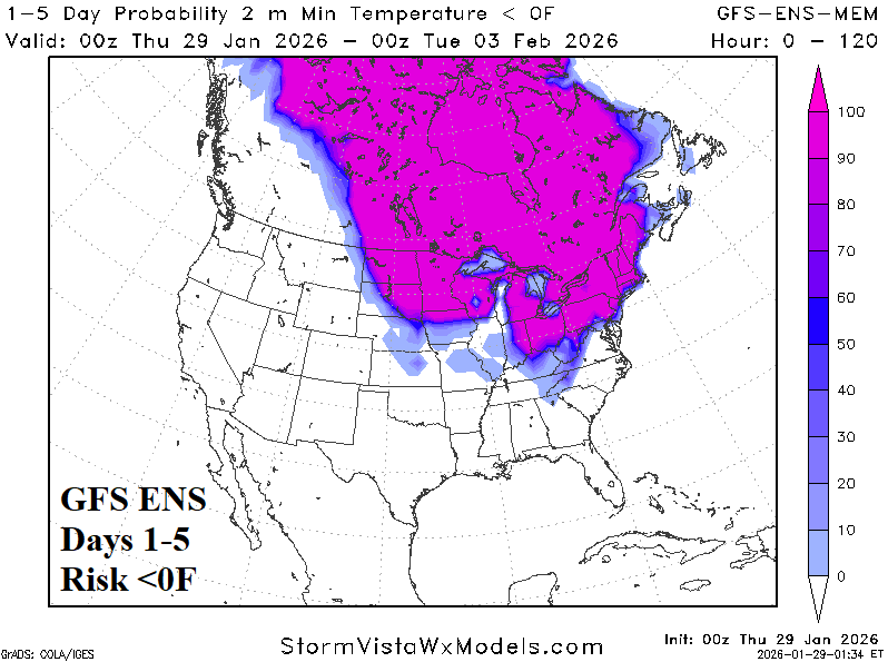
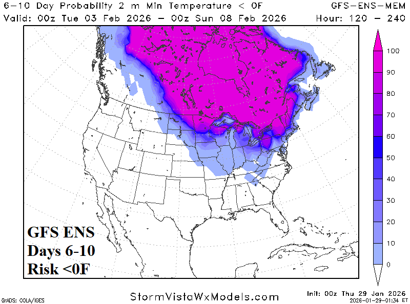
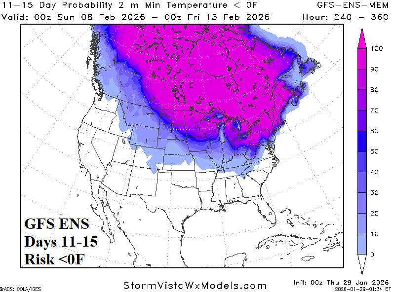
Fig. 1-3: The GFS ENS risk of <0F across the U.S. through 15 days.
Discussion: The frigid North-central to Ohio Valley to Northeast U.S. temperature pattern, frequently producing <0F risk is likely to continue into mid-February. Overnight, already frigid risk <0F covering the Upper Midwest to Northeast U.S. the next 10 days, appears to expand slightly in the 11-15-day period (Fig. 1-3). GFS adds additional snow to the already expansive deep snow cover during the latest 15-day outlook accounting for the sustained cold.
The ongoing strong negative arctic oscillation (-AO) continues to cause problematic weather across Europe. An increasingly well-established storm track has evolved across West and South Europe during the past week (Fig. 4). The Southern Europe storm track is likely to continue for another 2 weeks (Fig. 5). Included is a streak of heavy snow across Eastern Ukraine and Southwest Russia. The GFS maintains the cold clash across North and East Europe with a milder trend in Southeast Europe to help generate the potent storm track (Fig. 6).
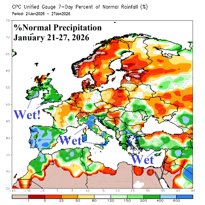
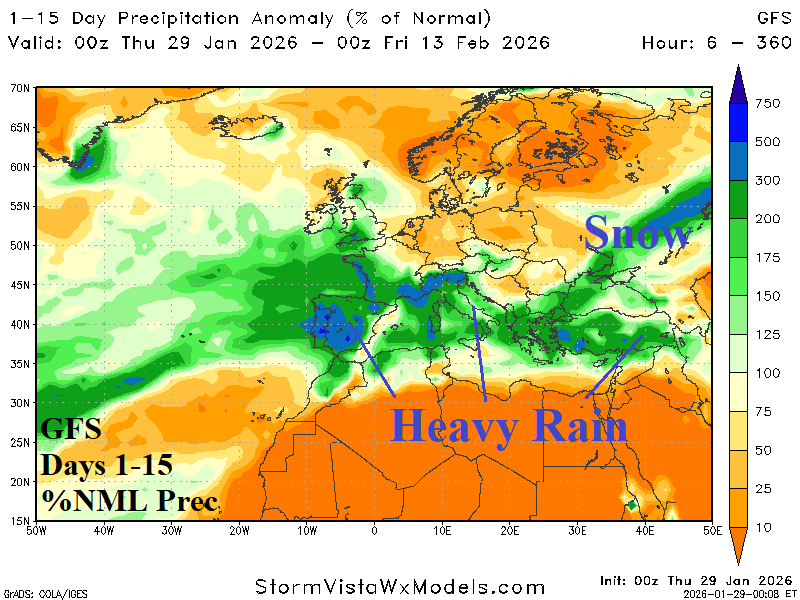
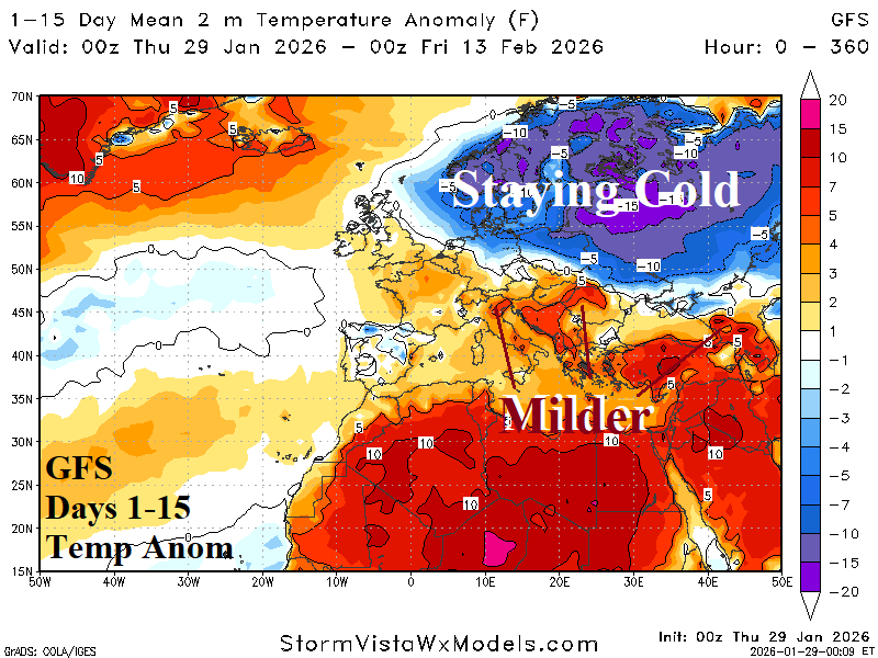
Fig. 4-6: The percent of normal precipitation observed Jan. 21-27 across Europe, GFS 15-day percent of normal precipitation forecast, and GFS 15-day temperature anomaly outlook.
In South America, several weather hazards are indicated in the GFS 10-day precipitation outlook. Developing heavy rains last through the next 10 days east of Paraguay to the Southeast Brazil Coast (Fig. 7). Meanwhile, Northern Argentina is dry and extremely hot through 10 days. The exception is an area of heavy thunderstorms in Central Argentina during the 6-10-day period. Combining GFS and ECM yields a widening wet weather pattern for Brazil in the 11-15-day period (Fig. 8).
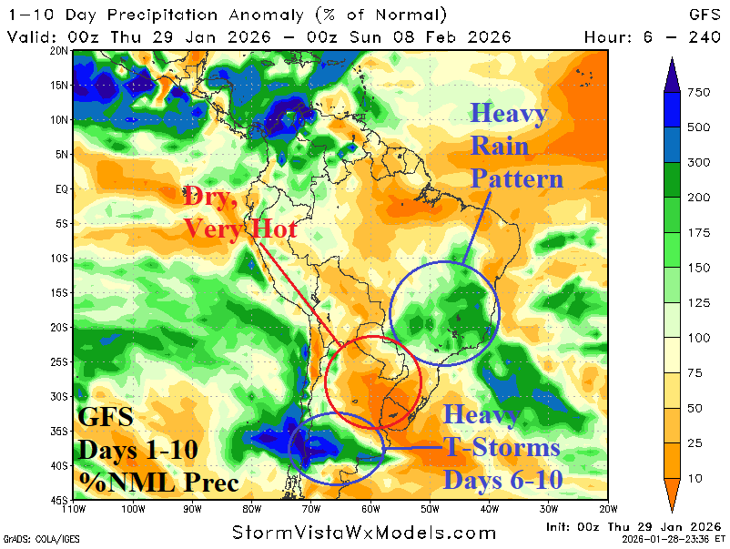
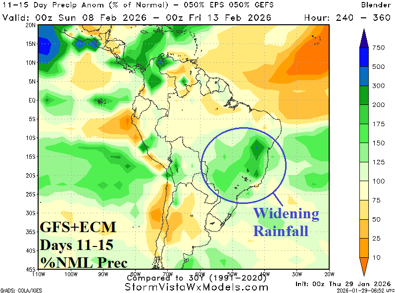
Fig. 7-8: The GFS percent of normal 10-day rainfall forecast across South America and combining GFS/ECM to generate the 11-15-day outlook.