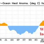
Neutral ENSO; Upper Ocean Heat Increasing
04/06/2026, 1:07 pm EDT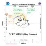
Are Central U.S. Forecasts Too Wet?
04/08/2026, 5:20 am EDT
Climate Impact Company Early AG Market ALERT
Issued: Tuesday April 7, 2026
Highlight: Is the wet forecast for the Central U.S. too wet? Western Plains trend drier. Europe forecast is drier.
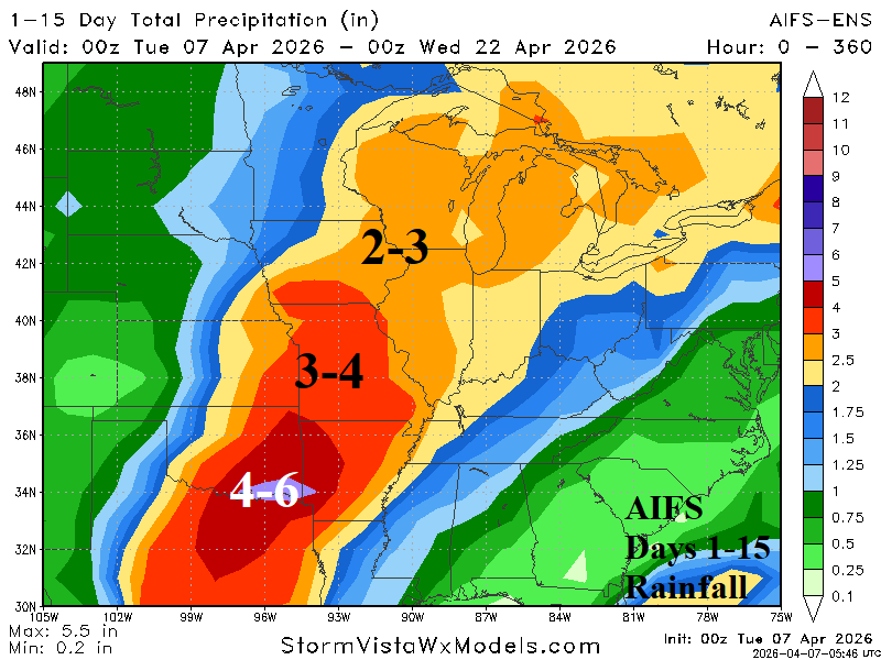
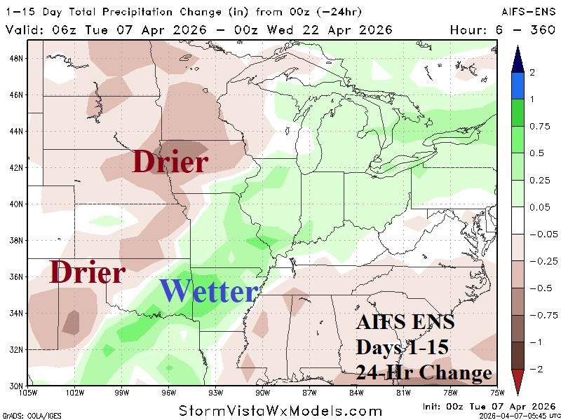
Fig. 1-2: AIFS ENS 15-day rainfall amount forecast across the U.S. AG Belt and 24-hour change.
Discussion: Tropical forcing to cause excessive rain in the Central U.S. is directly associated with the influence and strength of the Madden Julian oscillation (MJO). MJO phase_6 is present this week. NOAA/SPC indicates associated emergence of severe thunderstorms across Texas and the southern Great Plains later this week. MJO shifts eastward, past the Dateline and toward the Americas (phase_7/phase_8) through the middle third of April. During that time, tropical forcing to enhance Central U.S. rainfall is directed at the southeast Great Plains to the Midwest and then farther eastward (and weakening). The AIFS ENS has the least rainfall (forecast) bias from the past 30 days. AIFS ENS correctly positions heavy rainfall across central/northeast Texas through the Missouri Valley to the Midwest States (Fig. 1). Note that the western Great Plains receive considerably less rainfall. The 24-hour rainfall forecast change is appropriately drier for the Western Corn Belt to the southwestern Great Plains (Fig. 2). The transient MJO (tropical forcing) forecasts suggest duration of influence to force heavy rain is limited and heavy rainfall amount indicated by AIFS ENS (and other models) may be too buoyant.
The 15-day precipitation forecast across Europe is drier with a wider aerial coverage (Fig. 3). Soil moisture dryness is worsening. Large areas of dry-to-drought soil moisture conditions increase the risk of summertime heat which can further aggravate a drought. The wet zone is the Middle East and northward to Southwest Russia including the eastern half of the Black Sea region. The 15-day temperature forecast for Europe indicates, on average, a warm few days this week then cooler for most of April 9-14 (Fig. 4). Potential for a warm spike is forecast by some (not all) models just after mid-April.
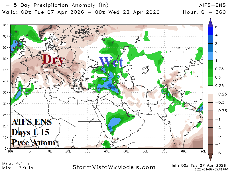
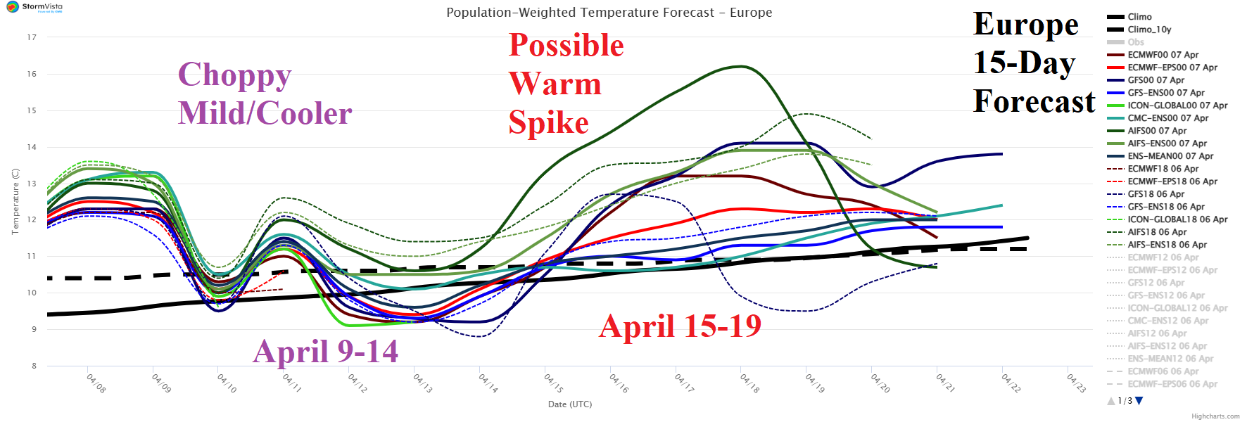
Fig. 3-4: The 15-day (AIFS ENS) precipitation anomaly forecast across Europe/Western Russia/Middle East and 15-day Europe population weight daily average temperature forecast.