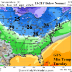
Cold Burst, After Heavy Rain, Midwest/Northeast U.S. Next Week
04/02/2025, 8:46 am EDT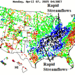
Rapid Stream Flows Ohio and Mississippi Valley
04/07/2025, 7:50 am EDT
Charts of the day: NCEP/CAS soil moisture forecasts.

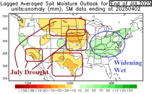
Discussion: The NCEP/CAS (model) identifies the wet soil moisture change in the Mid-south U.S. certainly stronger than indicated. However, surrounding the wet zone, dry-to-drought conditions remain most notably across the Southwest States. As mid-summer arrives, NCEP/CAS projects widening wet soils in the East while drought risk is highest in the Great Plains. A wet Southwest U.S. Monsoon is expected and weakens parts of the Southwest U.S. drought zone.
Medium-range 6-10 Day Forecast Valid April 9-13, 2025 (24-hour change)
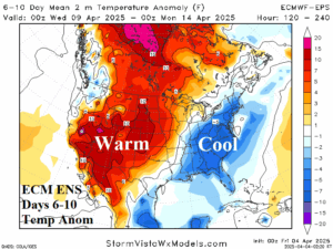
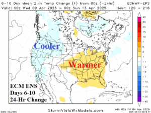
Discussion: Upper trough in the East begins to fade late period; Broad upper ridge warms the West. An upper trough cools the Northwest Coast.
Medium-range 11-15 Day Forecast Valid April 14-18, 2025 (24-hour change)
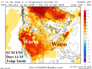
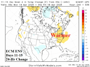
Discussion: The zonal upper air forecast remains valid. The warm pattern consolidates in the Southwest and is the source region for a milder regime extending eastward.
U.S. Medium-range Precipitation Forecast
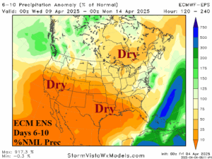
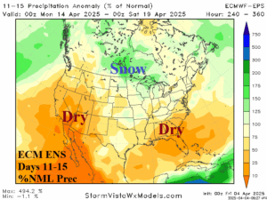
Discussion: After the extreme rainfall centered on the Mid-south States in the current weather pattern, the U.S. medium range precipitation forecast reverses much drier.
Days 16-20 Extended range Temperature Forecast valid April 19-23, 2025
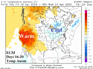
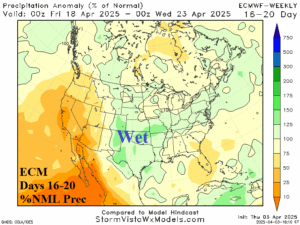
Discussion: Maintaining warm risk across the Southwest U.S. with a compensating cooler trend centered on the Great Lakes region. Wet weather is forecast across the Great Plains.