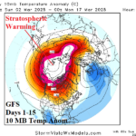
Update on Stratospheric Warming Event
03/02/2025, 10:52 am EST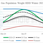
U.S. Gas Population Weight HDD: Coldest Since 2013-14 and 11th Coldest of this Century
03/04/2025, 4:24 am EST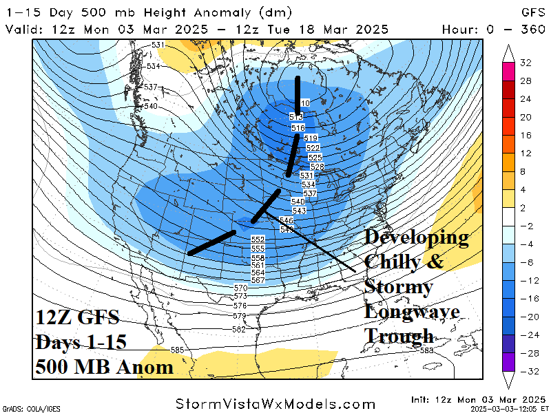

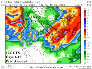
Fig. 1-2: The 12Z GFS 500 MB anomaly forecast through the next 15 days and the attendant storm track.
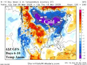
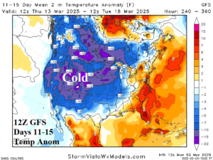
Fig. 3-4: The 12Z GFS U.S. medium range temperature anomaly forecast.
Discussion: Today’s 12Z GFS forecast is the first to show a sprawling colder and stormy look since stratospheric warming conditions were in the forecast. At midday, the 12Z GFS reveals an evolving central North America longwave trough (Fig. 1). The polar vortex shifts from the coast of Northeast Canada to Hudson Bay. The storm track becomes stronger and features hefty precipitation amount on the West Coast and across the eastern 40% of the U.S. (Fig. 2). Included is hefty snow along the northern portion of the storm track. The 12Z GFS medium range temperature anomaly forecast reveals a colder look to Southern Canada in the 6-10-day period (Fig. 3) while the western 2/3 of the nation is chilly in the 11-15-day period (Fig. 4). The HDD forecast is significantly higher and now favoring above normal national heating demand for the middle third of March (Table 1).
| EIA End | Forecast | 12-Hour Change | 24-Hour Change | 30-Year Normal | 10-Year Normal |
| 3/6 | 152.1 | +0.2 | +0.2 | 165.7 | 157.5 |
| 3/13 | 156.7 | +28.0 | +36.4 | 152.7 | 143.5 |
| 3/20 | 153.3 | +30.4 | +9.4 | 139.2 | 129.8 |
Table 1: The midday 12Z GFS U.S. gas population weight HDD projections through the middle third of March.