
92L Likely to Develop, Stay Out-to-Sea; Comments on the 2013 TC Season (and Following Winter)
09/15/2025, 11:41 am EDT
Could Gabrielle Cause High Latitude Block by Early October?
09/17/2025, 9:50 am EDT
Climate Impact Company Week 2-4 Outlook
North America
Issued: Tuesday, September 16, 2025
Highlight: Warm pattern shifts into the East; Wet West Coast next week, widening rainfall the following week.
Chart of the day: Past 30 days, “weeklies” verification.
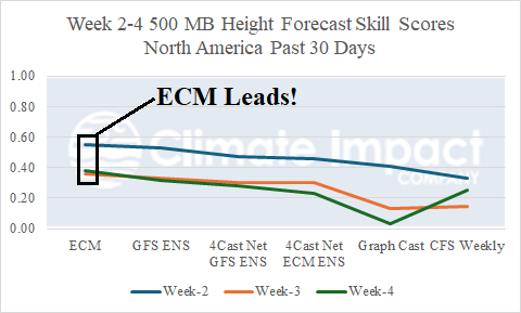
Discussion: ECM “weeklies” reign number one predicting the 500 MB height pattern across North America for the week 2-4 outlook during the past 30 days.
Week-2 Ahead Forecast valid September 21-28, 2025: Rainy West Coast; Very warm/dry Great Plains.
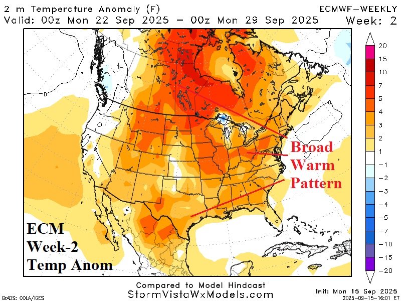
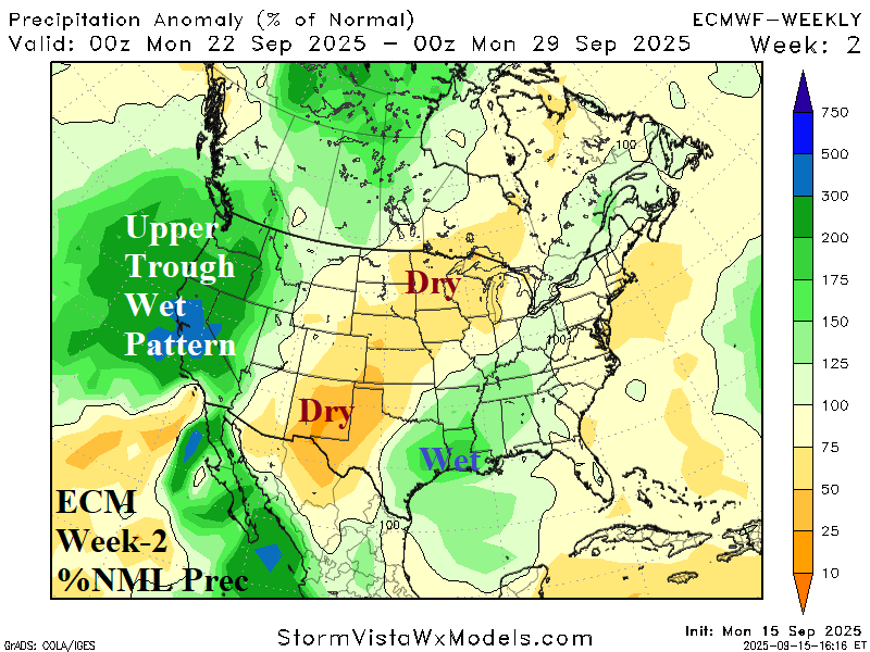
Discussion: Upper trough approaches the U.S. West Coast igniting a wet pattern. East of the trough, an upper ridge continues to warm most of the U.S. and Canada. Beneath the ridge, the Great Plains stay dry. Wet weather in the northwest Gulf could be related to a tropical cyclone.
Week-3 Ahead Forecast valid September 28-October 5, 2025: Widening wet weather.
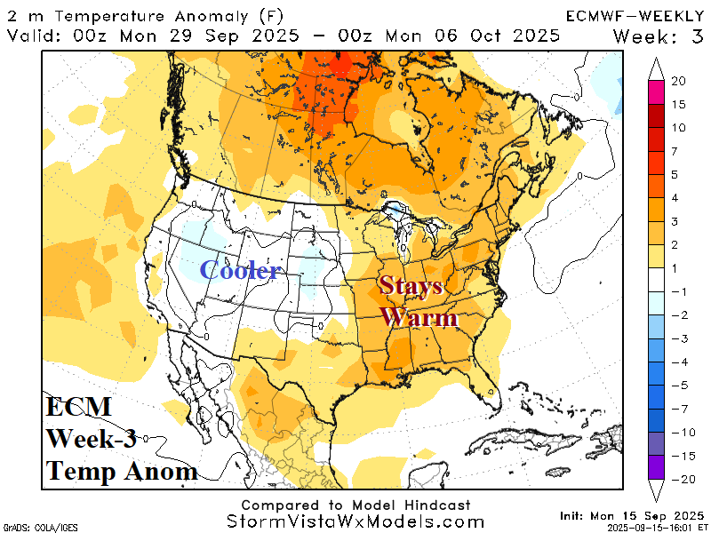
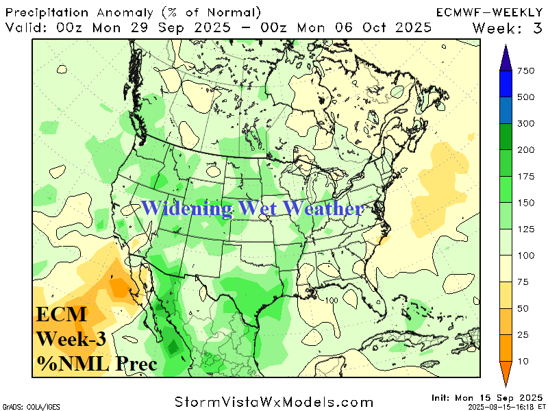
Discussion: The upper trough shifts eastward causing a wetter pattern across most of the U.S. The warm pattern lingers in the East.
Week-4 Ahead Forecast valid October 5-12, 2025: Rewarming the West; Wet Southwest.
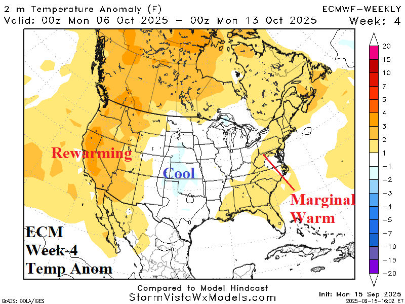

Discussion: Upper trough remains in the Central U.S. causal to Southeast U.S. rainfall. In the southwest Gulf, a tropical cyclone risk. The West rewarms while the East Coast is marginally warm. The Northeast is susceptible to “sneaky” cool weather.