U.S. and Europe HDD Forecast Update
12/26/2025, 8:19 am EST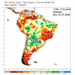
Recent Heavy Rain Argentina While East Brazil is Very Dry
12/29/2025, 11:56 am EST
![]()
Climate Impact Company U.S. Sunday Report
Issued: Sunday, December 28, 2025, Happy New Year!
Highlight: Cold is back week-4; Plethora of hazardous weather events start the week.
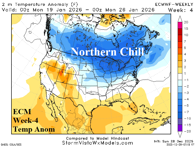
Fig. 1: ECM week-4 North America temperature anomaly forecast.
Discussion: The extended range forecast offers regenerating cold (Fig. 1) across the Northern U.S. according to ECM (and CFS V2). The U.S. gas population weight HDD forecasts are colder for next week and the following week compared to 48 hours ago (Fig. 2). The just received 12Z GFS was a little warmer. Interestingly, the AI week 4-5 HDD projection shifts much warmer than indicated late last week while CFS/ECM consensus is sharply colder for week-4 (Fig. 3). Short-term hazards are intense and feature Blizzard Warnings across the Upper Midwest to the Northern Great Lakes and widespread high wind alerts for the East-central and Midwest U.S. (Fig. 4). Winter Weather Advisories for snow to ice extend across the Northeast States. The 12Z GFS indicates the maximum gust in the Midwest States are tonight and Northeast region tomorrow night (Fig. 5-6) with 40-60 mph potential. Heavy snow featuring blizzard conditions due to high wind extend from the Upper Midwest to Quebec tonight into Tuesday (Fig. 7) while significant ice accretion (0.25 to 0.50 in.) is projected for the eastern Great Lakes to New England (Fig. 8).
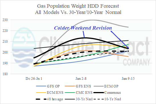
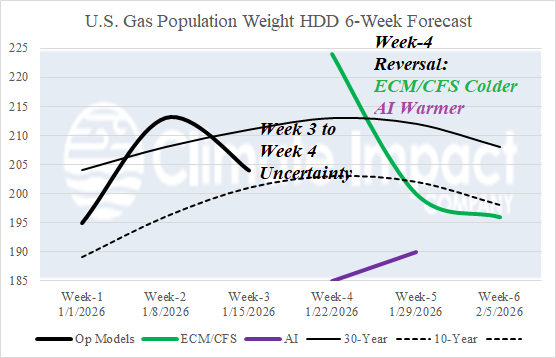
Fig. 2-3: The weekend U.S. gas population weight HDD forecast utilizing all models trend colder through mid-January while CFS/ECM and AI week 4-6 (HDD) estimates reverse as AI shifts warmer.
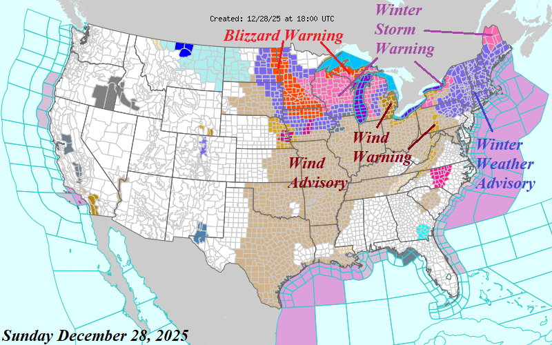
Fig. 4: Current NOAA/NWS weather watch, warning and advisories.
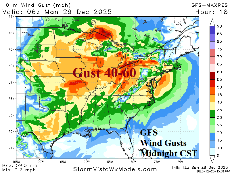
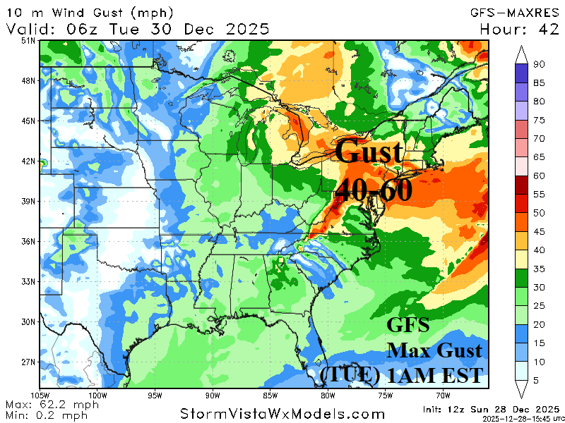
Fig. 5-6: 12Z GFS maximum wind gusts in the Ohio Valley for tonight and Northeast U.S. tomorrow night.
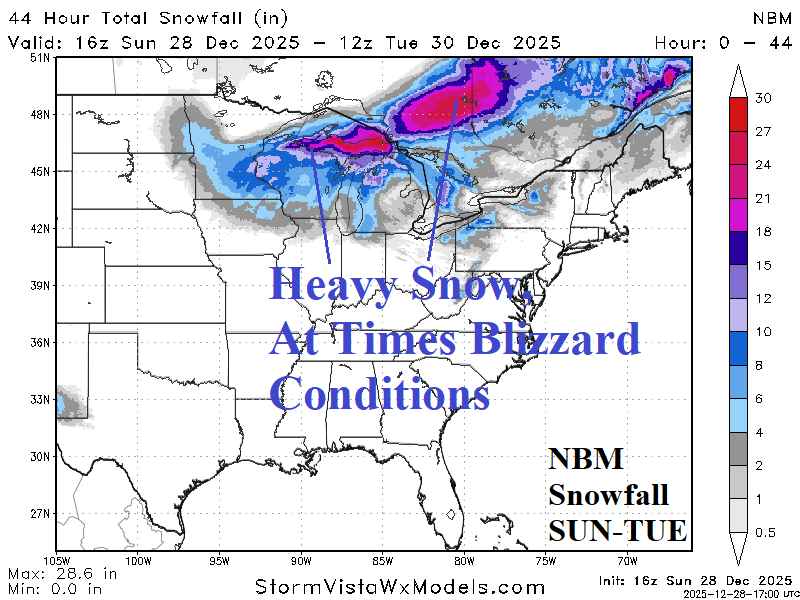
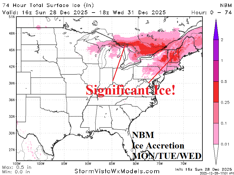
Fig. 7-8: The NBM snowfall and ice accretion forecast across the East U.S. for early week.