Tropics to Activate; Busy October Ahead
09/24/2025, 6:07 am EDT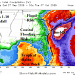
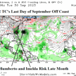
Imelda Flooding Rainfall Remains in Forecast; New Concern is Long-duration East Wind Causing Flooding
09/27/2025, 9:30 am EDT
Climate Impact Company U.S. Medium Range Report
Issued: Thursday September 25, 2025
Highlight: Very warm forecast continues; Heavy rain suppresses warmth in the Mid-Atlantic States.
Chart of the day: ALERT…Dangerous flooding rainfall in the East!
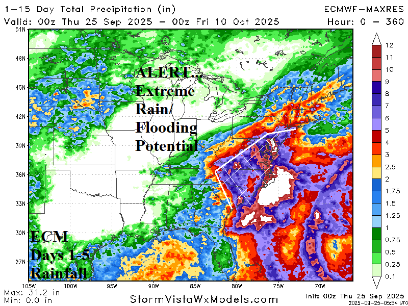
Discussion: ECMWF forecasts heavy rain effects from Imelda early next week followed by a second event in the 11-15-day period. Each event combines for widespread flooding risk in the 15-day forecast.
Medium-range 6-10 Day Forecast Valid September 30-October 4, 2025 (ECM OP right)
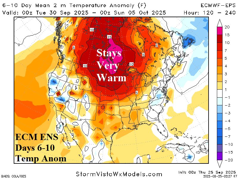
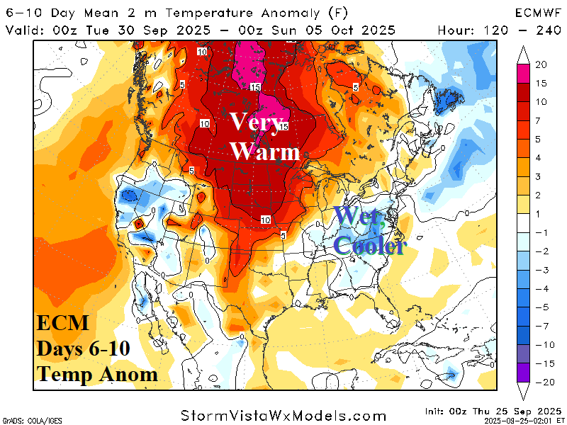
Discussion: Becoming the primary focus of the 6-10-day period is the potential heavy rain in the Mid-Atlantic region which causes cooler changes. The ECM OP rainfall forecast is used in today’s outlook (below) therefore also used as the alternative temperature outlook.
Medium-range 11-15 Day Forecast Valid October 5-9, 2025 (ECM OP right)
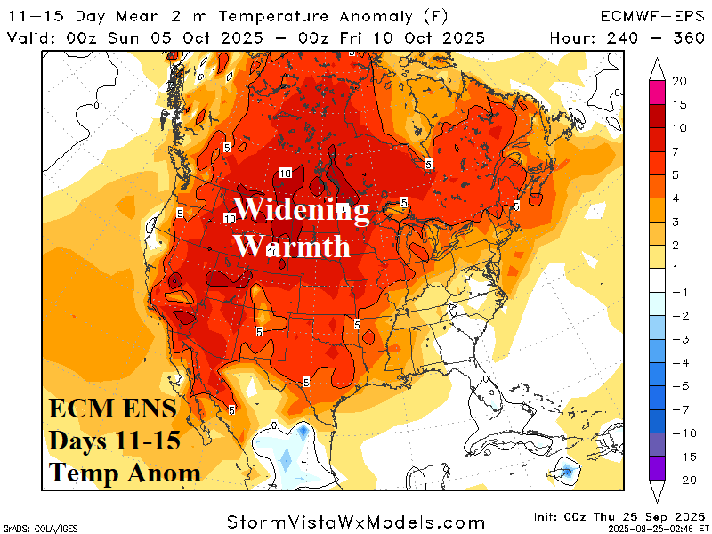
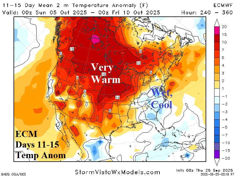
Discussion: ECM OP indicates a potential second heavy rain event in the Mid-Atlantic region suppressing temperature in that region. Elsewhere, the broad extraordinary warm pattern continues during early October.
U.S. Medium-range Precipitation Forecast
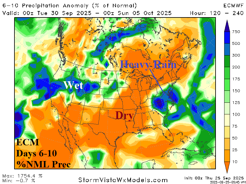
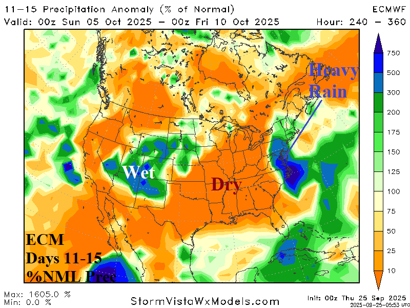
Discussion: ECM OP indicates prohibitive rainfall in the Mid-Atlantic region centered on Virginia during the medium range. Western wet weather in the 6-10-day period shifts to the Central Rockies in the 11-15-day forecast.
Days 16-20 Extended range Temperature Forecast valid October 10-14, 2025
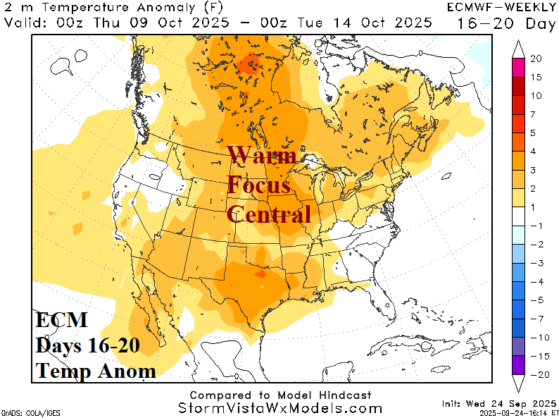
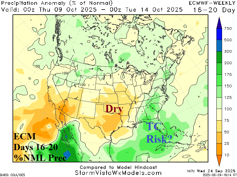
Discussion: The warm pattern continues in the extended range with new wet weather risk possibly associated with a tropical cyclone across the Southeast U.S. and Florida.