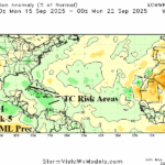
Expecting TC Activity Each of the Next 4 Weeks
08/19/2025, 3:54 pm EDT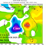
Wet/Cool Spring Followed by Evolving Summer Heat/Dryness East Australia
08/22/2025, 5:20 am EDT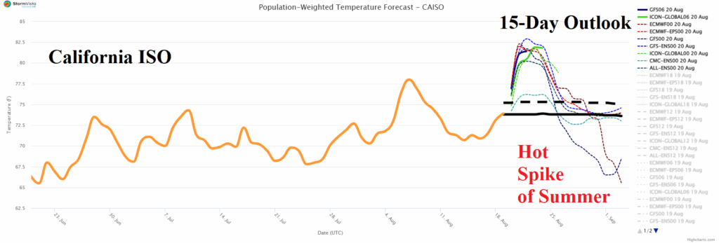

Climate Impact Company U.S. Medium Range Report
Issued: Wednesday August 20, 2025
Highlight: U.S. Medium-range forecast trend is cooler; 16-20-day warmer pattern change.
Chart of the day: Hottest event of the summer 2025 season in California.
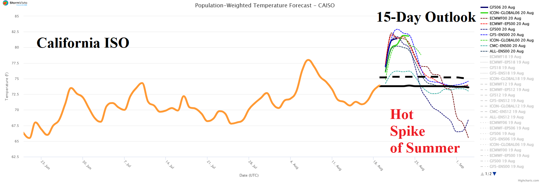
Discussion: Intense heat will spread across much of California during the next few days leading to the hottest summer 2025 event of the season. Sacramento and Burbank reach 102F THU/FRI; San Jose to 95F tomorrow; Bakersfield 108F on Friday. Farther east, Las Vegas reaches 110F and Phoenix 112F on Thursday.
Medium-range 6-10 Day Forecast Valid August 25-29, 2025 (AIFS ENS right)

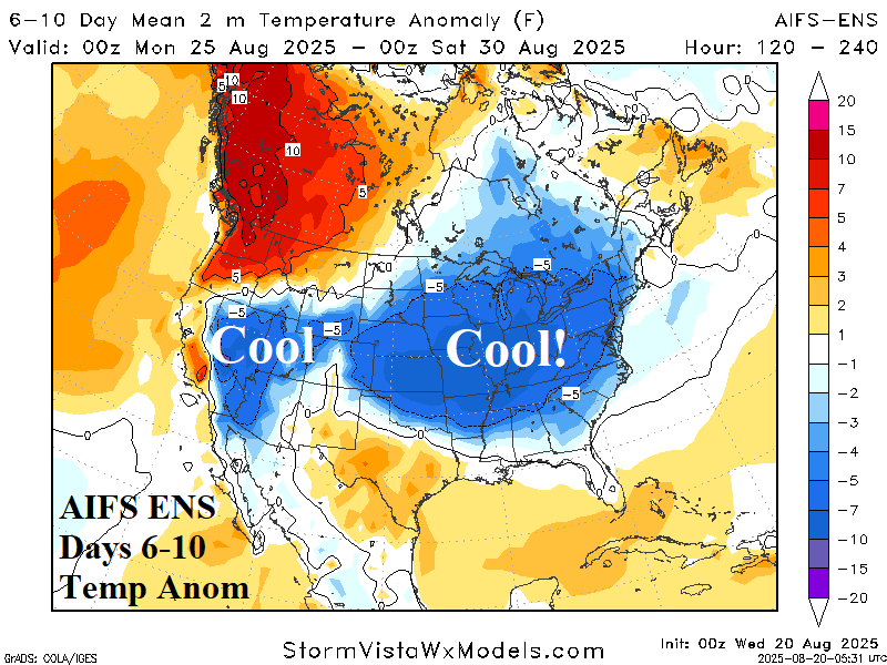
Discussion: Upper trough producing the cool air mass centered on the Midwest U.S. is sharper therefore cooler changes. The cool weather extends westward into the rainy zone across the Southwest States. Note that coastal California may stay hot.
Medium-range 11-15 Day Forecast Valid August 30-September 3, 2025 (AIFS ENS right)
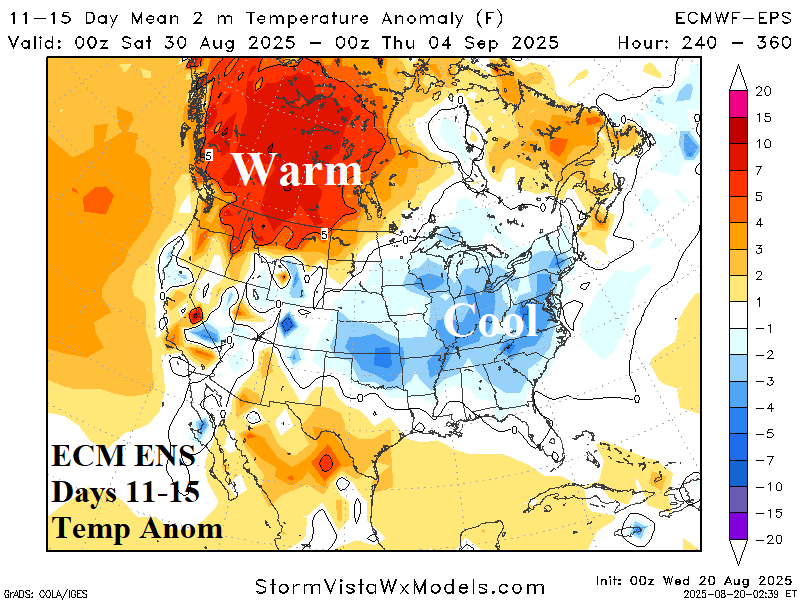
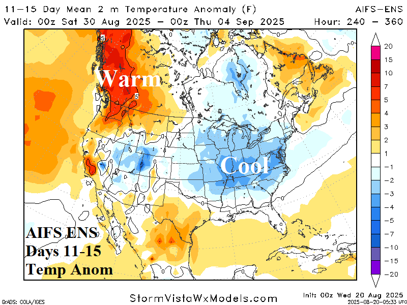
Discussion: The upper trough remains although less amplified. Both ECM ENS and AIFS ENS stay cool in the East. The Far Northwest U.S. and possibly Coastal California are the hot zones.
U.S. Medium-range Precipitation Forecast
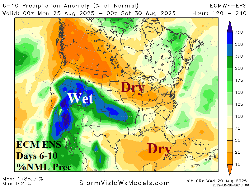
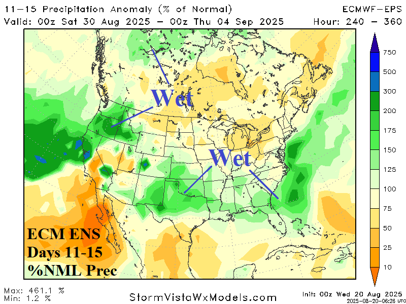
Discussion: The 6-10-day forecast trend is wetter across the Southwest U.S., Great Basin, and eastward across the southern Great Plains. The wet weather extends to the Southeast U.S. in the 11-15-day period. There may be a tropical system off the Southeast Coast in the 11-15-day period.
Days 16-20 Extended range Temperature Forecast valid September 4-8, 2025 (yesterday’s forecast right)
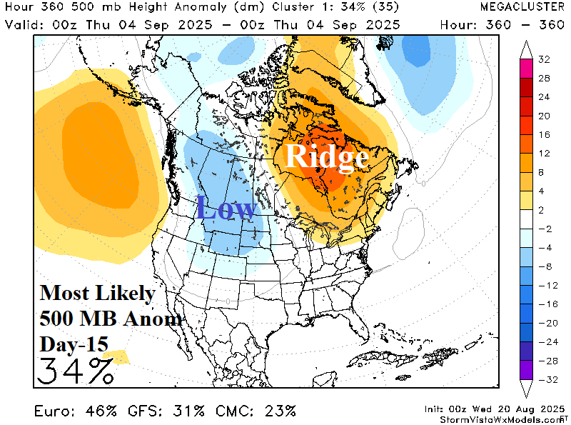
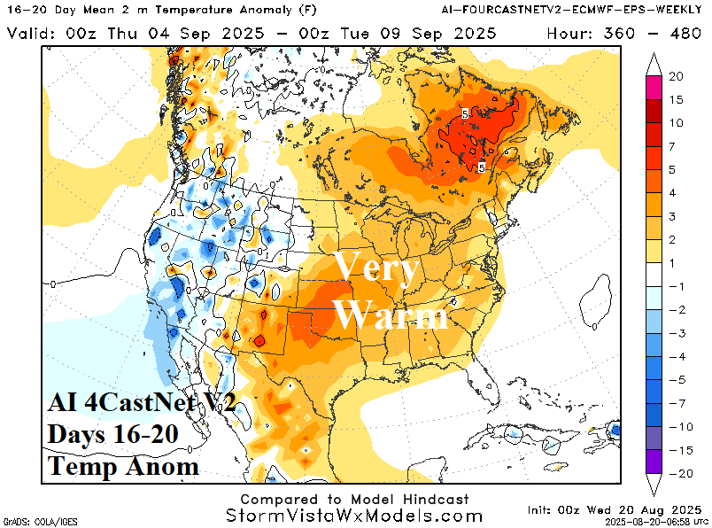
Discussion: The mega-cluster ensemble “most likely” upper air forecast for day-15 indicates a Northwest U.S. trough. The sensible 16-20-day forecast that follows supports a cooler regime in the West compensated for by a Central/East U.S. warm-up. Forecast confidence is low (34%)!