
Excessive Rainfall Forecast by ECM Central/East-central South America.
12/08/2025, 4:30 am EST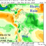
MJO-Inspired Heavy Rain for Brazil, Once Effect Fades, Brazil Drier into New Year
12/10/2025, 3:38 am EST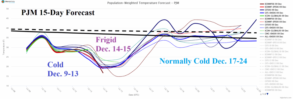

Climate Impact Company Early U.S. Notes
Issued: Tuesday December 9, 2025
Highlight: Plenty of snow and (very) cold weather Central and East well into next week; Northwest storminess. Extended range warm-up.
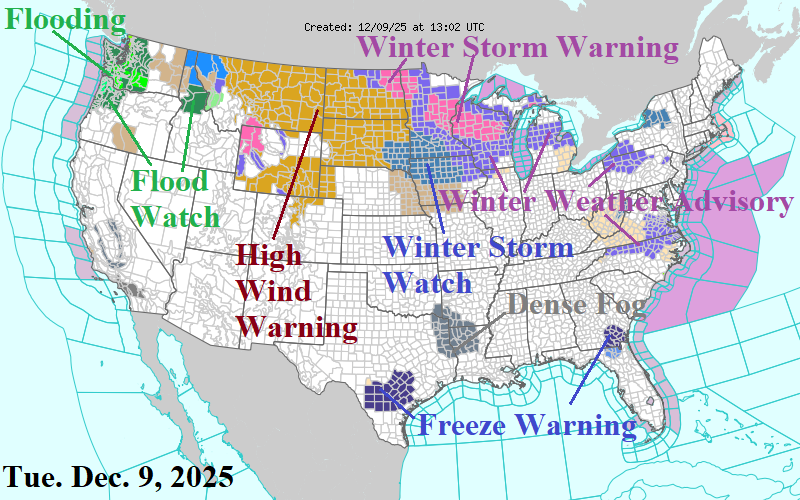
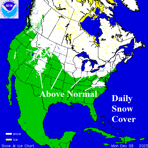
Fig. 1-2: NOAA/NWS weather watch, warning, and advisories plus the daily snow cover analysis.
Discussion: A Winter Storm Watch for moderate snow and high wind is issued for the Upper Midwest (Fig. 1). Blizzard conditions are possible due to wind in this zone. Winter Weather Advisories extend eastward to Pennsylvania and linger in Virginia. Flooding rains continue in the Coastal Northwest U.S. with the Pacific storm track causing High Wind Warning conditions across Montana and the Dakotas. Snow cover is well above normal in the Midwest U.S. to the Northeast Corridor (Fig. 2). Snowfall forecasts by NBM indicate moderate to heavy snow across the Upper Midwest, Great Lakes, and Interior Northeast States today through tomorrow (Fig. 3). More snow although not as heavy extends across the North-central U.S. to the Interior Northeast States later this week (Fig. 4). More snow is likely from the Ohio Valley across the Northeast States this weekend (Fig. 5). The ongoing snowfall leaves deep snow cover for the Midwest to the Northeast by middle of next week (Fig. 6). The deepening snow enhances arctic air presence peaking in strength early next week across the PJM System (Fig. 7). The Northwest U.S. is hit hard by Pacific storms. NBM indicates up to one foot of rain west-facing lower elevations of Washington and Orgon in the latest 7-day forecast (Fig. 8). Higher elevations receive excessive snow. NMB projects heavy snowfall for the Northern Rockies over the next 7 days (Fig. 9). The U.S. gas population weight HDD forecast ends the cold regime and high heating demand regime after Christmas Day (Fig. 10).
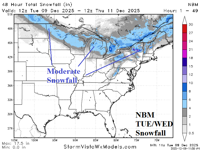
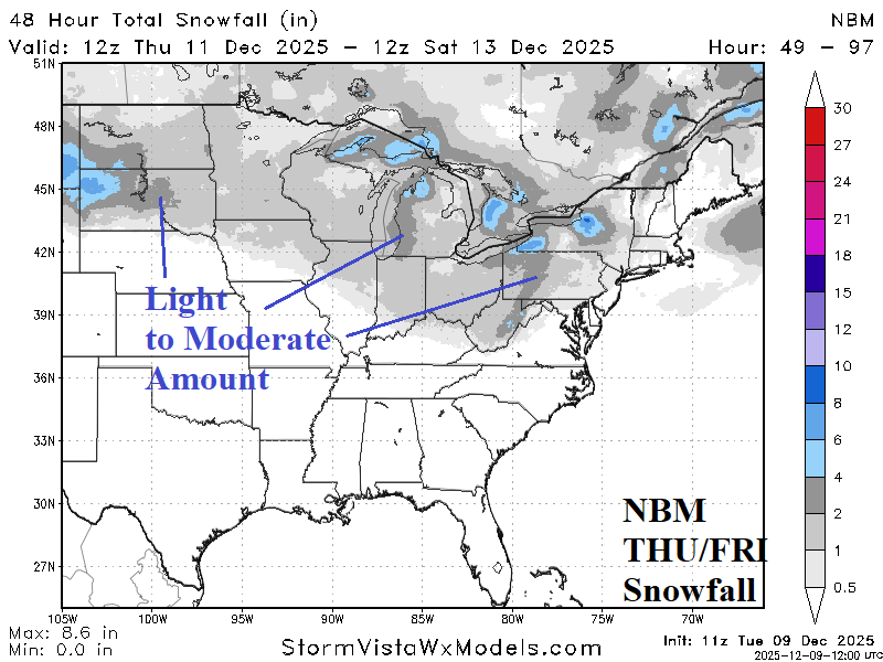
Fig. 3-4: NBM 48-hour snowfall for TUE/WED and THU/FRI of this week for the eastern half of the U.S.

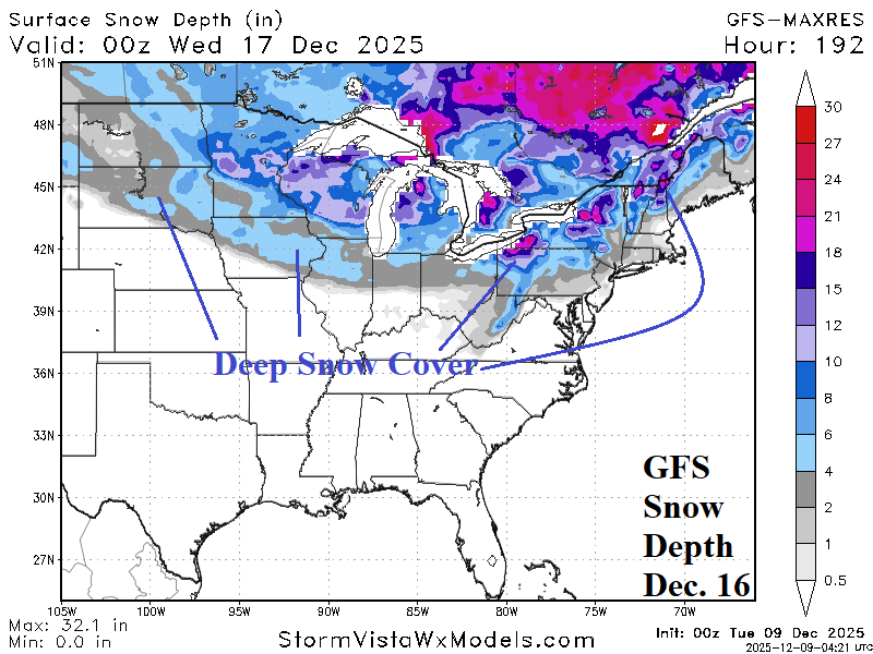
Fig. 5-6: NBM 48-hour snowfall for the weekend and GFS Dec. 16th snow cover forecast.
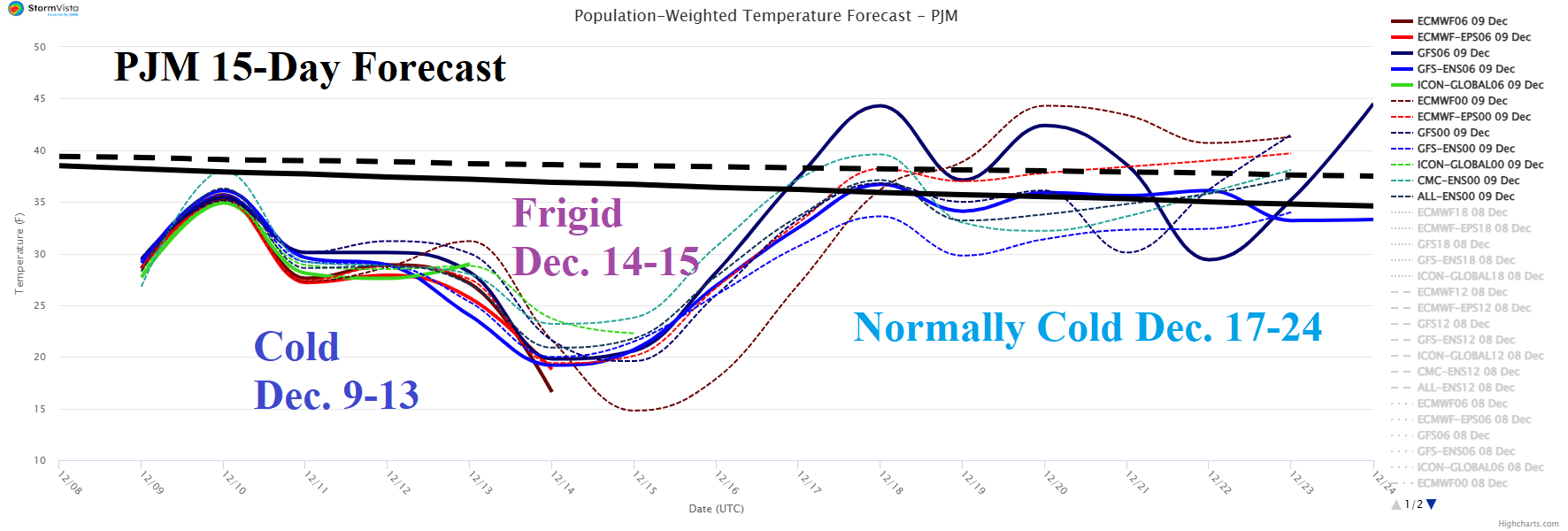
Fig. 7: PJM System Average 15-day temperature forecast.
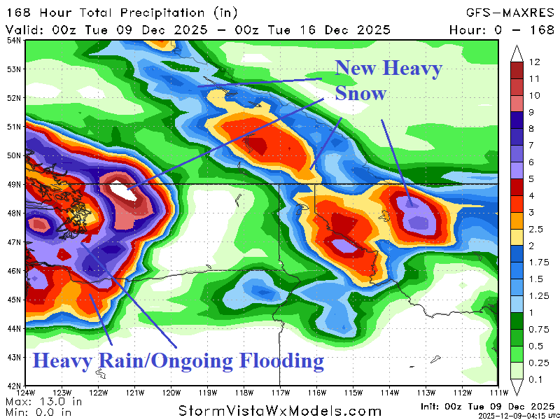
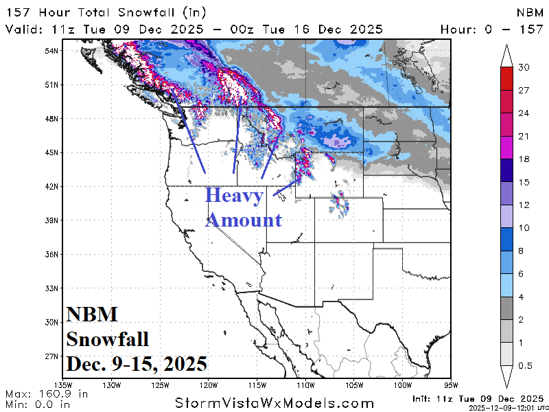
Fig. 8-9: The GFS 7-day precipitation amount forecast for the West U.S. and NBM 7-day snowfall amount outlook.
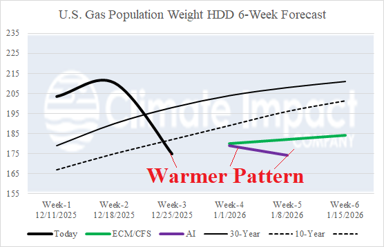
Fig. 10: using all operational models, the U.S. gas population weight HDD forecast through Dec. 25th and the CIC HDD forecast estimate combining 3 AI models and the CFS/ECM output.