High Impact/High Windstorm Later This Week Great Plains
03/09/2025, 2:35 pm EDT
Extreme Rainfall from Alfred; New Wet Pattern Ahead Australia
03/11/2025, 10:23 am EDT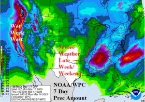
Fig. 1: The NOAA/WPC 7-day quantitative precipitation forecast for the U.S.
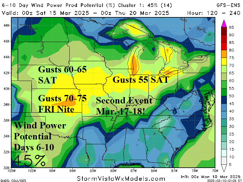
Discussion: High impact weather affects much of the U.S. this week. Severe weather becomes an issue Friday and continues Saturday in the Mid-south States where excessive rain and tornadoes threaten (Fig. 1). A steady onslaught of heavy rain and mountain snow with high wind affects the West Coast this week into next weekend. An unusually strong wind event begins Friday across the southwest Great Plains and Texas shifting to Kansas Friday night. Hurricane force wind is widespread with this event (Fig. 2). The high wind event shifts to Nebraska and the Northern Ohio Valley next Saturday. Another high wind event with similar intensity in the same location is forecast early next week. The U.S. gas population weight HDD forecast indicates below normal national heating demand into early calendar spring (Fig. 3).
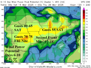
Fig. 2: The GFS ENS highlights an area susceptible to two high wind events beginning Friday night with a second event early next week.
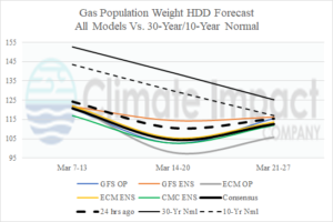
Fig. 3: The U.S. gas population weight HDD forecast utilizing all models, their consensus, and comparing with 24 hours ago.

