Big Storms Ahead in U.S., Especially for the West Coast
11/17/2024, 10:09 am ESTNew NOAA Long-lead Forecasts for Winter 2024-25
11/21/2024, 12:40 pm EST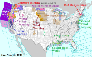
Fig. 1: The latest NOAA/NWS weather watch, warnings, and advisories.
Discussion: A plethora of weather watch, warning, and advisories are issued for the West Coast likely to remain through the weekend as an “atmospheric river” pattern develops (Fig. 1). Included are the first of many blizzard warnings, beginning in the Northern Cascades with Winter Storm Warnings for mountain snow extending south to the northern half of the Sierra Nevada. A Freeze Warning is issued for the San Joaquin Valley. A Winter Storm Warning is issued for the northern Great Plains while the northwest Plains are affected by a High Wind Warning. Windy weather with very dry soil conditions spawns another Massachusetts Red Flag Warning. Wind Advisories are issued for Illinois. Coastal Flood Advisories are issued for the entire Louisiana and New Jersey Coasts.
NOAA/WPC identifies heavy rain causing flooding on the central Gulf Coast and Northwest Coast today (Fig. 2). The excessive rain/flood risk becomes increasingly dangerous mid-to-late week with day after day heavy rains/mountain snows slamming Northern California (Fig. 3-5).
The NOAA/WPC 7-day quantitative precipitation (QPF) forecast projects 10-20 in. of rain (and many feet of mountain snow) centered on Northern California (Fig. 6).
Cold air concern in the medium range influences the U.S., especially in the 11-15-day period although the mega-cluster ensemble indicates forecast confidence at 71% that the cold risk moderates once out of Canada (Fig. 7). The “Caveat” forecast indicates potent cold in the 11-15-day period at a much lower 29% risk (Fig. 8).
Notable is the colder U.S. gas population weight HDD forecast valid for Nov. 29-Dec. 3 lead by the GFS (Fig. 9).
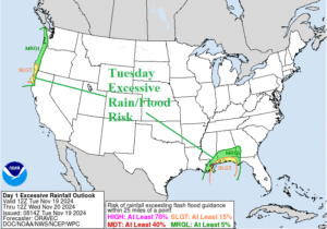
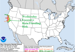
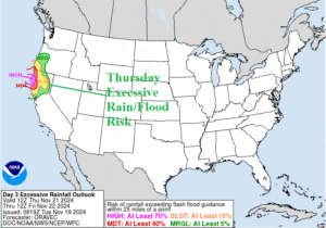
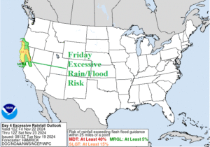
Fig. 2-5: The NOAA/WPC excessive rain/flood risk areas for the next 4 days.
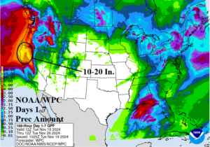
Fig. 6: The NOAA/WPC 7-day quantitative precipitation forecast for the U.S.
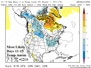
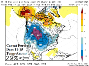
Fig. 7-8: The mega-cluster ensemble identifies U.S. cold risk in 11-15 days.
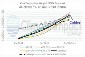
Fig. 9: The U.S. gas population weight HDD forecast through mid-November utilizing all models, their consensus, and comparing with 24 hours ago/climatology.
