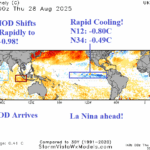
Strong Negative Indian Ocean Dipole Arrives; La Nina Approaching!
08/29/2025, 4:57 am EDT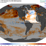
Is Upper Air Pattern Associated NAWH Inhibiting TC Season?
09/08/2025, 5:44 am EDT
Climate Impact Company Week 2-to-5 Tropical Outlook
Issued: Wednesday September 3, 2025
Highlight: East Pacific/Outer Atlantic active; Western North Atlantic basin below normal TC risk.
Charts of the day: High pressure preventing active tropics.
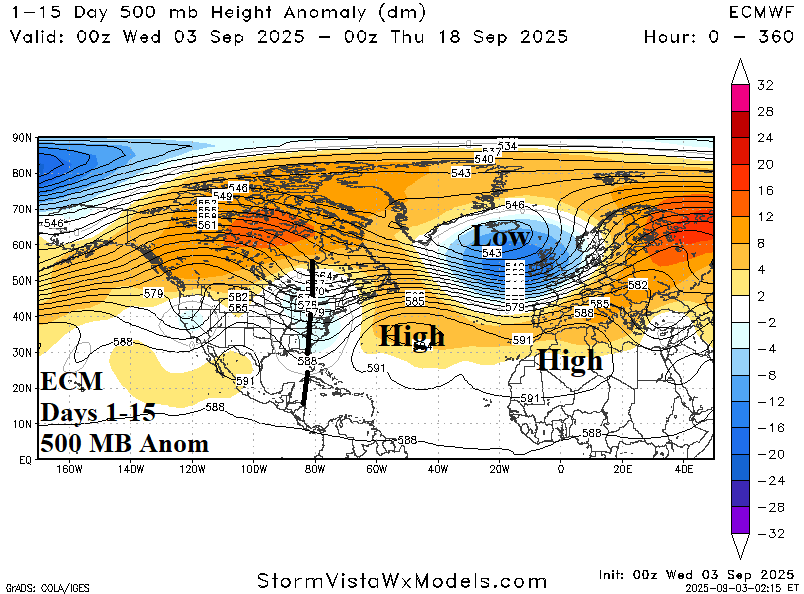
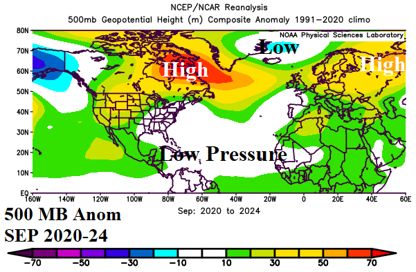
Discussion: During September 2020-24, the tropical North Atlantic (TNA) index has averaged +0.83, the warmest of any 5-year period on record. On average, 7 tropical storms, 3 hurricanes, and 1 intense hurricane has formed in the North Atlantic basin in September during this decade so far. Operational models project 1 tropical cyclone occurring during their 15-day outlooks implying just 1 tropical cyclone through September 18th well below the 2020-24 (and historical) climatology. The culprit is too much dry air promoted by a strong subtropical high pressure stretched across the North Atlantic basin whereas 2020-24 produced low pressure in the tropical/subtropical North Atlantic due to presence of tropical cyclones.
Week-2 Valid September 7-14, 2025: Projecting 1 (out-to-sea) significant event.
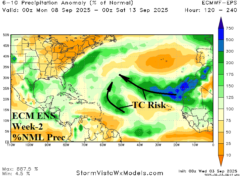
Discussion: A tropical cyclone is likely travelling west-northwest from the outer tropics toward the central North Atlantic basin next week. A second system with lower probability of development is indicated just east of the Caribbean Sea. Wet weather off the East Coast is due to a stalled frontal system.
Week 3 Valid September 14-21, 2025: Below normal risk of western North Atlantic basin tropical cyclone activity.
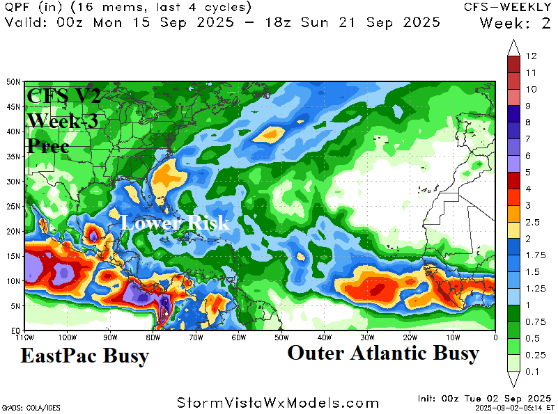
Discussion: The NCEP CFS V2 projects an active tropical pattern for the East Pacific. Normally, when the East Pacific is tropically active, the western North Atlantic tropics observes below normal risk of tropical cyclone activity.
Week 4 Valid September 21-28, 2025: Lower than normal risk of western North Atlantic basin tropical cyclone activity is maintained.
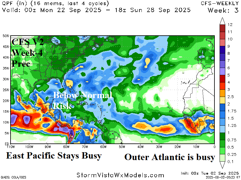
Discussion: The East Pacific and outer North Atlantic tropics are tropically active leaving an in-between lower than normal risk of tropical cyclone generation across the western North Atlantic basin with possible exception of the Bay of Campeche.
Week 5 Valid September 28-October 5, 2025: West Caribbean risk.
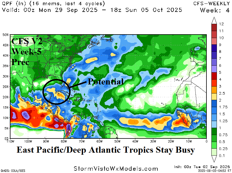
Discussion: The deep tropics of the East Pacific and North Atlantic remain active. The NVEP CFS V2 forecast reveals a tropical cyclone risk in the western Caribbean Sea.