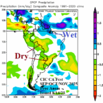
Focus on South America Climate: Southwest/Southeast Brazil to Argentina Drought Ahead Into Summer 2025-26
08/14/2025, 5:28 am EDT
Expecting TC Activity Each of the Next 4 Weeks
08/19/2025, 3:54 pm EDT
Climate Impact Company North Atlantic Basin 10-Day Monitor
Issued: Friday August 15, 2025, 5:45AM EDT
Highlight: Support (30-31C water) for category-4 major hurricane east of Bahamas early next week.

Fig. 1: The latest NOAA/NHC 5-day forecast track for Tropical Storm Erin.
Discussion: At 5AM EDT, Tropical Storm Erin was located at 17.8N/54.4W or about 570 miles east of the northern Leeward Islands. Erin is moving west-northwest at 17 mph with top wind near 70 mph and central pressure 997 MB. The initial position intensity is “generous” according to NOAA/NHC. Erin remains disorganized although certainly a larger area of convection from 24 hours ago. The increasing expanse and general intensity increase since yesterday is due to passage over warmer water. Erin is forecast to steadily increase intensity today approaching 29C water temperatures and become a hurricane by tonight. The NOAA/NHC 5-day forecast brings Erin to a major hurricane tomorrow night and is trending farther west of 70W compared to previous forecasts citing the Google Deep Mind AI model. Erin will travel across 30C-31C water early next week which supports intensification to a category-4 major hurricane, somewhat stronger than forecast by NOAA/NHC. Erin travels northward just west of 70W and increases size interacting with an approaching upper trough. Consequently, tropical storm force wind is possible on the Carolina Coast Wednesday, Mid-Atlantic Coast Wednesday night and Thursday, and New England Coast on Thursday coupled with high waves and dangerous rip currents. The back edge of heavy rain will be very close to the coast. In the Gulf of Mexico, Tropical Disturbance 98L needs more time to intensify. This system reaches the northeast coast of Mexico just before strengthening to a tropical storm.
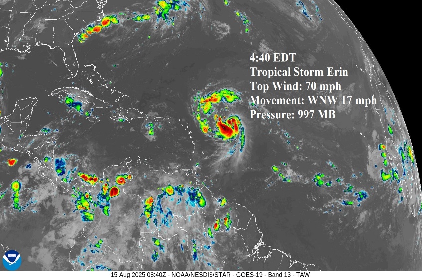
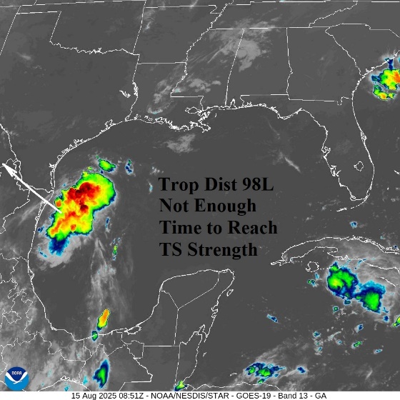
Fig. 2-3: Tropical Storm Erin remains disorganized but has increased convection significantly from 24 hours ago. Tropical Disturbance 98L needs more time to become a tropical storm moving into Northeast Mexico/Southern Texas tonight.
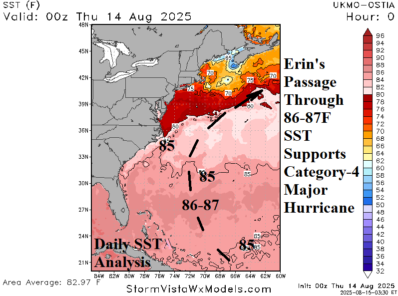
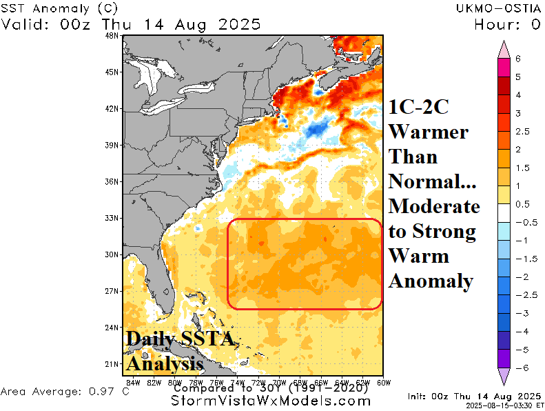
Fig. 4-5: The daily sea surface temperature observations reveal 86-87F/30-31C warmth along Erin’s forecast track early next week. SSTA are very warm (+1C to+2C).
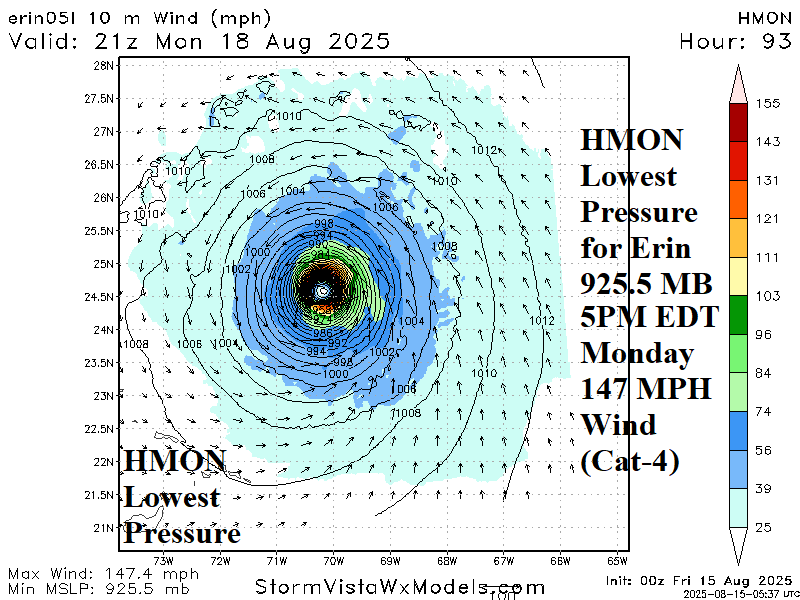
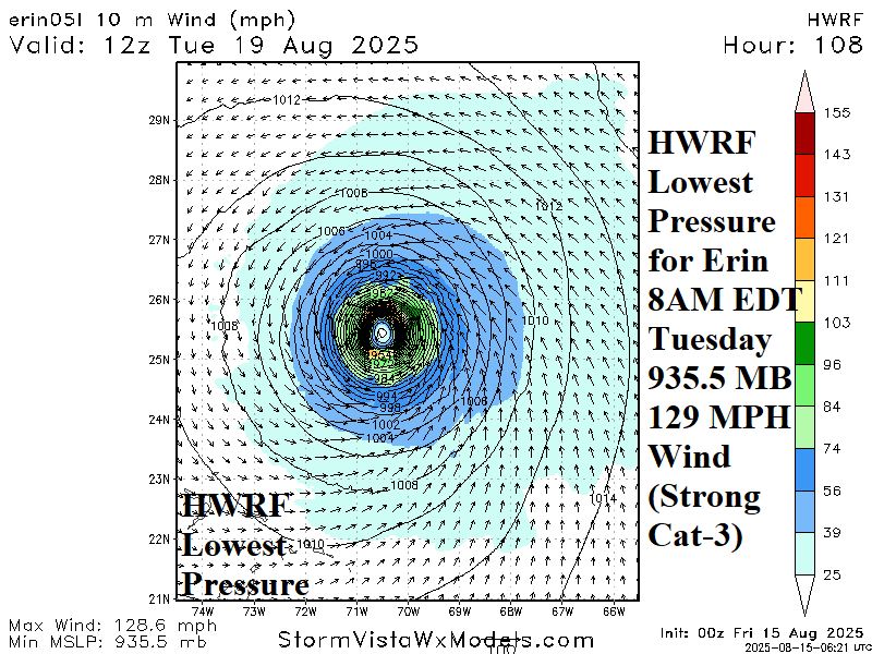
Fig. 6-7: HMON and HWRF hurricane forecast models and their lowest pressure for Erin. The consensus favors a category-4 major hurricane Monday night.
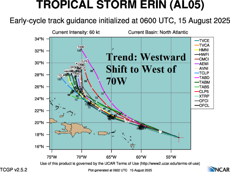

Fig. 8-9: Tropical cyclone model tracks and intensity forecasts for Erin. Forecast tracks are farther west in 4-5 days and one model (Navy) indicates potential category-5 major hurricane intensity.

Fig. 10: The AIFS ENS identifies potential paths of Erin during the north and northeast turn next week.