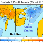
Trend Toward La Nina Temporarily Eases, Resumes Later August
08/04/2025, 9:20 am EDT
12Z GFS: Simultaneous U.S./Europe Heatwaves Next Week
08/07/2025, 1:42 pm EDT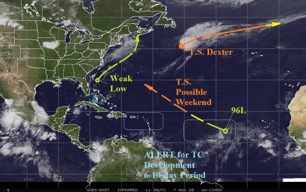

Climate Impact Company North Atlantic Basin 10-Day Monitor
Issued: Thursday August 7, 2025, 8:25AM EDT
Highlight: Getting interesting!
Colorado State University updates seasonal forecast. No change, similar with CIC (and 30-year climatology). See details below.

Fig. 1: The latest weather-satellite view of the North Atlantic basin.
Discussion: The North Atlantic basin is relatively quiet this morning. Tropical Storm Dexter is well southeast of Newfoundland and according to NOAA/NHC could briefly become a hurricane tonight/tomorrow. Tropical Disturbance 96L is benign. However, tropical cyclone models indicate a west to northwest track with development to a tropical storm this weekend. Extended-range forecasts indicate potential for 96L to become a hurricane meandering off the Northeast Coast later next week. A low-pressure area north of the Bahamas appears less likely to become a problem as the system drifts northeastward through the weekend. In the 6-10-day period, both GFS and ECM indicate significant tropical cyclone risk in the northeast Caribbean Sea and central North Atlantic tropics.
Colorado State University updated their seasonal tropical cyclone activity forecast yesterday. The outlook is unchanged from early June with 16 tropical storms, 8 hurricanes, and 3 major hurricanes indicated. The accumulative cyclone energy index is 140. Similar with Climate Impact Company, the outlook is near the 30-year normal but below the 2016-24 active period climatology. Subtract 4 tropical storms from the totals mentioned for activity so far this season. CSU indicates a slightly above normal risk of a major hurricane striking BOTH the Gulf of Mexico and East Coast this season.