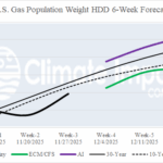
Comparing Estimated HDD Via ECM/CFS and AI Models for Week 4-6 Ahead
11/13/2025, 8:41 am EST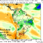
Anticipated Wetter Brazil Pattern Initiates in the 6-10-Day Period
11/16/2025, 12:17 pm EST
Climate Impact Company Week 2-4 Outlook
Europe/Western Russia
Issued: Friday, November 14, 2025
Highlight: Northwest Eurasia snow cover to advance and cause a cold bias in that region while Europe is near normal.
Charts of the day: -SCAND, expanding snow cover, colder regime.
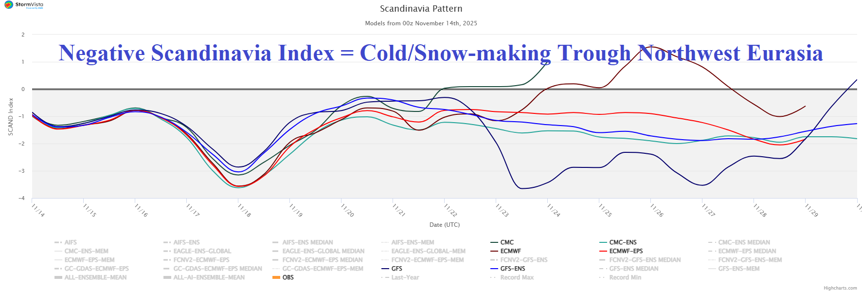
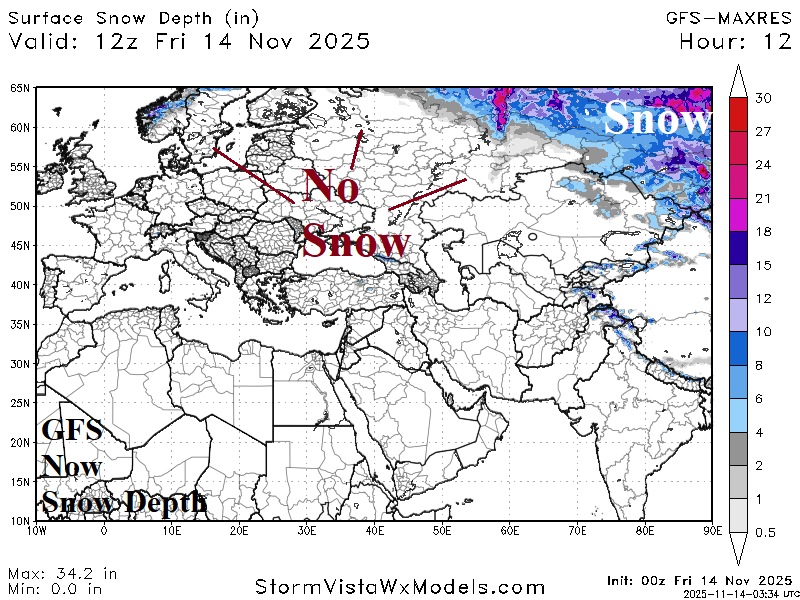
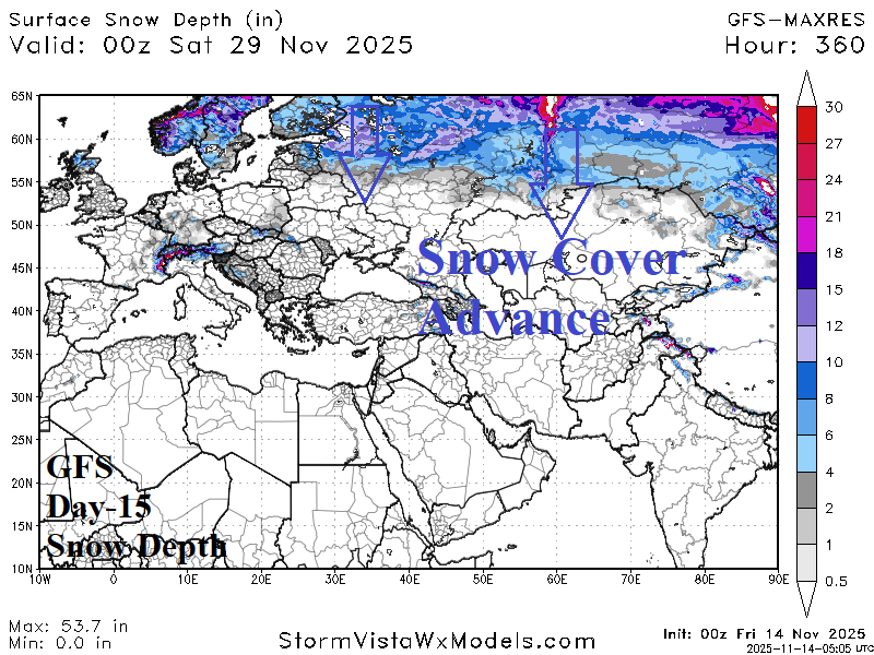
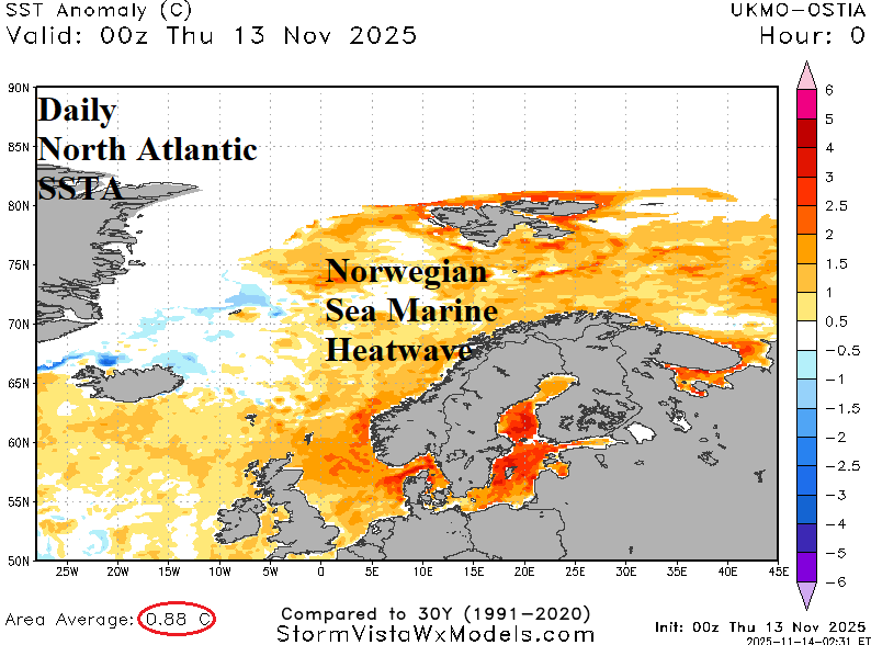
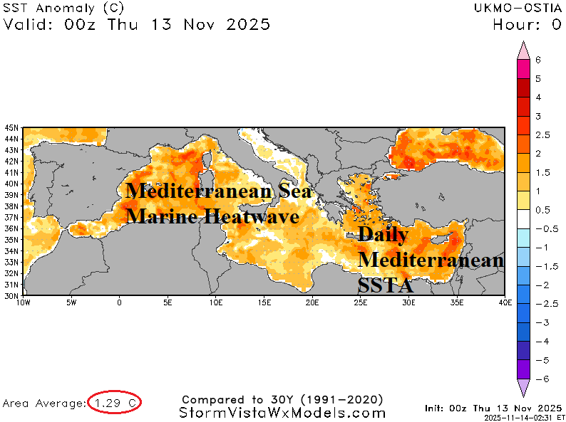
Discussion: An evolving strong negative Scandinavia (-SCAND) index develops over Northwest Eurasia the remainder of November causing a colder pattern-change most notable next week and possibly lingering to late month. -SCAND is the catalyst to expanding snow cover, well below normal now, but expanding across Scandinavia to the Baltic Region and much of Western Russia in 15 days. An inhibitor of significant cold and snow is the warm SSTA surrounding Europe with ongoing marine heatwaves in the Norwegian Sea and Mediterranean Sea.
Week-2 Ahead Forecast valid November 23-30, 2025: Warm Black Sea region; Near normal most of Europe.
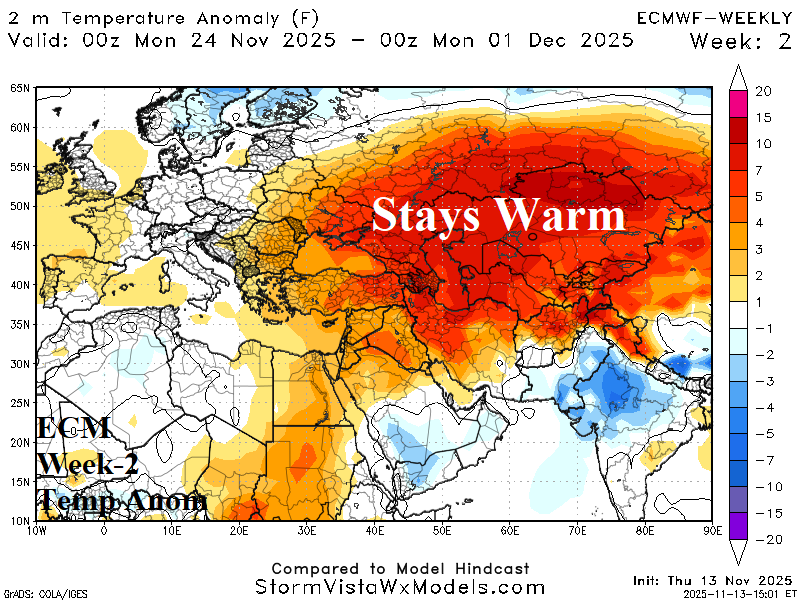
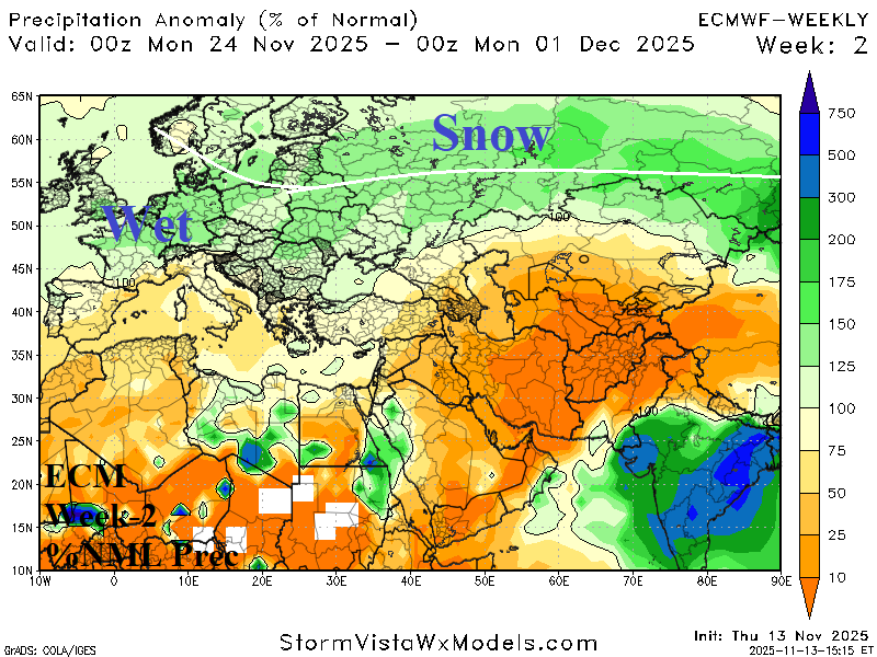
Discussion: Staying warm south of snow cover while Europe is temperate with wet weather centered on Germany. Northwest Eurasia snow cover continues to increase.
Week-3 Ahead Forecast valid November 30-December 7, 2025: Colder Northwest Eurasia; Europe near normal temperature/drier.

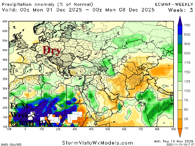
Discussion: Near normal temperature across much of Europe and turning drier. Northwest Eurasia chill strengthens due to snow cover. The Black Sea region warmth eases.
Week-4 Ahead Forecast valid December 7-14, 2025: Wet Southern Europe; Northwest Eurasia snowbound chill continues.
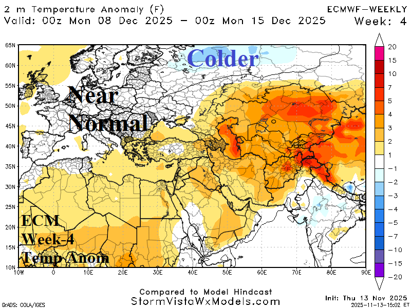
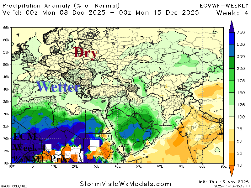
Discussion: Weak Madden Julian oscillation (MJO) signature may appear supporting a wet pattern across Southern Europe to North Africa while areas to the north are drier than normal. The Northwest Eurasia snowbound chill may advance farther west and south than indicated.