10/21/2025, 5:30 am EDT

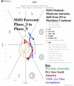
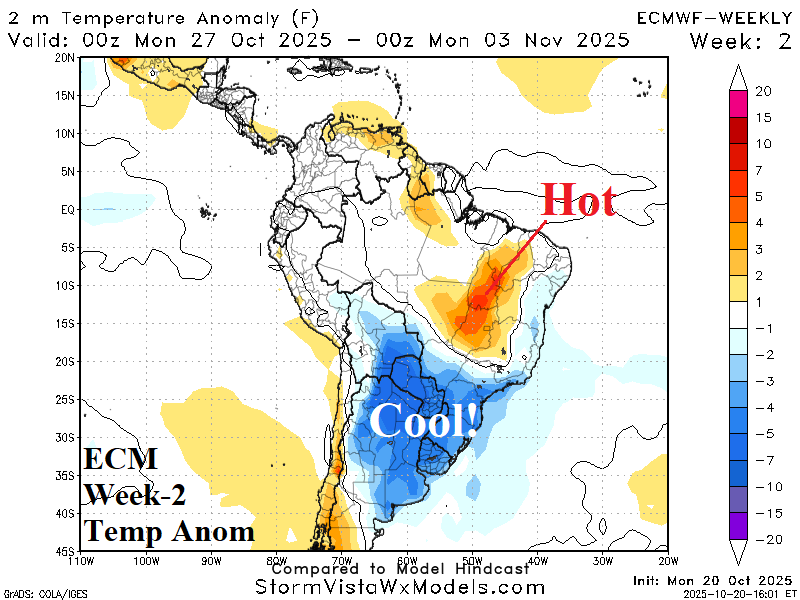
One cold front has plowed into Northeast Brazil this week and another stronger front shifts across Argentina late week/early weekend. The second front delivers a widespread cool air mass for next week across Argentina. The supporting upper trough cuts off over central South America in early November to deliver wet weather to the Brazil drought zone.
