
Northwest Eurasia Snow Cover to Advance!
11/14/2025, 5:02 am EST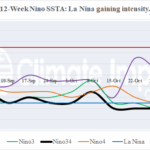
La Nina Gaining Strength
11/17/2025, 11:36 am EST
![]()
Climate Impact Company Sunday AG Report
Global Weather/Climate Report
Issued: Sunday November 16, 2025
Highlight: Wet weather shift to Brazil remains in the forecast, Europe turns chilly (and wet), and North/East coastal heavy rains for Australia.
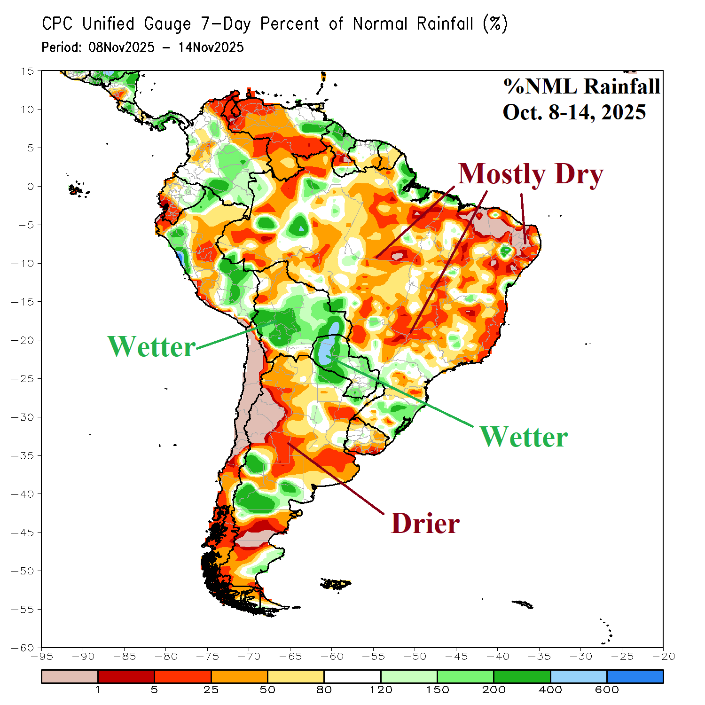
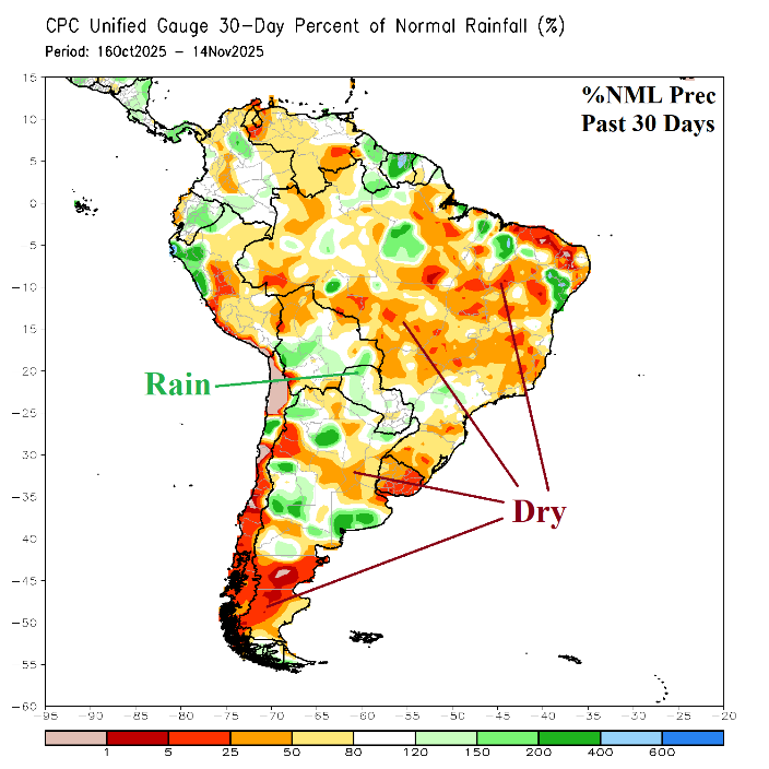
Fig. 1-2: The South America 7-day percent of normal rainfall observations and 1-10-day rainfall anomaly forecast.
Discussion: The South America rainfall pattern during the past week focuses heavy rain on Bolivia and Paraguay to Southeast Brazil with mostly drier than normal conditions either side of the wet arc (Fig. 1). Comparing short-term rainfall to the 30-day observations the rainfall trend is wetter central continent, mostly dry conditions in Central/East Brazil, and patchy heavy rains in Argentina (Fig. 2). Expected in late November and December is a wetter pattern change for Central and East Brazil and drier in Argentina. The mega-cluster ensemble “most likely” rainfall forecast for the upcoming week is an eastward shift of wet weather from central continent to Southeast Brazil/Northeast Argentina (Fig. 3). However, during the medium range, the mega-cluster ensemble indicates a clear shift of wet weather shifting into East Brazil extending westward across Mato Grosso while Northeast Argentina is drier and hotter (Fig. 4-5). The AI Graph Cast (and other models) maintain the Central/East Brazil rains in the 16-20-day forecast (Fig. 6).
In Europe, the negative Scandinavia (-SCAND) index forecast holds. An intense Northwest Eurasia trough extends southward, and Europe will turn much cooler and wetter during the second half of November (Fig. 7-8). Northern Europe and Northwest Russia are cold and snowy after a mild and snowless start to the month. The Black Sea region stays mild and eventually gains some rainfall.
In Australia, November has produced widespread areas of moderate rainfall (so far), including northern and eastern continent (Fig. 9). The 12Z GFS maintains areas of heavy rain for the North and East Coast in the latest 15-day rainfall forecast (Fig. 10).
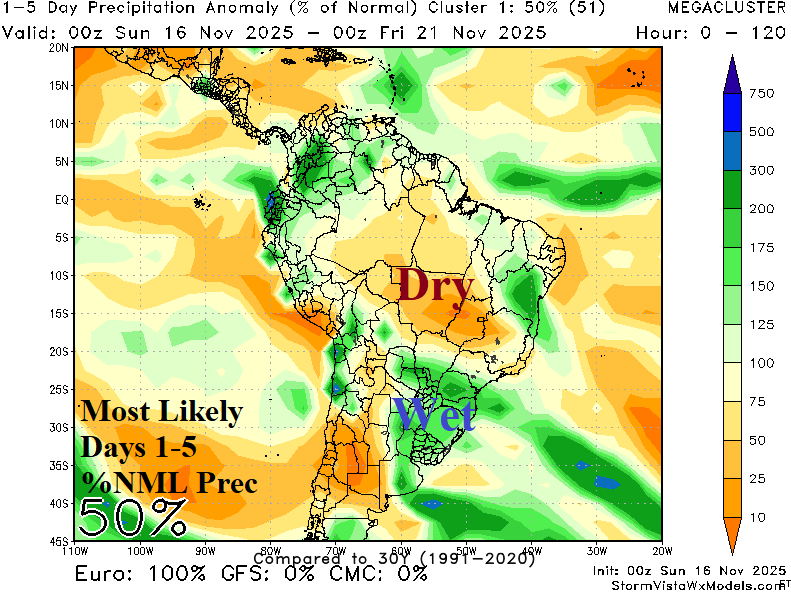
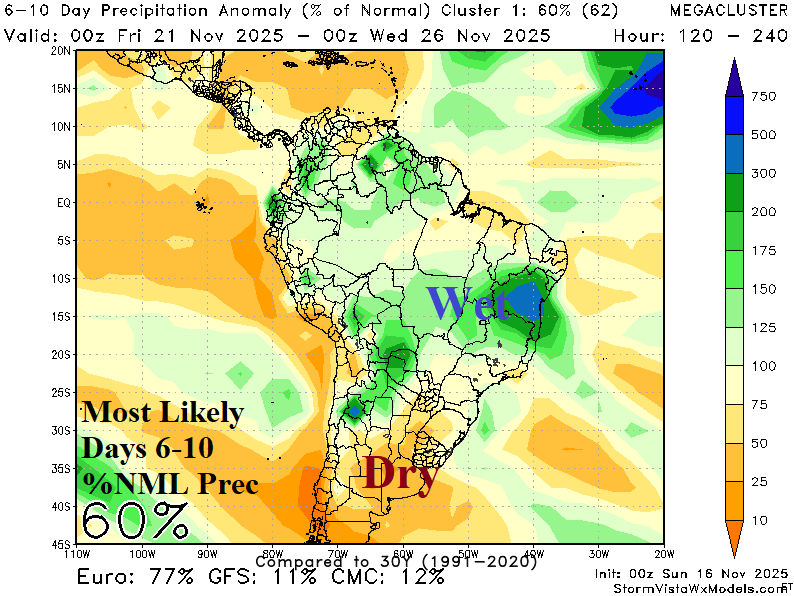
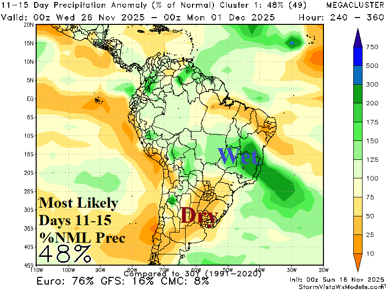
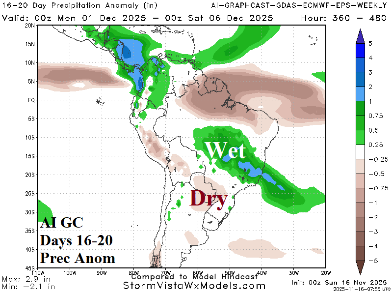
Fig. 3-6: The South America 7-day percent of normal rainfall observations and 1-10-day rainfall anomaly forecast.

Fig. 7-8: Europe turns chilly and wet with snow Northwestern Eurasia through the next 15 days.


Fig. 9-10: Australia rainfall in November (so far) and the 12Z GFS 15-day rainfall forecast.