
El Nino Analogs for U.S. Corn Belt JUN-SEP
02/22/2026, 1:31 pm EST
New Concern…Evolving (MJO-inspired) Heavy Rain/Severe Weather Pattern South-central U.S. Next Week
02/26/2026, 8:14 am EST
Climate Impact Company AG Hot Spot
Issued: Wednesday February 25, 2026
Highlight: Europe shifts warmer/drier.
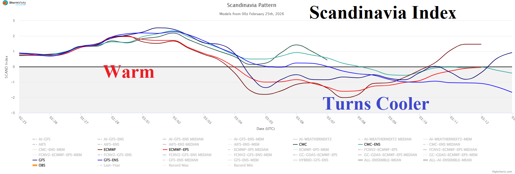
Fig. 1: The 15-day Scandinavia index forecast utilizing all models.
Discussion: Positive phase of the Scandinavia index (SCAND) supports anomalous warmth and dryness across much of Europe through the next week (Fig. 1). SCAND shifts to negative phase during the medium range which suggests a cooler and potentially wetter regime. The 15-day population weight Europe temperature forecast identifies the warmth through 10 days shifting cooler in the extended range (Fig. 2). ECM ENS is moderately warm in the latest 15-day outlook for Southern Europe (Fig. 3). Other models are warmer and do not indicate the decelerating warmth in the extended range. The 15-day percent normal precipitation outlook is drier than normal including Southern Europe which has observed wet climate for much of the winter season (Fig. 4). However, wet risk is maintained across Portugal and Spain.
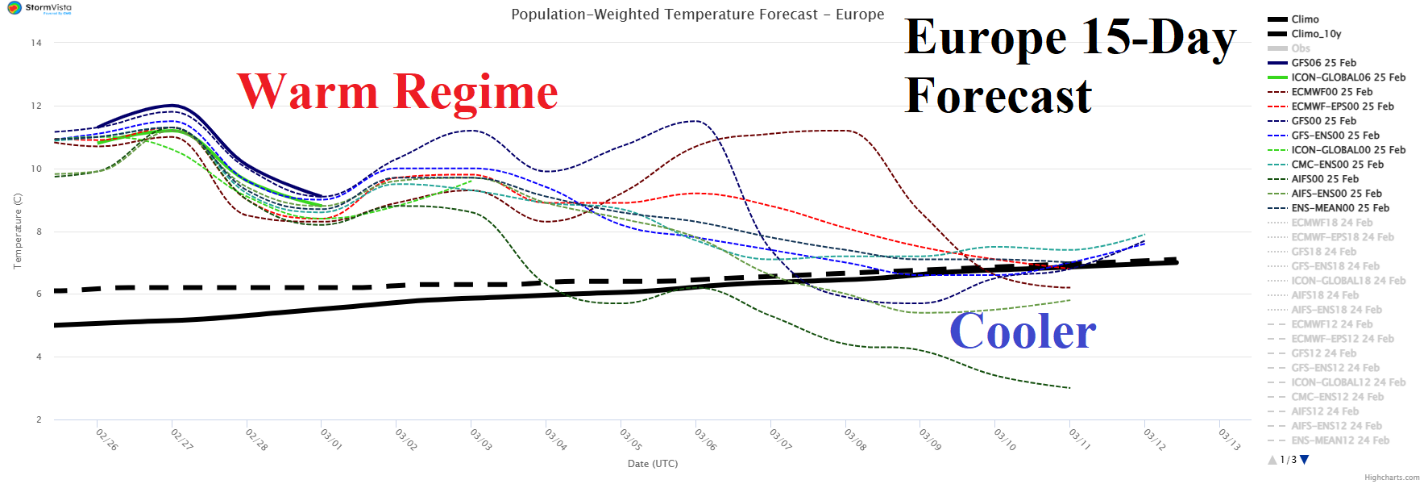
Fig. 2: The population weight daily average temperature departure from normal across Europe utilizing all models through the next 15 days.
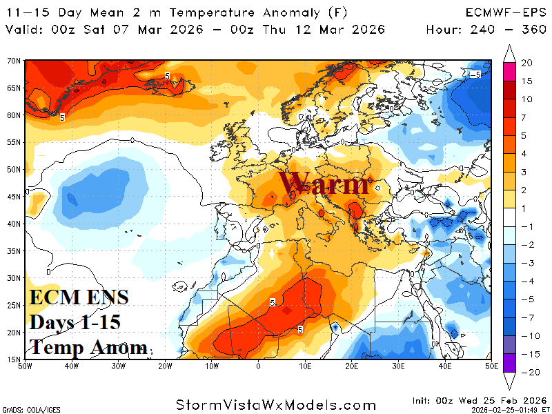
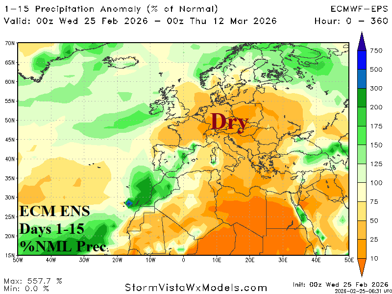
Fig. 3-4: ECM ENS 15-day temperature and percent of normal precipitation forecast across Europe.