Short-term Rains for Brazil Drought Area Reversing Dry Again Next Week
09/21/2025, 11:20 am EDT
Onto Solar Cycle 26
09/23/2025, 2:47 pm EDT
Climate Impact Company Early AG Market ALERT
Issued: Monday September 22, 2025
Highlight: Brazil dry again after this week; Extended range is (also) dry.
Discussion: Recent heavy rains in the West Africa cocoa-growing areas, especially eastern sections, have weakened drought. The drought remains potent, especially southern portions of the western-growing areas. The 15-day rainfall outlook remains wetter than normal but not as wet as weekend forecasts. Seasonality is forcing the connective rains within the ITCZ to shift south favoring wetter weather for coastal tropical West Africa.
A strong stratospheric warming (SW) episode emerged over the weekend across Antarctica. 15-day forecasts maintain the event. The SW event is contributing to strong negative global atmospheric angular momentum (GLAAM), the 3rd negative spike since June. Stratospheric warming events over Antarctica have less predictable influence on the southern hemisphere continental weather due to the moderating influence of the maritime climate. However, the SW episode has continued to a persistent 3 long wave troughs in the 15-day forecast centered in the South Indian Ocean, south of New Zealand, and southwest of Chile.
The Australia 15-day outlook is interesting. ECM maintains a dry forecast, possibly related to the SW event as -IOD/La Nina climate usually produces above normal wet risk. However, overnight GFS forecasts shift the North and East Australia forecast considerably wetter.
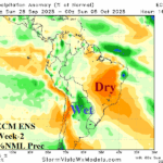
In Brazil, no change as this week’s wet weather affecting the drought area disappears completely during the medium range as dry weather regenerates. Extended range forecasts (16-30 days) reveal dryness in Brazil is likely to persist.
In the U.S., a period of heavy rain across the Midwest States early-to-middle week brings some relief to the late summer drought. The 6-10-day forecast is dry although wetter weather appears in GFS and ECM forecasts from overnight in the 11-15-day period. The wetter 11-15-day forecasts are made with low confidence.
In Europe, East France to Italy look very wet based on GFS and ECM 15-day forecasts while surrounding areas are trending drier heading into early October.
The Nino34 SSTA index is -0.41C, remaining just below the La Nina threshold. The daily IOD -s -0.73, firmly in negative phase although not as intense as mid-month,
Charts of the Day
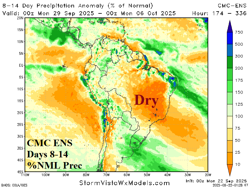
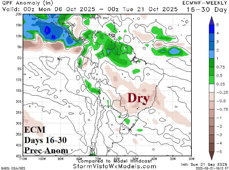
Fig. 1-2: After this week’s rainfall in the Brazil drought area, the 8-14-day and 16-30-day outlooks are dry.
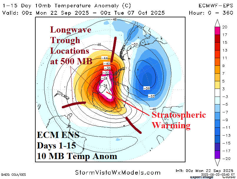
Fig. 3-4: The NOAA/WPC 72-hour rainfall forecast unloads heavy rain on the Midwest U.S. plus the ECM ENS 15-day 10 MB temperature anomaly outlook.