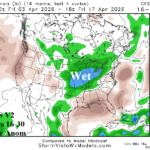
Central/East-central/Mid-south U.S. Shift Wetter Extended-range Forecast
03/20/2026, 8:39 am EDT
Climate Impact Company Early AG Market ALERT
Issued: Monday March 23, 2026
Highlight: Wetter 8-14-day forecasts in the Great Plains and Black Sea region; Central/East-central South America shifts hot/dry.
Discussion: The U.S. AG Belt trends wetter during the medium range. The already wet 11-15-day forecast is preceded by added rainfall in the 6-10-day period. GFS and ECM disagree on whether the core of the heavier precipitation in the 11-15-day period. ECM has heaviest precipitation in the North-central U.S. while GFS wettest projection is in the Ohio Valley. The 16-30-day outlook stays wet. However, the wet weather may retreat to the southwest quadrant of the U.S. while re-emerging near the U.S./Canada border leaving the central Great Plains drier.
In South America, the 1-5-day forecast Brazil is wet while Argentina is dry and turning hotter. In the medium range, hot and dry weather amplifies across Northern Argentina, Paraguay, and Southeast Brazil. Utilizing Graph Cast, wet weather is centered on Uruguay and vicinity and East-central/Northeast Brazil in the 16-30-day period while Paraguay is very dry.
In Europe, a persistent presence of a deep upper-level low-pressure trough ignites a wet pattern across Central and southeast Europe and southeastward throughout the Middle East region. Western Russia is mostly dry and quite warm in the 15-day outlook. The wet weather zone gradually shifts cooler. Wet weather reaches the Black Sea region during the next 2 weeks. In the 16-30-day forecast, the southern latitude wet weather continues with some of the wet weather reaching the Black Sea region.
Tropical Storm Narelle rests over the coastal northwest portion of Australia soon to move offshore and begin to redevelop. In 4-5 days, Narelle reaches category-2 or category-3 intensity moving into the northwest coast of Western Australia. Through 10 days, the West Coast region of Australia is very wet.
Cocoa regions of West Africa shift wetter than normal in the medium range. Wet weather is favored in the extended range by ECM “weeklies” forecast models.
In the Persian Gulf, plenty of lightning from thunderstorms this week. ECM returns a thunderstorm regime to the region in the 11-15-day forecast.
The Nino34 SSTA is exactly zero last week as oceanic ENSO phase remains locked neutral. The southern oscillation index (SOI) jumps to strong positive phase (affected by the presence of nearby Narelle).
Charts of the day…
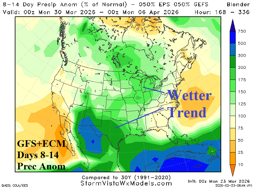
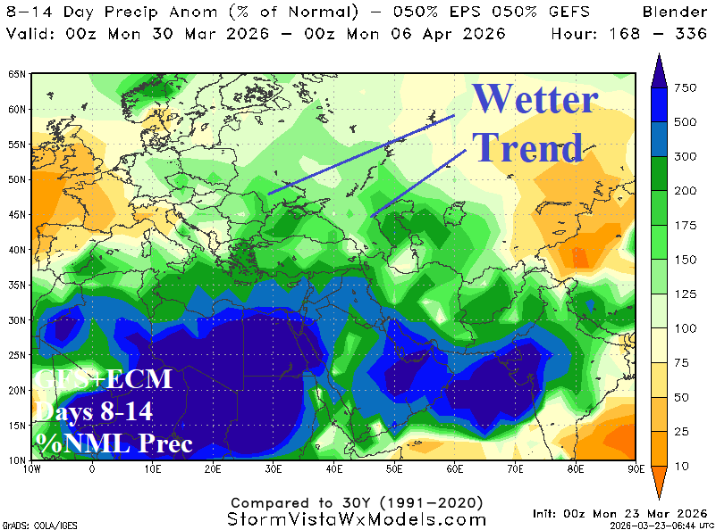
Fig. 1-2: GFS+ECM precipitation forecasts indicate wetter trends during the 8-14-day period in the Central U.S. and Black Sea region.
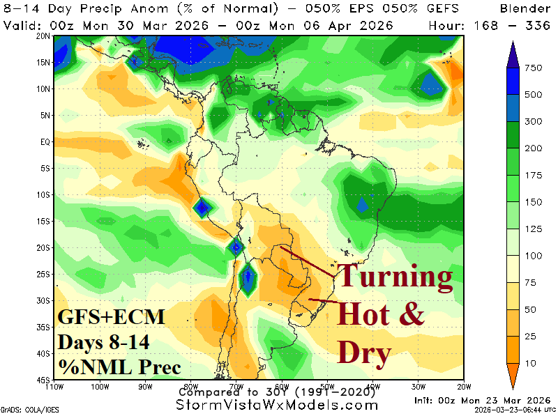
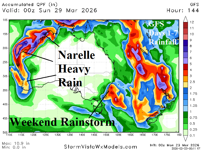
Fig. 3-4: GFS+ECM 8-14-day percent of normal rainfall forecast across South America and the rainfall amount forecast by GFS through the next 7 days across Australia.