
Narelle To Re-Intensify; Strikes West Coast Late Week
03/23/2026, 9:59 am EDT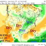
The U.S. Precipitation Pattern Shifts Wetter
03/26/2026, 8:36 am EDT
Climate Impact Company Tropical Feature
Issued: Wednesday March 25, 2026
Highlight: Cooling surface and subsurface in the North Atlantic tropics coupled with El Nino expectations could produce a relatively quiet 2026 TC season.
Early next week: Initial 2026 North Atlantic tropical cyclone outlook.
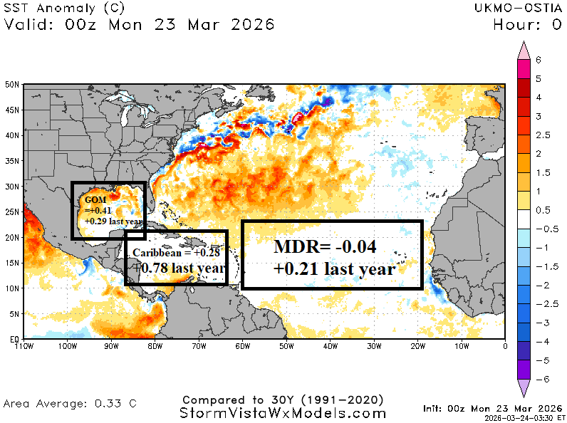
Fig. 1: The daily sea surface temperature anomalies across the North Atlantic basin.
Discussion: The North Atlantic basin is marginally warmer than normal (+0.33C) and similar with this time last year (Fig. 1). However, in the lower latitudes, the Caribbean Sea, and main development region (MDR) are somewhat cooler than last year at this time. The Gulf of Mexico basin is near +0.4C although nearly 1C cooler than one month ago. Upper ocean heat in the Gulf of Mexico and main development region (MDR) for North Atlantic hurricanes is second coolest in the 2013-26 climatology (Fig. 2-3). Upper ocean heat across the tropical North Atlantic is also cooler than the 14-year climatology and much cooler than the past 2 years (Fig. 4). Given expectations of El Nino mid-to-late year and the cooler oceans of the tropics as summertime approaches, potential for a relatively quiet 2026 tropical cyclone season increases.
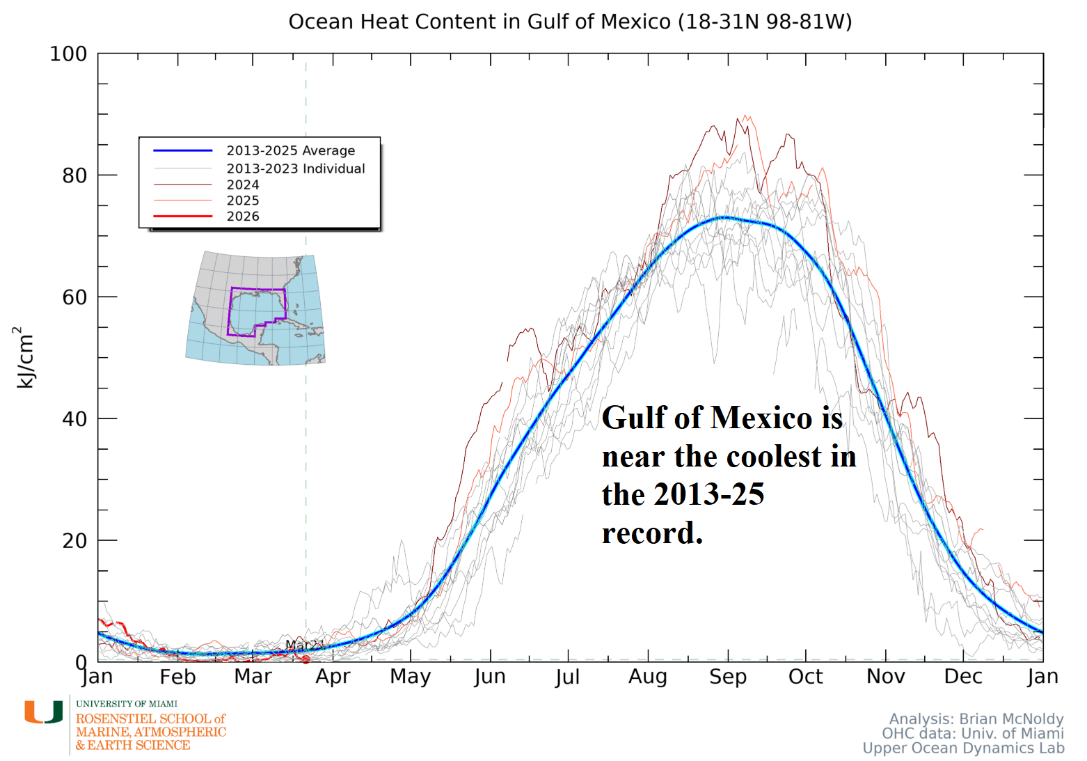
Fig. 2: Upper ocean heat in the Gulf of Mexico compared to 2013-25 observations in March.
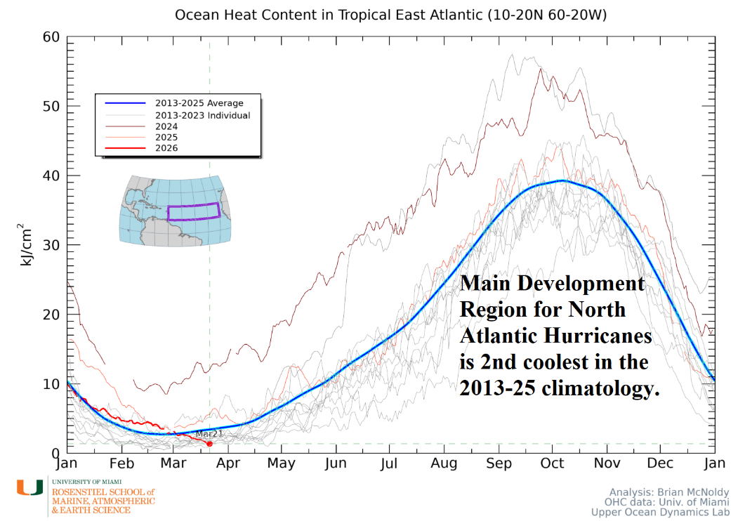
Fig. 3: Upper ocean heat in the main development region for hurricanes compared to 2013-25 observations in March.
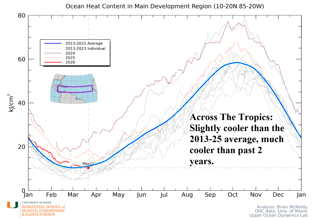
Fig. 4: Upper ocean heat in the North Atlantic tropics compared to 2013-25 observations in March.