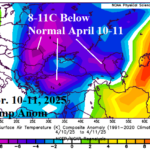
One of The Worst Freezes on Record Southeast Europe, Turkey, and into Black Sea Region
04/14/2025, 5:19 am EDT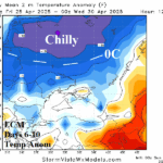
Another Cool Wave Toward Ukraine/Black Sea Region Next Weekend
04/20/2025, 7:05 am EDT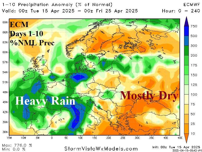
Chart of the day: More high impact weather for Europe; Heavy rain event!
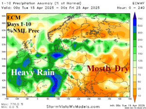
Discussion: The recent cold wave across Southeast Europe to Turkey was caused by a polar vortex generation likely related to stratospheric warming in the polar region of the past 6 weeks. Another intense trough spins out of that regime and brings heavy rain to Southwest and South Europe through the next 10 days.
Week-2 Ahead Forecast valid April 20-26, 2025: Heavy rains Western Europe.
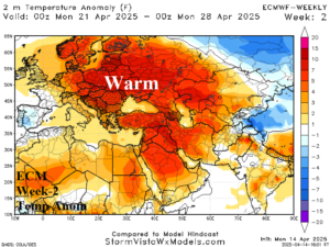
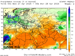
Discussion: Upper trough, possibly stronger than indicated by ECM “weeklies” brings heavy rain to Western Europe. To the east, a compensating warm and dry upper ridge reverses the recent chill in the Black Sea region.
Week-3 Ahead Forecast valid April 27-May 3, 2025: Wetter West-central Russia; Europe is warmer/drier.
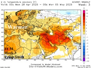
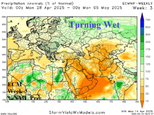
Discussion: ECM “weeklies” projects two upper-level high pressure ridge areas (over U.K. and Caspian Sea) to bring a widespread warmer and drier weather pattern while cool and wet conditions shift to the Russia Spring Wheat Crop Area.
Week-4 Ahead Forecast valid May 4-10, 2025: Warm pattern shifts southward.
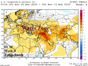
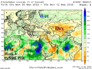
Discussion: ECM “weeklies” broaden the Northwest Eurasia trough causing the warm pattern to retreat southward. North Africa and the Mediterranean Sea is trending wetter. Dryness is strongest across and east of the Black Sea region.
Week-5 Ahead Forecast valid May 11-17, 2025 (previous below): Warmer/drier again.
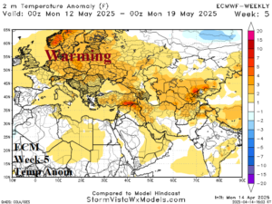
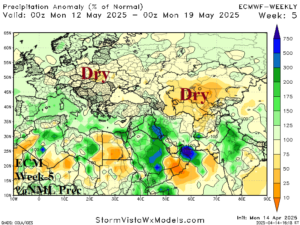
Discussion: A warm and dry ridge regenerates Central Europe to Southwest Russia.