Subsurface Equatorial Pacific Is Cooling As La Nina Development Has Restarted
07/29/2024, 7:36 pm EDTECM Ensemble Best Medium-range Temperature Forecast Model for U.S. Past 30 Days; AIFS 4th Best
07/31/2024, 8:36 am EDTHighlight: HRRR forecasts a derecho today from Iowa to Indiana.
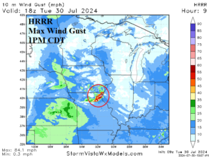
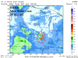
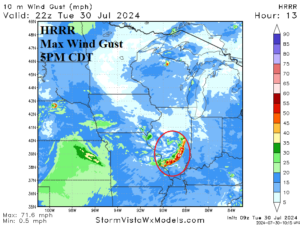
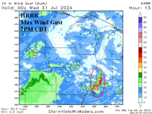
Fig. 1-4: HRRR maximum wind gust forecast for today indicates potential for a derecho forming this afternoon in northeast Missouri shifting southeastward to southwest Indiana by early evening.
Discussion: NOAA/SPC indicates risk of damaging wind due to severe thunderstorms from Des Moines to Nashville today. The HRRR model specifically defines the threat area beginning early afternoon on the southeast Iowa/northeast Missouri state line (Fig. 1). The line moves southeastward across western Illinois mid-afternoon to southern Illinois late afternoon and into southwest Indiana by early evening (Fig. 2-4). Wind gusts as high as 70-90 mph are possible within the affected areas. The derecho weakens in eastern Tennessee later this evening.