
Historical Precipitation Event Ahead West U.S. – Causes and Implications
12/16/2025, 4:43 am EST
La Nina Gains Strength, Strongest Signature of Late 2025 So Far
12/23/2025, 8:23 am EST
Climate Impact Company U.S. Medium Range Report
Issued: Friday December 19, 2025
Highlight: Warm forecasts continue. Warmest changes in the East.
Charts of the day: Warm Northeast Pacific enhances the “atmospheric river”.
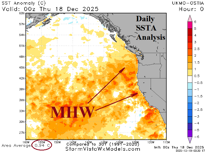

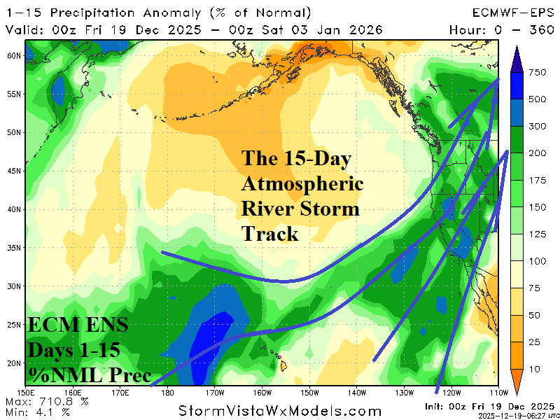
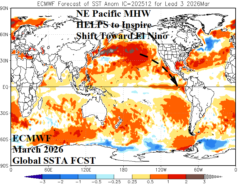
Discussion: The effectiveness of the “atmospheric river” storm track is enhanced by a surge in warming of the Northeast Pacific. A marine heatwave centered in the Northeast Pacific well northeast of Hawaii has strengthened and expanded to the U.S. West Coast. The warmer ocean surface temperature adds low-level atmosphere moisture entrained by the Pacific storm track and unloaded on the West U.S. with attendant latent heat release warming much of the U.S. for the next 2-3 weeks. The warming of the Northeast Pacific may be relevant to ENSO. In September, the strongest Northeast Pacific SSTA on record was observed inspired by a super marine heatwave. Surprisingly, the MHW weakened. However, the re-warming during meteorological winter (unusual) may indicate signs of an ENSO change ahead. The most dramatic example of MHW-induced warming of the Northeast Pacific eventually leading to an El Nino episode was observed 10 years ago. If the Northeast Pacific warming continues and spreads south, as implied by ECMWF, a trend toward El Nino (as early as March) could occur. Warming of the subsurface equatorial East Pacific (which is starting to generate) will validate the El Nino risk.
Medium-range 6-10 Day Forecast Valid December 24-28, 2025 (ECM ENS left and 24-hour change right)
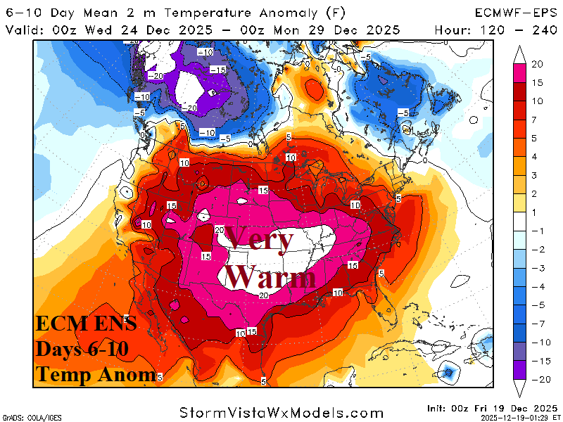
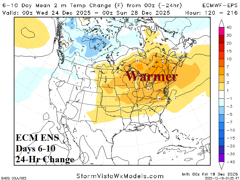
Discussion: Record warmth affects a large portion of the U.S. in the 6-10-day period. The Northeast States are trending somewhat warmer.
Medium-range 11-15 Day Forecast Valid December 29, 2025-January 2, 2026 (ECM ENS left and 24-hour change right)
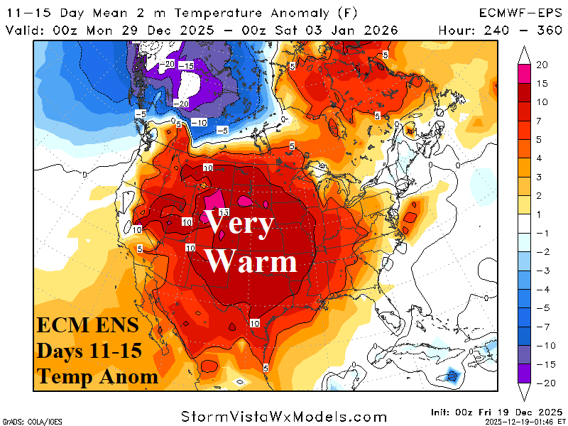
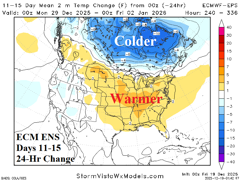
Discussion: The warm pattern continues in the 11-15-day period and trends warmer in the East although yesterday’s warm-up across Eastern Canada is less aggressive.
U.S. Medium-range Precipitation Forecast
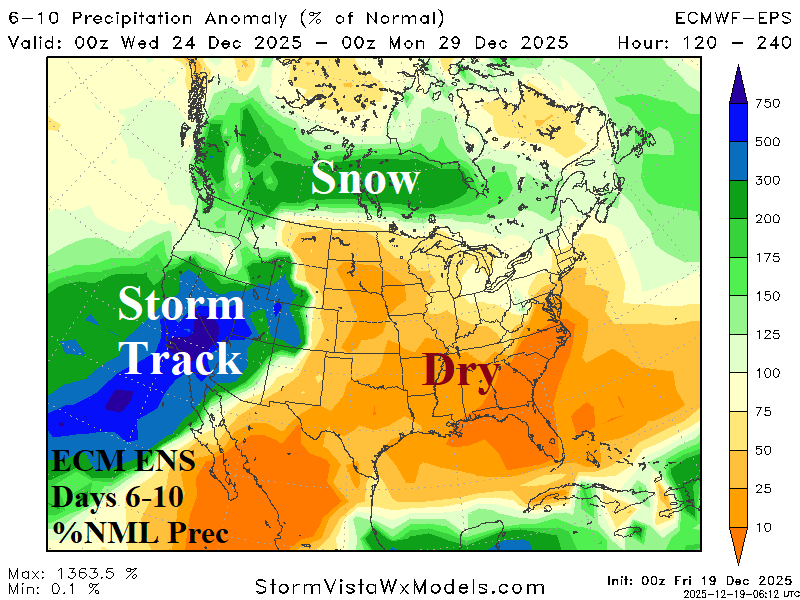
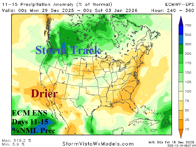
Discussion: Extreme rain causing flash flooding, high wind, and heavy mountain snow persists across California to the Great Basin for the Christmas Holiday. The storm track edges northward in the 11-15-day period.
Days 16-20 Extended range Temperature Forecast valid January 3-7, 2026
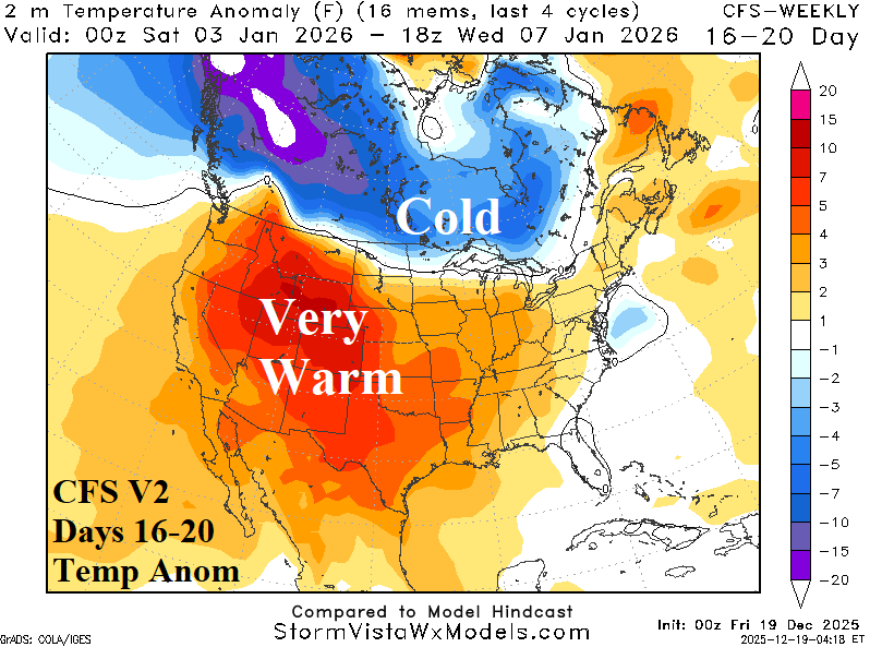
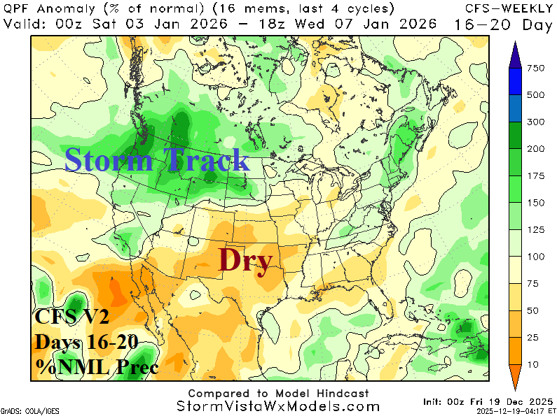
Discussion: The U.S. stays warm although Canadian chill expands eastward and could briefly touch the Northeast U.S.