
Arctic Air, Snow and Ice; Cold Blast East Finishes January!
01/19/2026, 12:53 pm EST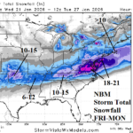
Incoming Arctic Air Triggers Major Snow and Ice Storm South and East U.S.
01/21/2026, 6:09 am EST
Climate Impact Company Early U.S. Notes
Issued: Tuesday January 20, 2026
Highlight: Timing the incoming arctic air and associated weather hazards.
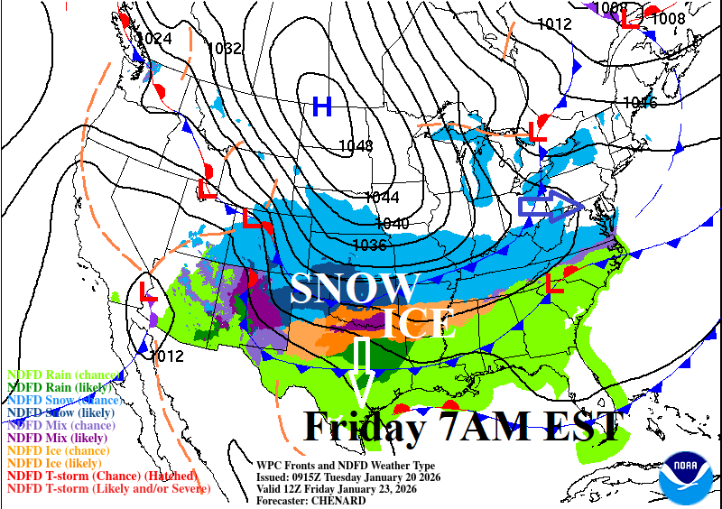
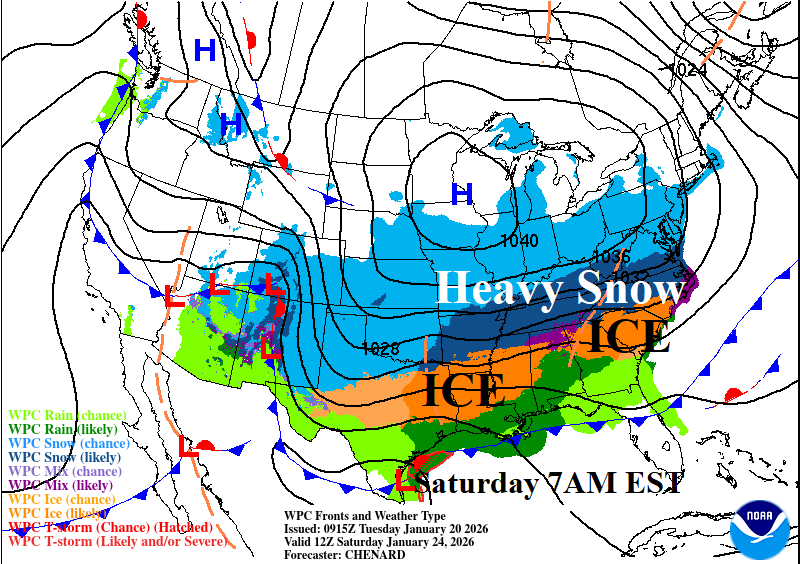

Fig. 1-3: NOAA/WPC frontal positions for incoming arctic air Friday through Sunday morning at 7AM EST.
Discussion: An arctic air mass is poised to surge through the Great Plains early Friday (Fig. 1), slow down while easing into the South U.S. on Saturday (Fig. 2), moderating into the Southeast States by Sunday (Fig. 3). The southern periphery of the cold air mass will inspire a large area of wintery weather extending eastward from the southern Great Plains and Texas across the Tennessee Valley and into the Southeast and including the Atlantic Seaboard through next weekend. Bitter cold, with wind, follows passage of the arctic front. Moderate to heavy snow is focused on Saturday in the East including up to one foot of snow in western Virginia (Fig. 4) with lingering moderate snow for the Northeast Corridor on Sunday (Fig. 5). Eastern Virginia appears to be the jackpot snowfall area due to 2 full days of accumulating snow. A major icing event is forecast for parts of north-central Texas, northern Louisiana/southern Arkansas and eastward across northern Mississippi to South Carolina (Fig. 6). Atlanta is in the major icing threat zone. The latest U.S. gas population weight HDD forecast is impressively cold with potential for the coldest last week of January on record for this century (Fig. 7). The early February forecast is adjusted colder since yesterday. The week 4-6 forecasts by ECM/CFS consensus and 3 AI models trend colder from late last week.


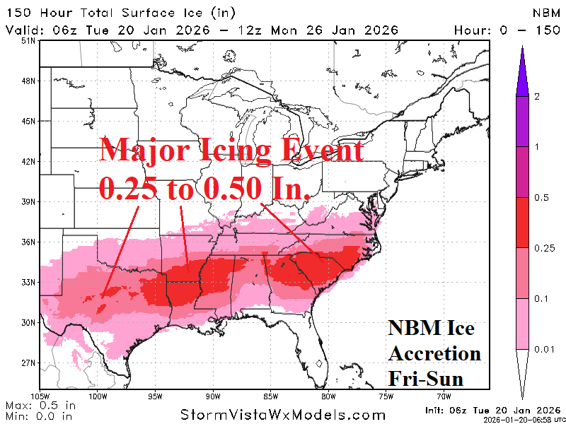
Fig. 4-6: NBM 24-hour snowfall forecasts for Saturday and Sunday and storm total of ice accretion according to NBM model.
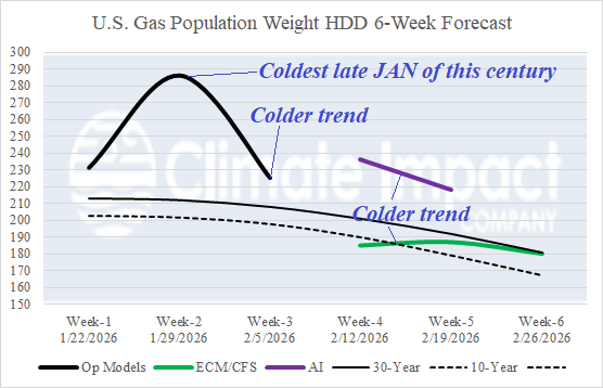
Fig. 7: U.S. gas population weight 6-week HDD forecast.