
Cool Air Masses South America; Brazil Rains 1st Week of November
10/21/2025, 5:30 am EDT
Searing Heat and Dryness in Australia Forecast to Fade
10/26/2025, 12:13 pm EDT
Climate Impact Company North Atlantic Basin 10-Day Monitor
Issued: Thursday October 23, 2025, 8:50AM EST
Highlight: Melissa remains a RI candidate.

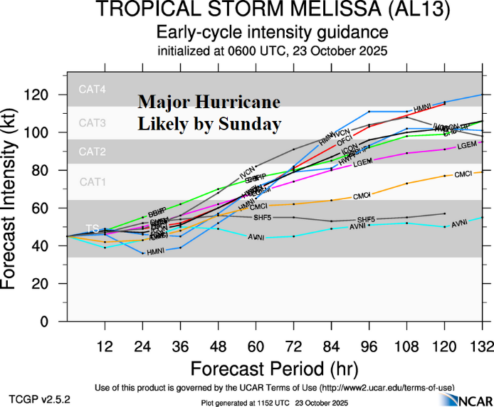
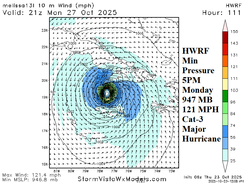
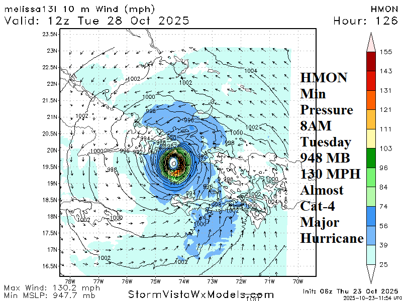
Fig. 1-4: Tropical cyclone models tracks and intensity forecasts plus peak intensity forecast from hurricane models HWRF and HMON.
Discussion: At 8AM EDT, Tropical Storm Melissa was located about 215 miles southeast of Kingston, Jamaica moving northwest at 5 mph with top wind near 50 mph and central pressure 1003 MB. Westerly shear continues to inhibit Melissa’s development. However, the environment changes significantly on the weekend possible supportive of a rapid intensification (RI) tropical cyclone. RI is defined as a tropical cyclone gaining more than 35 mph in top wind speed within 24 hours. On the weekend, an upper-level high pressure builds east-northeast of Melissa forcing a discernable northwest steering current. During this time, upper-level shear eases. As Melissa moves northwest in an improving environment, the storm is better able to intensify rapidly moving across 30-31C surface water and the 3rd warmest upper ocean heat content on record for the Caribbean Sea. HWRF and HMON peak intensity forecasts (within the next 126 hours) indicate strong category-3 major hurricane intensity with location varying from off the southwest coast of Cuba to just southeast of Guantanamo Bay, Cuba. Melissa should move north and then northeast once north of the Caribbean Islands.