02/05/2026, 9:52 am EST
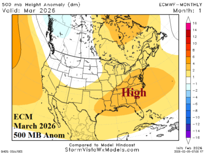
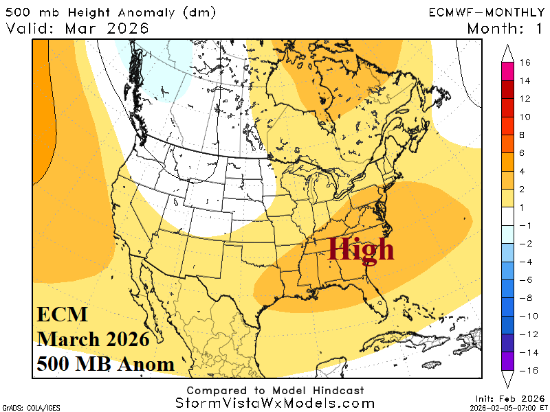
In March, ECMWF crests an upper ridge across the Southeast U.S. which leads to high risk of unusually warm early spring climate for the Southeast and Mid-Atlantic States. In April, the warm ridge shifts westward and settles on the southern Great Plains where dry and warm mid-spring weather is likely. Late meteorological spring brings an upper ridge to the Great Basin promoting dry and very warm climate across the West and Southwest U.S.
