03/18/2025, 4:21 am EDT
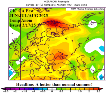
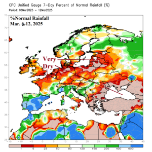
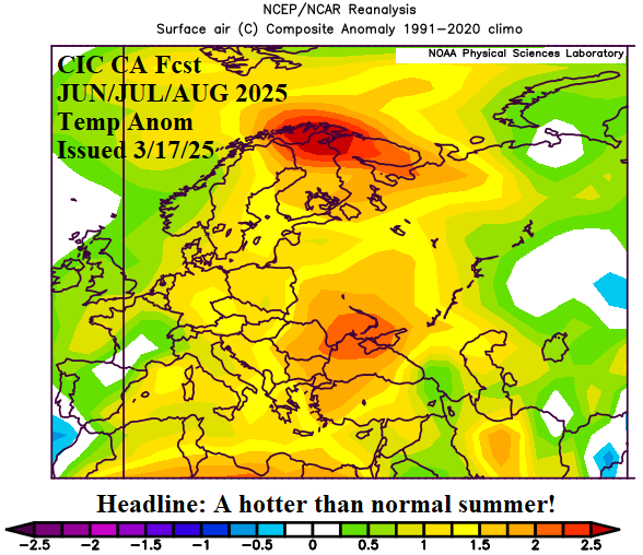
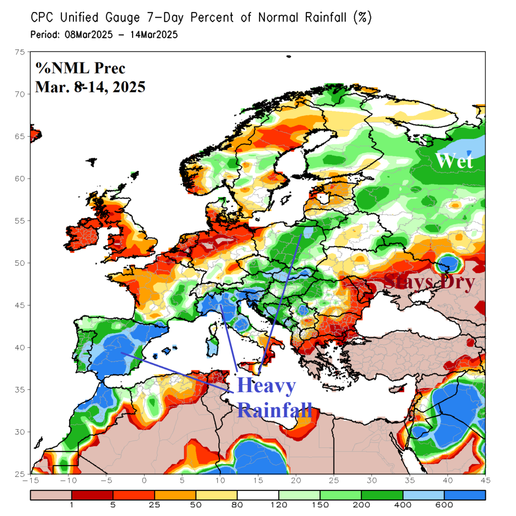
A primary concern is whether presence of dry-to-drought conditions across the eastern half of Europe to Southwest Russia and the Black Sea region will worsen mid-to-late spring and summer. The outlooks support intensification as the presence of upper-level ridging to warm and dry this region well-supported by the correlating SSTA forecasts.

